Poughkeepsie - Hudson Valley Rgnl
Airport details
| Country | United States of America |
| State | New York |
| Region | K6 |
| Airspace | Boston Ctr |
| Municipality | Town of Wappinger |
| Elevation | 165ft (50m) |
| Timezone | GMT -5 |
| Coordinates | 41.62658, -73.88419 |
| Magnetic var | |
| Type | land |
| Available since | X-Plane v10.40 |
| ICAO code | KPOU |
| IATA code | POU |
| FAA code | POU |
Communication
| Hudson Valley Rgnl ASOS | 126.750 |
| Hudson Valley Rgnl CTAF | 124.000 |
| Hudson Valley Rgnl UNICOM | 122.950 |
| Hudson Valley Rgnl Clearance DEL | 121.800 |
| Hudson Valley Rgnl Ground Control | 121.700 |
| Hudson Valley Rgnl Tower | 124.000 |
Approach frequencies
| ILS-cat-I | RW06 | 111.3 | 18.00mi |
| 3° GS | RW06 | 111.3 | 18.00mi |
Nearby Points of Interest:
Joseph Horton House
-Bain Commercial Building
-Wappingers Falls Historic District
-Wappingers Falls Village Hall
-Elias Titus House
-Dutchess Company Superintendent's House
-Rombout House
-Freer House
-Milton Railroad Station
-Locust Grove
-Union Free School
-Vassar College Observatory
-Main Building
-Thompson House
-Stone Street Historic District
-Adolph Brower House
-Abraham Brower House
-Zion Memorial Chapel
-Main Street Historic District
-Shay's Warehouse and Stable
-Poughkeepsie Meeting House
-William Shay Double House
-Cedarcliff Gatehouse
-Maple Grove
-Ethal House
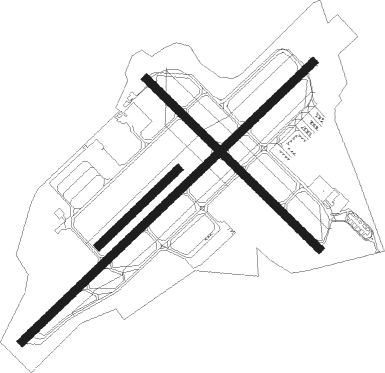
Runway info
Runway 6 / 24  | ||
| length | 1523m (4997ft) | |
| bearing | 59° / 239° | |
| width | 30m (98ft) | |
| surface | asphalt | |
| displ threshold | 0m (0ft) / 36m (118ft) | |
| blast zone | 0m (0ft) / 93m (305ft) | |
| Runway 15 / 33 | ||
| length | 913m (2995ft) | |
| bearing | 131° / 311° | |
| width | 30m (98ft) | |
| surface | asphalt | |
| displ threshold | 37m (121ft) / 40m (131ft) | |
| Runway 7 / 25 | ||
| length | 414m (1358ft) | |
| bearing | 58° / 238° | |
| width | 30m (98ft) | |
| surface | grass | |
| blast zone | 0m (0ft) / 134m (440ft) | |
Nearby beacons
| code | identifier | dist | bearing | frequency |
|---|---|---|---|---|
| IGN | KINGSTON VOR/DME | 3.6 | 58° | 117.60 |
| SKU | STANWYCK (NEWBURGH) NDB | 9.3 | 238° | 261 |
| PWL | PAWLING (POUGHKEEPSIE) VOR/DME | 15.3 | 63° | 114.30 |
| SW | NEELY (NEWBURGH) NDB | 17.6 | 248° | 335 |
| CMK | CARMEL VOR/DME | 24.8 | 139° | 116.60 |
| HUO | HUGUENOT VOR/DME | 34.3 | 253° | 116.10 |
| PFH | PHILMONT (HUDSON) NDB | 38.3 | 14° | 272 |
| BDR | BRIDGEPORT VOR/DME | 44.2 | 122° | 108.80 |
| SAX | SPARTA VORTAC | 44.6 | 229° | 115.70 |
| TEB | TETERBORO VOR/DME | 47.4 | 193° | 108.40 |
| MM | MOREE (MORRISTOWN) NDB | 49.2 | 211° | 392 |
| HVN | HAVEN DME | 50 | 110° | 109.80 |
| LGA | LA GUARDIA (NEW YORK) VOR/DME | 50.6 | 179° | 113.10 |
| TE | TORBY (TETERBORO) NDB | 50.6 | 197° | 214 |
| FR | FRIKK (FARMINGDALE) NDB | 54.1 | 155° | 407 |
| DPK | DEER PARK VOR/DME | 56.5 | 145° | 117.70 |
| CTR | CHESTER VOR/DME | 57.7 | 55° | 115.10 |
| STW | STILLWATER VOR/DME | 58.3 | 237° | 109.60 |
| CAT | CHATHAM NDB | 58.6 | 212° | 254 |
| JFK | KENNEDY (NEW YORK) VOR/DME | 59.8 | 174° | 115.90 |
| BWZ | BROADWAY (SCHOOLEY'S MT) VOR/DME | 65.3 | 229° | 114.20 |
Departure and arrival routes
| Transition altitude | 18000ft |
| Transition level | 18000ft |
| SID end points | distance | outbound heading | |
|---|---|---|---|
| RW06 | |||
| DUCHS8 | 19mi | 253° | |
| RW15 | |||
| DUCHS8 | 19mi | 253° | |
| RW24 | |||
| DUCHS8 | 19mi | 253° | |
| RW33 | |||
| DUCHS8 | 19mi | 253° | |
| STAR starting points | distance | inbound heading | |
|---|---|---|---|
| ALL | |||
| HUD4 | 56.5 | 325° | |
Instrument approach procedures
| runway | airway (heading) | route (dist, bearing) |
|---|---|---|
| RW06 | CMK (319°) | CMK CANTY (27mi, 292°) 3800ft CANTY (turn) 3200ft |
| RW06 | HUO (73°) | HUO CANTY (22mi, 80°) 3200ft |
| RW06 | IGN (238°) | IGN CANTY (16mi, 238°) 3300ft CANTY (turn) 3200ft |
| RNAV | CANTY 3200ft WEXIR (6mi, 58°) 2200ft VIYUP (3mi, 58°) 1160ft KPOU (3mi, 59°) 205ft (4686mi, 119°) 503ft JURIL (4685mi, 299°) IGN (2mi, 57°) 3000ft IGN (turn) | |
| RW24 | CMK (319°) | CMK VECYU (24mi, 355°) 3600ft JUVBI (5mi, 313°) 2900ft |
| RW24 | HUO (73°) | HUO WAGIP (45mi, 64°) 4000ft JUVBI (5mi, 133°) 2900ft |
| RNAV | JUVBI 2900ft ZIDLU (4mi, 239°) 2400ft UKAYU (3mi, 239°) 2000ft JUTRU (2mi, 239°) 1100ft KPOU (3mi, 238°) 212ft (4686mi, 119°) 564ft CANTY (4694mi, 299°) 3200ft CANTY (turn) |
Holding patterns
| STAR name | hold at | type | turn | heading* | altitude | leg | speed limit |
|---|---|---|---|---|---|---|---|
| HUD4 | PWL | NDB | right | 21 (201)° | < 17999ft | 1.0min timed | ICAO rules |
| *) magnetic outbound (inbound) holding course | |||||||
Disclaimer
The information on this website is not for real aviation. Use this data with the X-Plane flight simulator only! Data taken with kind consent from X-Plane 12 source code and data files. Content is subject to change without notice.