Parsons - Parsons Tri-city
Airport details
| Country | United States of America |
| State | Kansas |
| Region | K3 |
| Airspace | Kansas City Ctr |
| Municipality | Parsons |
| Elevation | 897ft (273m) |
| Timezone | GMT -6 |
| Coordinates | 37.33081, -95.50616 |
| Magnetic var | |
| Type | land |
| Available since | X-Plane v10.40 |
| ICAO code | KPPF |
| IATA code | PPF |
| FAA code | PPF |
Communication
| Parsons Tri-City ASOS | 118.175 |
| Parsons Tri-City CTAF/UNICOM | 123.000 |
Nearby Points of Interest:
Booth Theater
-Union Implement and Hardware Building-Masonic Temple
-State Street Bridge
-Onion Creek Bridge (Coffeyville, Kansas)
-City Square Park Bandstand
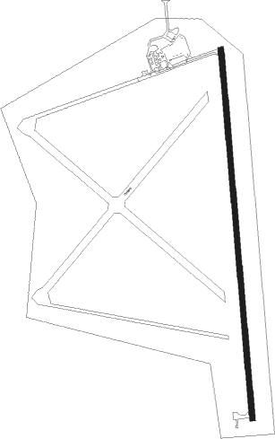
Runway info
| Runway 17 / 35 | ||
| length | 1527m (5010ft) | |
| bearing | 180° / 360° | |
| width | 23m (75ft) | |
| surface | concrete | |
Nearby beacons
| code | identifier | dist | bearing | frequency |
|---|---|---|---|---|
| OSW | OSWEGO VOR/DME | 17.8 | 120° | 117.60 |
| CNU | CHANUTE VOR/DME | 18.2 | 344° | 109.20 |
| BV | DEWIE (BARTLESVILLE) NDB | 38.2 | 226° | 201 |
| BVO | BARTLESVILLE VOR/DME | 38.6 | 226° | 117.90 |
| JL | LUNNS (JOPLIN) NDB | 45.9 | 98° | 344 |
| EMP | EMPORIA VORTAC | 65 | 327° | 112.80 |
Instrument approach procedures
| runway | airway (heading) | route (dist, bearing) |
|---|---|---|
| RW17 | CEBIX (180°) | CEBIX 3000ft |
| RW17 | DUSLE (151°) | DUSLE CEBIX (5mi, 90°) 3000ft |
| RW17 | ERONE (208°) | ERONE CEBIX (5mi, 270°) 3000ft |
| RNAV | CEBIX 3000ft FASKO (6mi, 180°) 2500ft YIKCU (2mi, 180°) 1780ft KPPF (3mi, 180°) 946ft (5668mi, 111°) 1194ft CEGAS (5669mi, 291°) 3000ft CEGAS (turn) | |
| RW35 | CEGAS (360°) | CEGAS 3000ft |
| RW35 | DUTRE (331°) | DUTRE CEGAS (5mi, 270°) 3000ft |
| RW35 | EKILE (28°) | EKILE CEGAS (5mi, 90°) 3000ft |
| RNAV | CEGAS 3000ft FARAR (6mi, 360°) 2500ft JUROB (2mi, 360°) 1700ft KPPF (3mi, 360°) 910ft (5668mi, 111°) 1130ft CEBIX (5667mi, 291°) 3000ft CEBIX (turn) |
Disclaimer
The information on this website is not for real aviation. Use this data with the X-Plane flight simulator only! Data taken with kind consent from X-Plane 12 source code and data files. Content is subject to change without notice.