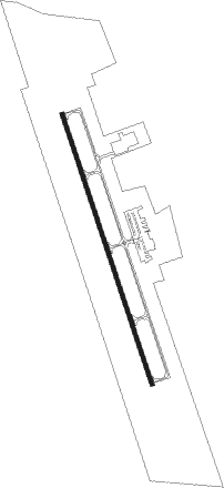
Pascagoula - Trent Lott Intl
Airport details
| Country | United States of America |
| State | Mississippi |
| Region | K7 |
| Airspace | Houston Oceanic Ctr |
| Municipality | Moss Point |
| Elevation | 17ft (5m) |
| Timezone | GMT -6 |
| Coordinates | 30.46278, -88.52923 |
| Magnetic var | |
| Type | land |
| Available since | X-Plane v10.40 |
| ICAO code | KPQL |
| IATA code | PGL |
| FAA code | PQL |
Communication
| Trent Lott INTL ATIS | 135.175 |
| Trent Lott INTL UNICOM | 122.800 |
| Trent Lott INTL CTAF | 118.575 |
| Trent Lott INTL CLD | 121.725 |
| Trent Lott INTL unnamed entity | 128.800 |
| Trent Lott INTL MOBILE Approach/Departure | 121.000 |
Approach frequencies
| ILS-cat-I | RW17 | 110.1 | 18.00mi |
| 3° GS | RW17 | 110.1 | 18.00mi |
Nearby Points of Interest:
Griffin House
-St. Mary's By the River
-Old Spanish Fort
-Pascagoula station
-Pascagoula Central Fire Station No. 1
-Old Pascagoula High School
-Bellevue
-Grand Bay Historic District
-Bishop Manor Estate
-Saint John's Episcopal Church
-Tullis-Toledano Manor
-Old Brick House
-United States Post Office, Courthouse, and Customhouse
-Redding House
-Beauvoir
-Roberts House
-Ross Knox House
-Collins-Marston House
-Robert L. Spotswood House
-Collins-Robinson House
-James Arthur Morrison House
-Carolina Hall
-Stewartfield
-Sodality Chapel
-19th Century Spring Hill Neighborhood TR
Nearby beacons
| code | identifier | dist | bearing | frequency |
|---|---|---|---|---|
| SJI | SEMMES (MOBILE) VORTAC | 18 | 33° | 115.30 |
| BIX | KEESLER (BILOXI) TACAN | 21 | 262° | 111.80 |
| MOB | WISLE (MOBILE) NDB | 21.3 | 37° | 248 |
| BFM | BROOKLEY (MOBILE) VORTAC | 26.1 | 72° | 112.80 |
| GPT | GULFPORT VORTAC | 28.5 | 264° | 109 |
| GP | BAYOU NDB | 32.7 | 272° | 360 |
| GCV | GREENE CO. (LEAKESVILLE) VORTAC | 38.2 | 4° | 115.70 |
| HS | HANCO (BAY ST LOUIS) NDB | 47.9 | 269° | 221 |
| LBY | EATON (HATTIESBURG) VORTAC | 70.9 | 320° | 110.60 |
Instrument approach procedures
| runway | airway (heading) | route (dist, bearing) |
|---|---|---|
| RW17 | BEZJU (164°) | BEZJU 1800ft |
| RNAV | BEZJU 1800ft PORAN (5mi, 164°) 1800ft JOSIG (3mi, 164°) 980ft KPQL (3mi, 164°) 66ft (5329mi, 109°) 800ft BEZJU (5332mi, 289°) 1800ft BEZJU (turn) | |
| RW35 | CLEAK (315°) | CLEAK YEPBU (6mi, 269°) 2100ft |
| RW35 | YEPBU (344°) | YEPBU 2100ft |
| RW35 | ZUXNY (15°) | ZUXNY YEPBU (6mi, 66°) 2100ft |
| RNAV | YEPBU 2100ft NUGTE (6mi, 344°) 1500ft APIVE (3mi, 344°) 560ft KPQL (2mi, 344°) 57ft (5329mi, 109°) 267ft BEZJU (5332mi, 289°) 1800ft BEZJU (turn) |
Disclaimer
The information on this website is not for real aviation. Use this data with the X-Plane flight simulator only! Data taken with kind consent from X-Plane 12 source code and data files. Content is subject to change without notice.