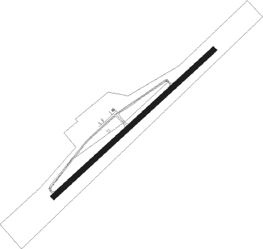
Dublin - New River Valley
Airport details
| Country | United States of America |
| State | Virginia |
| Region | K6 |
| Airspace | Atlanta Ctr |
| Municipality | Pulaski County |
| Elevation | 2104ft (641m) |
| Timezone | GMT -5 |
| Coordinates | 37.13734, -80.67848 |
| Magnetic var | |
| Type | land |
| Available since | X-Plane v10.40 |
| ICAO code | KPSK |
| IATA code | PSK |
| FAA code | PSK |
Communication
| NEW RIVER VALLEY AWOS 3 | 127.375 |
| NEW RIVER VALLEY CTAF/UNICOM | 122.700 |
| NEW RIVER VALLEY ROANOKE Approach/Departure | 126.000 |
Approach frequencies
| ILS-cat-I | RW06 | 110.9 | 18.00mi |
| 3° GS | RW06 | 110.9 | 18.00mi |
Nearby Points of Interest:
Spring Dale (Dublin, Virginia)
-Rockwood (Dublin, Virginia)
-Dublin Historic District
-Back Creek Farm
-Belle-Hampton
-Fairview District Home
-Haven B. Howe House
-John Hoge House
-La Riviere (Radford, Virginia)
-Ingles Ferry
-Glencoe Museum
-Ingles Bottom Archeological Sites
-West Radford Commercial Historic District
-Harvey House
-Arnheim
-Kentland Farm Historic and Archeological District
-Halwyck
-Pulaski County Courthouse
-Dalton Theater
-Pulaski South Historic Residential and Industrial District
-John Grayson House
-Grayson-Gravely House
-Snowville Historic District
-Snowville Christian Church
-Bishop House (Graysontown, Virginia)
Nearby beacons
| code | identifier | dist | bearing | frequency |
|---|---|---|---|---|
| PSK | PULASKI (DUBLIN) VORTAC | 3.4 | 215° | 116.80 |
| TEC | TECH (BLACKSBURG) NDB | 13.8 | 75° | 368 |
| BLF | BLUEFIELD VOR/DME | 26.6 | 288° | 110 |
| ROA | ROANOKE VOR/DME | 31.5 | 71° | 109.40 |
| ODR | WOODRUM (ROANOKE) VOR | 35.2 | 75° | 114.90 |
| VIT | VINTON (ROANOKE) NDB | 38.3 | 85° | 277 |
| LW | BUSHI (LEWISBURG) NDB | 40 | 18° | 346 |
| BKW | BECKLEY VOR/DME | 44 | 325° | 117.70 |
| LWB | DME | 45.7 | 22° | 116.05 |
| UV | BALES (MARTINSVILLE) NDB | 49.1 | 126° | 396 |
| RNL | RAINELLE VOR | 50.6 | 351° | 116.60 |
| JUH | ASHEE (JEFFERSON) NDB | 52.3 | 222° | 410 |
| SIF | SLAMMER (REIDSVILLE) NDB | 63.2 | 130° | 423 |
Instrument approach procedures
| runway | airway (heading) | route (dist, bearing) |
|---|---|---|
| RW06 | ERATH (99°) | ERATH GUNTO (10mi, 180°) 5400ft GUNTO (turn) 5000ft GIPDY (4mi, 58°) 4100ft |
| RW06 | MAXME (61°) | MAXME GUNTO (5mi, 67°) 5000ft GIPDY (4mi, 58°) 4100ft |
| RW06 | PSK (35°) | PSK GUNTO (10mi, 245°) 5000ft GUNTO (turn) 5000ft GIPDY (4mi, 58°) 4100ft |
| RW06 | WILIZ (332°) | WILIZ GUNTO (19mi, 290°) 5100ft GUNTO (turn) 5000ft GIPDY (4mi, 58°) 4100ft |
| RNAV | GIPDY 4100ft VRGIL (3mi, 58°) 3900ft KPSK (6mi, 58°) 2163ft OHICE (6mi, 58°) FAPOM (6mi, 161°) WILIZ (14mi, 180°) 6000ft WILIZ (turn) | |
| RW24 | PSK (35°) | PSK AXJED (17mi, 54°) 6000ft AXJED (turn) 6000ft ENEYO (4mi, 238°) 4900ft |
| RW24 | ROA (251°) | ROA WEZXY (9mi, 260°) 6000ft AXJED (10mi, 260°) 6000ft ENEYO (4mi, 238°) 4900ft |
| RW24 | ZOOMS (195°) | ZOOMS WAKTA (3mi, 147°) 6000ft AXJED (10mi, 147°) 6000ft ENEYO (4mi, 238°) 4900ft |
| RNAV | ENEYO 4900ft OHICE (3mi, 238°) 4000ft KPSK (6mi, 238°) 2117ft GUNTO (13mi, 238°) 5000ft GUNTO (turn) |
Disclaimer
The information on this website is not for real aviation. Use this data with the X-Plane flight simulator only! Data taken with kind consent from X-Plane 12 source code and data files. Content is subject to change without notice.
