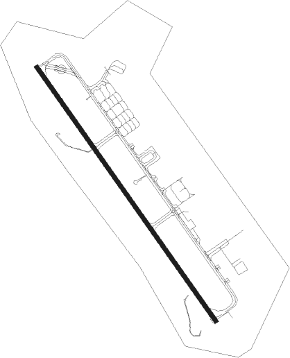
Portsmouth - Portsmouth Intl At Pease
Airport details
| Country | United States of America |
| State | New Hampshire |
| Region | K6 |
| Airspace | Boston Ctr |
| Municipality | Newington |
| Elevation | 100ft (30m) |
| Timezone | GMT -5 |
| Coordinates | 43.07795, -70.82328 |
| Magnetic var | |
| Type | land |
| Available since | X-Plane v10.40 |
| ICAO code | KPSM |
| IATA code | PSM |
| FAA code | PSM |
Communication
| PORTSMOUTH INTL AT PEASE Portsmouth ATIS | 132.050 |
| PORTSMOUTH INTL AT PEASE Portsmouth UNICOM | 122.950 |
| PORTSMOUTH INTL AT PEASE Portsmouth GROUND | 120.950 |
| PORTSMOUTH INTL AT PEASE Portsmouth TOWER | 128.400 |
| PORTSMOUTH INTL AT PEASE Portsmouth Clearance Delivery | 335.800 |
| PORTSMOUTH INTL AT PEASE Portsmouth GCA | 227.120 |
| PORTSMOUTH INTL AT PEASE Boston ApproachROACH | 125.050 |
| PORTSMOUTH INTL AT PEASE Boston DepartureARTURE | 125.050 |
Approach frequencies
| ILS-cat-I | RW16 | 110.1 | 18.00mi |
| ILS-cat-I | RW34 | 110.1 | 18.00mi |
| 3° GS | RW16 | 110.1 | 18.00mi |
| 3° GS | RW34 | 110.1 | 18.00mi |
Nearby Points of Interest:
Richman Margeson Estate
-Newington Railroad Depot
-George Rogers House
-Richard Jackson House
-Weeks House
-Freewill Baptist Church-Peoples Baptist Church-New Hope Church
-Larkin-Rice House
-Whidden-Ward House
-Hart-Rice House
-Daniel Pinkham House
-Jeremiah Hart House
-Phoebe Hart House
-Nutter-Rymes House
-Henry Sherburne House
-James Neal House
-John Hart House
-Simeon P. Smith House
-Benedict House
-Portsmouth Academy building
-Samuel Beck House
-Portsmouth Parade Historic District
-Rockingham Hotel
-Portsmouth Downtown Historic District
-Portsmouth Athenæum
-New Hampshire Bank Building
Nearby beacons
| code | identifier | dist | bearing | frequency |
|---|---|---|---|---|
| PSM | (PORTSMOUTH) DME | 0.5 | 307° | 116.50 |
| ESG | ROLLINS (ROLLINSFORD) NDB | 8.5 | 358° | 260 |
| SF | SANFD (SANFORD) NDB | 15.3 | 357° | 349 |
| ENE | KENNEBUNK VOR/DME | 22.8 | 31° | 117.10 |
| LWM | DME | 23.5 | 219° | 112.50 |
| MHT | MANCHESTER VOR/DME | 27 | 249° | 114.40 |
| CO | EPSOM (CONCORD) NDB | 27.6 | 274° | 216 |
| MJ | FITZY (MANCHESTER) NDB | 33.5 | 253° | 209 |
| CON | CONCORD VOR/DME | 34 | 281° | 112.90 |
| LC | BLNAP (LACONIA) NDB | 41.6 | 303° | 328 |
| BOS | BOSTON VOR/DME | 43.8 | 193° | 112.70 |
| LE | LEWIE (AUBURN-LEWISTON) NDB | 57.1 | 29° | 240 |
| OW | STOGE (NORWOOD) NDB | 59.1 | 198° | 397 |
Departure and arrival routes
| Transition altitude | 18000ft |
| Transition level | 18000ft |
| SID end points | distance | outbound heading | |
|---|---|---|---|
| RW16 | |||
| PSM4, TANKR3 | 62mi | 226° | |
| RW34 | |||
| PSM4, TANKR3 | 62mi | 226° | |
Instrument approach procedures
| runway | airway (heading) | route (dist, bearing) |
|---|---|---|
| RW16 | ITAWA (141°) | ITAWA 3000ft |
| RW16 | ITAWT (106°) | ITAWT ITAWA (10mi, 66°) 3000ft |
| RW16 | ITAYI (189°) | ITAYI ITAWA (10mi, 246°) 3000ft |
| RNAV | ITAWA 3000ft PUDYE (6mi, 141°) 2000ft CARAY (4mi, 141°) 720ft KPSM (3mi, 141°) 152ft (4571mi, 121°) 300ft TTATT (4570mi, 301°) IDEED (10mi, 141°) 3000ft IDEED (turn) 3000ft | |
| RW34 | IDEED (321°) | IDEED 3000ft |
| RW34 | YINUY (12°) | YINUY IDEED (10mi, 66°) 3000ft |
| RW34 | YITUR (285°) | YITUR IDEED (10mi, 246°) 3000ft |
| RNAV | IDEED 3000ft YOKNZ (6mi, 321°) 1700ft KPSM (6mi, 321°) 148ft (4571mi, 121°) 284ft ITAWA (4580mi, 301°) 3300ft ITAWA (turn) 3300ft |
Disclaimer
The information on this website is not for real aviation. Use this data with the X-Plane flight simulator only! Data taken with kind consent from X-Plane 12 source code and data files. Content is subject to change without notice.