Palm Springs - Palm Springs Intl
Airport details
| Country | United States of America |
| State | California |
| Region | K2 |
| Airspace | Los Angeles Ctr |
| Municipality | Palm Springs |
| Elevation | 477ft (145m) |
| Timezone | GMT -8 |
| Coordinates | 33.82778, -116.50886 |
| Magnetic var | |
| Type | land |
| Available since | X-Plane v10.40 |
| ICAO code | KPSP |
| IATA code | PSP |
| FAA code | PSP |
Communication
| Palm Springs Intl Palm Springs ATIS | 124.650 |
| Palm Springs Intl Palm Springs Delivery | 128.350 |
| Palm Springs Intl Palm Springs Ground Control | 121.900 |
| Palm Springs Intl Palm Springs Tower | 119.700 |
| Palm Springs Intl SOCAL Approach | 126.700 |
| Palm Springs Intl SOCAL Departure | 126.700 |
Nearby Points of Interest:
Coachella Valley Savings No. 2
-Kenaston House
-Palm Springs Aerial Tramway Mountain Station
-Long Valley Ranger Station
-Peak Shelter Cabin
-Ryan House and Lost Horse Well
-Gilman Ranch
-Cow Camp
-Keys Desert Queen Ranch
-Desert Queen Mine
-Integratron
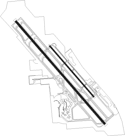
Runway info
Runway 13R / 31L  | ||
| length | 3052m (10013ft) | |
| bearing | 138° / 318° | |
| width | 46m (150ft) | |
| surface | asphalt | |
| displ threshold | 921m (3022ft) / 457m (1499ft) | |
| blast zone | 61m (200ft) / 61m (200ft) | |
| Runway 13L / 31R | ||
| length | 1512m (4961ft) | |
| bearing | 138° / 318° | |
| width | 23m (75ft) | |
| surface | asphalt | |
| blast zone | 41m (135ft) / 45m (148ft) | |
Nearby beacons
| code | identifier | dist | bearing | frequency |
|---|---|---|---|---|
| PSP | PALM SPRINGS VORTAC | 4.6 | 62° | 115.50 |
| TRM | THERMAL VORTAC | 21.1 | 120° | 116.20 |
| HDF | HOMELAND (RIVERSIDE) VOR | 33.9 | 266° | 113.40 |
| RIV | MARCH (RIVERSIDE) TACAN | 38.4 | 276° | 113 |
| TNP | TWENTYNINE PALMS VORTAC | 40.5 | 69° | 114.20 |
| JLI | JULIAN VORTAC | 41.4 | 186° | 114 |
| SB | PETIS (SAN BERNARDINO) NDB | 44.8 | 285° | 397 |
| RAL | RIVERSIDE VOR | 47.5 | 278° | 112.40 |
| NFG | CAMP PENDLETON (OCEANSIDE TACAN | 55 | 238° | 111.80 |
| OCN | OCEANSIDE VORTAC | 57.5 | 237° | 115.30 |
| HEC | HECTOR VORTAC | 58.2 | 3° | 112.70 |
| VCV | VICTORVILLE VOR/DME | 63.5 | 311° | 109.05 |
| NKX | MIRAMAR (SAN DIEGO) TACAN | 66 | 214° | 109.60 |
| NJK | EL CENTRO TACAN | 72.8 | 140° | 111 |
Departure and arrival routes
| Transition altitude | 18000ft |
| Transition level | 18000ft |
| SID end points | distance | outbound heading | |
|---|---|---|---|
| RW13 (ALL) | |||
| TRM6 | 21mi | 120° | |
| RW31 (ALL) | |||
| TRM6 | 21mi | 120° | |
| STAR starting points | distance | inbound heading | |
|---|---|---|---|
| ALL | |||
| SIZLR3 | 87.7 | 116° | |
| SBONO1 | 21.7 | 261° | |
| CLOWD1 | 28.7 | 262° | |
Instrument approach procedures
| runway | airway (heading) | route (dist, bearing) |
|---|---|---|
| RW13RZ | FERNN (165°) | FERNN 11000ft JEVOK (7mi, 137°) 10000ft CUXIT (9mi, 66°) 7100ft HOPLI (6mi, 337°) 7100ft YOCUL (5mi, 314°) 7000ft WASAK (6mi, 260°) 6000ft |
| RW13RZ | SBONO (261°) | SBONO 9000ft YAGUS (5mi, 266°) 8000ft CUXIT (7mi, 299°) 7100ft HOPLI (6mi, 337°) 7100ft YOCUL (5mi, 314°) 7000ft WASAK (6mi, 260°) 6000ft |
| RW13RZ | TRM (300°) | TRM 9000ft CUXIT (21mi, 337°) 7100ft HOPLI (6mi, 337°) 7100ft YOCUL (5mi, 314°) 7000ft WASAK (6mi, 260°) 6000ft |
| RNAV | WASAK 6000ft LACIV (5mi, 216°) 4400ft FIVUT (2mi, 199°) 3800ft JEXOT (3mi, 179°) 2900ft NUDCI (4mi, 152°) KPSP (4mi, 140°) 496ft (6712mi, 106°) 900ft TRM (6699mi, 286°) 4000ft TRM (turn) | |
| RW31LY | BALDI (356°) | BALDI 12000ft CUPOL (10mi, 49°) HIXOV (6mi, 82°) TEVUC (9mi, 225°) 4000ft |
| RW31LY | CLOWD (262°) | CLOWD 11000ft WEMIR (11mi, 244°) RIYOC (8mi, 209°) TEVUC (9mi, 265°) 4000ft |
| RW31LY | PSP (242°) | PSP 11000ft HIXOV (10mi, 113°) TEVUC (9mi, 225°) 4000ft |
| RW31LY | SBONO (261°) | SBONO 9000ft WEMIR (6mi, 209°) RIYOC (8mi, 209°) TEVUC (9mi, 265°) 4000ft |
| RW31LY | TRM (300°) | TRM 5500ft TEVUC (11mi, 283°) 4000ft |
| RNAV | TEVUC 4000ft JISOP (4mi, 317°) 2900ft KPSP (8mi, 316°) 461ft (6712mi, 106°) 1800ft TRM (6699mi, 286°) 4000ft TRM (turn) |
Holding patterns
| STAR name | hold at | type | turn | heading* | altitude | leg | speed limit |
|---|---|---|---|---|---|---|---|
| CLOWD1 | CLOWD | VHF | right | 72 (252)° | < 17999ft | 1.0min timed | ICAO rules |
| SBONO1 | CLOWD | VHF | right | 72 (252)° | < 17999ft | 1.0min timed | ICAO rules |
| *) magnetic outbound (inbound) holding course | |||||||
Disclaimer
The information on this website is not for real aviation. Use this data with the X-Plane flight simulator only! Data taken with kind consent from X-Plane 12 source code and data files. Content is subject to change without notice.