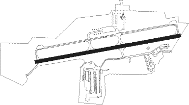
Pottstown - Heritage Field
Airport details
| Country | United States of America |
| State | Pennsylvania |
| Region | K6 |
| Airspace | New York Ctr |
| Municipality | Limerick Township |
| Elevation | 308ft (94m) |
| Timezone | GMT -5 |
| Coordinates | 40.23956, -75.55672 |
| Magnetic var | |
| Type | land |
| Available since | X-Plane v10.40 |
| ICAO code | KPTW |
| IATA code | n/a |
| FAA code | PTW |
Communication
| Heritage Field ASOS | 119.425 |
| Heritage Field CTAF/UNICOM | 122.700 |
| Heritage Field PHILADELPHIA Approach | 126.850 |
| Heritage Field PHILADELPHIA Departure | 126.850 |
Approach frequencies
| LOC | RW28 | 108.3 | 18.00mi |
Nearby Points of Interest:
Isaac Hunsberger House
-Sanatoga Union Sunday School
-William and Mordecai Evans House
-River Bend Farm
-Sunnybrook (Lower Pottsgrove Township, Pennsylvania)
-Sunrise Mill
-Parker's Ford
-John Englehardt Homestead
-Bridge in Upper Frederick Township
-Grubb Mansion
-Henry Antes House
-Continental Stove Works
-High Street Historic District
-Knurr Log House
-Old Pottstown Historic District
-Conrad Grubb Homestead
-Long Meadow Farm
-Pottstown Roller Mill
-Reading Railroad Pottstown Station
-Black Rock Bridge
-Perkiomen Bridge
-Prizer's Mill Complex
-Vincent Forge Mansion
-Stephen Meredith House
-French Creek Farm
Nearby beacons
| code | identifier | dist | bearing | frequency |
|---|---|---|---|---|
| PTW | POTTSTOWN VORTAC | 1 | 191° | 116.50 |
| ING | AMBLER NDB | 14.2 | 113° | 275 |
| MXE | MODENA VORTAC | 20 | 200° | 113.20 |
| ETX | EAST TEXAS VOR/DME | 21.3 | 340° | 110.20 |
| FJC | ALLENTOWN VORTAC | 29.6 | 12° | 117.50 |
| ARD | YARDLEY VOR/DME | 29.7 | 89° | 108.20 |
| DQO | DUPONT (WILMINGTON) VORTAC | 33.7 | 185° | 114 |
| LRP | LANCASTER VOR/DME | 34.4 | 261° | 117.30 |
| OOD | WOODSTOWN VORTAC | 38 | 157° | 112.80 |
| IL | HADIN (WILMINGTON) NDB | 39.6 | 185° | 248 |
| SBJ | SOLBERG VOR/DME | 42.5 | 67° | 112.90 |
| GXU | MC GUIRE (WRIGHTSTOWN) VORTAC | 46.2 | 103° | 110.60 |
| BZJ | BELLGROVE (INDIANTOWN GAP) NDB | 47.1 | 281° | 328 |
| BWZ | BROADWAY (SCHOOLEY'S MT) VOR/DME | 47.4 | 53° | 114.20 |
| VCN | CEDAR LAKE (MILLVILLE) VOR/DME | 50.1 | 140° | 115.20 |
| RNB | RAINBOW (MILLVILLE) NDB | 53 | 153° | 363 |
| STW | STILLWATER VOR/DME | 55.1 | 42° | 109.60 |
| ACY | ATLANTIC CITY VORTAC | 65.2 | 129° | 108.60 |
| MTN | MARTIN (BALTIMORE) TACAN | 67.3 | 223° | 134.10 |
Instrument approach procedures
| runway | airway (heading) | route (dist, bearing) |
|---|---|---|
| RW28 | AWISA (283°) | AWISA IZIWA (5mi, 352°) 2200ft |
| RW28 | MAZIE (260°) | MAZIE IZIWA (9mi, 251°) 2200ft |
| RW28 | SPUDS (210°) | SPUDS CEMFY (9mi, 130°) 2400ft IZIWA (5mi, 173°) 2200ft |
| RNAV | IZIWA 2200ft BIDDU (7mi, 266°) 2200ft KPTW (5mi, 266°) 365ft (4746mi, 118°) 652ft EZABO (4756mi, 298°) 2600ft EZABO (turn) | |
| RWNVA | BUNTS (51°) | BUNTS GESMY (4mi, 338°) 2500ft EZABO (5mi, 352°) 2500ft |
| RWNVA | HOUTN (110°) | HOUTN EZABO (7mi, 159°) 2500ft |
| RNAV | EZABO 2500ft POMUF (4mi, 85°) 2200ft KPTW (6mi, 85°) 358ft (4746mi, 118°) 708ft IZIWA (4734mi, 298°) 2200ft IZIWA (turn) |
Disclaimer
The information on this website is not for real aviation. Use this data with the X-Plane flight simulator only! Data taken with kind consent from X-Plane 12 source code and data files. Content is subject to change without notice.