Pueblo - Pueblo Memorial
Airport details
| Country | United States of America |
| State | Colorado |
| Region | K2 |
| Airspace | Denver Ctr |
| Municipality | Pueblo |
| Elevation | 4729ft (1441m) |
| Timezone | GMT -7 |
| Coordinates | 38.28994, -104.49802 |
| Magnetic var | |
| Type | land |
| Available since | X-Plane v10.40 |
| ICAO code | KPUB |
| IATA code | PUB |
| FAA code | PUB |
Communication
| Pueblo Memorial ATIS | 125.250 |
| Pueblo Memorial UNICOM | 122.950 |
| Pueblo Memorial CTAF | 119.100 |
| Pueblo Memorial DLV | 120.900 |
| Pueblo Memorial Ground Control | 121.900 |
| Pueblo Memorial Tower | 119.100 |
| Pueblo Memorial Approach/Departure | 120.100 |
Approach frequencies
| ILS-cat-I | RW08R | 109.5 | 18.00mi |
| ILS-cat-I | RW26L | 108.3 | 18.00mi |
| 3° GS | RW08R | 109.5 | 18.00mi |
| 3° GS | RW26L | 108.3 | 18.00mi |
Nearby Points of Interest:
Pueblo County Courthouse
-Pueblo Federal Building
-Colorado Building
-Montgomery Ward Building
-Mechanics Building
-Henkel-Duke Mercantile Company Warehouse
-Rood Candy Company Building
-Union Avenue Historic Commercial District
-Union Depot
-St. John's Greek Orthodox Church
-Minnequa Steel Works Office Building and Dispensary, Colorado Fuel and Iron Company
-First Methodist Episcopal Church
-Charles H. Stickney House
-First Congregational Church, Pueblo, Colorado
-Avondale Bridge
-Old Livery Stable
-Pueblo Mountain Park
-Drennan School
-S. A. Wilson Elementary School
-Crowley School
-Santa Fe Railway Manzanola Depot
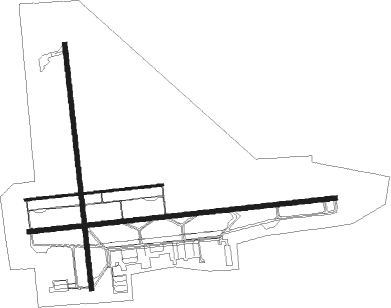
Runway info
Runway 8R / 26L  | ||
| length | 3192m (10472ft) | |
| bearing | 89° / 269° | |
| width | 46m (150ft) | |
| surface | asphalt | |
| Runway 17 / 35 | ||
| length | 2537m (8323ft) | |
| bearing | 178° / 358° | |
| width | 46m (150ft) | |
| surface | asphalt | |
| Runway 8L / 26R | ||
| length | 1431m (4695ft) | |
| bearing | 89° / 269° | |
| width | 23m (75ft) | |
| surface | asphalt | |
Nearby beacons
| code | identifier | dist | bearing | frequency |
|---|---|---|---|---|
| PUB | PUEBLO VORTAC | 3.2 | 86° | 116.70 |
| TF | ARUBA (PUEBLO) NDB | 6.7 | 90° | 373 |
| IHS | IRONHORSE (FORT CARSON) NDB | 26.2 | 327° | 335 |
| CO | PETEY (COLORADO SPRINGS) NDB | 26.3 | 332° | 407 |
| FCS | BUTTS (FORT CARSON) VOR/DME | 26.4 | 326° | 108.80 |
| BRK | BLACK FOREST VOR/DME | 39.8 | 348° | 112.50 |
| HGO | HUGO VOR/DME | 51.9 | 59° | 112.10 |
Instrument approach procedures
| runway | airway (heading) | route (dist, bearing) |
|---|---|---|
| RW08R | STANO (96°) | STANO DREXL (3mi, 136°) 7000ft |
| RW08R | VIGIL (3°) | VIGIL ASUNE (19mi, 313°) 7900ft DREXL (6mi, 358°) 7000ft |
| RNAV | DREXL 7000ft OKDEE (6mi, 89°) 6900ft GOYEP (4mi, 89°) 5640ft KPUB (3mi, 87°) 4730ft (6086mi, 110°) 4871ft HELER (6073mi, 290°) 7000ft HELER (turn) | |
| RW17 | DRAKE (195°) | DRAKE ZENRU (8mi, 223°) 7000ft |
| RW17 | ORWAY (272°) | ORWAY OHAGY (21mi, 305°) 7500ft ZENRU (6mi, 269°) 7000ft |
| RW17 | STANO (96°) | STANO OGHAL (14mi, 47°) 8100ft ZENRU (6mi, 89°) 7000ft |
| RNAV | ZENRU 7000ft PUBXO (7mi, 178°) 6500ft KPUB (6mi, 175°) 4779ft (6086mi, 110°) 6000ft BORUM (6082mi, 290°) 7500ft BORUM (turn) | |
| RW26L | DRAKE (195°) | DRAKE BONUH (16mi, 138°) 7700ft HELER (6mi, 178°) 7000ft |
| RW26L | ORWAY (272°) | ORWAY HELER (8mi, 276°) 7000ft |
| RW26L | PUB (266°) | PUB HELER (10mi, 90°) 7200ft HELER (turn) 7000ft |
| RW26L | STAXX (314°) | STAXX REDHI (13mi, 352°) 7000ft HELER (6mi, 352°) 7000ft |
| RW26L | VIGIL (3°) | VIGIL REDHI (22mi, 51°) 7900ft HELER (6mi, 352°) 7000ft |
| RNAV | HELER 7000ft JIKTA (6mi, 269°) 6600ft KPUB (7mi, 270°) 4709ft (6086mi, 110°) 4859ft MERTZ (6093mi, 290°) 7000ft MERTZ (turn) | |
| RW35 | ORWAY (272°) | ORWAY BORUM (18mi, 240°) 7100ft ESIFE (6mi, 269°) 7100ft |
| RW35 | STANO (96°) | STANO BUZRO (17mi, 139°) 7500ft ESIFE (6mi, 89°) 7100ft |
| RW35 | VIGIL (3°) | VIGIL ESIFE (9mi, 9°) 7100ft |
| RNAV | ESIFE 7100ft PUCUB (7mi, 358°) 6300ft WIVOD (2mi, 358°) 5640ft KPUB (4mi, 3°) 4693ft (6086mi, 110°) 5140ft OHAGY (6078mi, 290°) 7500ft OHAGY (turn) |
Disclaimer
The information on this website is not for real aviation. Use this data with the X-Plane flight simulator only! Data taken with kind consent from X-Plane 12 source code and data files. Content is subject to change without notice.