Dallas - Paulding Northwest Atlanta
Airport details
| Country | United States of America |
| State | Georgia |
| Region | K7 |
| Airspace | Atlanta Ctr |
| Municipality | Paulding County |
| Elevation | 1289ft (393m) |
| Timezone | GMT -5 |
| Coordinates | 33.91204, -84.94062 |
| Magnetic var | |
| Type | land |
| Available since | X-Plane v10.40 |
| ICAO code | KPUJ |
| IATA code | n/a |
| FAA code | PUJ |
Communication
| Paulding Northwest Atlanta AWOS-III | 126.225 |
| Paulding Northwest Atlanta UNICOM | 123.075 |
| Paulding Northwest Atlanta Atlanta Approach/Departure | 121.000 |
Approach frequencies
| ILS-cat-I | RW31 | 109.15 | 18.00mi |
| 3° GS | RW31 | 109.15 | 18.00mi |
Nearby Points of Interest:
Paulding County Courthouse
-Hiram Colored School
-Pickett's Mill Battlefield Site
-North Villa Rica Commercial Historic District
-Douglas County Courthouse
-Col. William T. Roberts House
-Haralson County Courthouse
-Etowah Indian Mounds
-Roselawn Museum
-Bartow County Courthouse
-William Gibbs McAdoo House
-Hawkes Children's Library
-Old Bartow County Courthouse
-Cedartown Waterworks-Woman's Building-Big Spring Park Historic District
-Beulah Grove Lodge No. 372, Free and Accepted York Masons
-Robert Mable House and Cemetery
-Ruff's Mill and Concord Covered Bridge
-Cassville Post Office
-Carroll County Courthouse
-Riverview Carousel
-Between the Rivers Historic District
-United States Post Office and Courthouse
-Judge William Wilson House
-Whittier Mill Village
-Marshall Forest
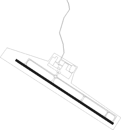
Runway info
| Runway 13 / 31 | ||
| length | 1678m (5505ft) | |
| bearing | 123° / 303° | |
| width | 30m (100ft) | |
| surface | concrete | |
| blast zone | 0m (0ft) / 40m (131ft) | |
Nearby beacons
| code | identifier | dist | bearing | frequency |
|---|---|---|---|---|
| RMG | ROME VORTAC | 17.4 | 324° | 115.40 |
| DOB | DOBBINS (MARIETTA) TACAN | 21.5 | 90° | 113 |
| GPQ | CARROLLTON NDB | 22.8 | 209° | 278 |
| AT | CATTA (ATLANTA) NDB | 25.4 | 124° | 375 |
| ATL | ATLANTA VORTAC | 30.4 | 119° | 116.90 |
| DJD | CHERO NDB | 30.4 | 53° | 415 |
| PDK | PEACHTREE (ATLANTA) VOR/DME | 32 | 93° | 116.60 |
| EQQ | COWETA COUNTY (NEWNAN) NDB | 40.9 | 161° | 234 |
| FFC | PECAT (ATLANTA) NDB | 43.1 | 143° | 316 |
| LGC | LA GRANGE VORTAC | 53.5 | 197° | 115.60 |
| AN | BOGGA (ANNISTON) NDB | 54.4 | 249° | 211 |
| OP | YATES (THOMASTON) NDB | 70.5 | 143° | 339 |
Departure and arrival routes
| Transition altitude | 18000ft |
| Transition level | 18000ft |
| STAR starting points | distance | inbound heading | |
|---|---|---|---|
| ALL | |||
| BOKRT3 | 40.4 | 17° | |
| DIFFI4 | 53.5 | 17° | |
| SWTEE2 | 10.7 | 103° | |
| BUKHD3 | 35.9 | 163° | |
| DEHAN3 | 58.4 | 239° | |
| WRGNZ3 | 71.0 | 293° | |
Instrument approach procedures
| runway | airway (heading) | route (dist, bearing) |
|---|---|---|
| RW13 | YOBUY (122°) | YOBUY 3000ft |
| RNAV | YOBUY 3000ft WUDPO (6mi, 122°) 3000ft KPUJ (6mi, 123°) 1339ft (5153mi, 112°) 1800ft YOBUY (5163mi, 292°) 3000ft YOBUY (turn) | |
| RW31 | OOUDT (303°) | OOUDT 3000ft |
| RNAV | OOUDT 3000ft PUJJY (6mi, 303°) 2900ft KPUJ (5mi, 303°) 1330ft (5153mi, 112°) 1483ft YOBUY (5163mi, 292°) 3000ft YOBUY (turn) |
Holding patterns
| STAR name | hold at | type | turn | heading* | altitude | leg | speed limit |
|---|---|---|---|---|---|---|---|
| BUKHD3 | HLNDS | VHF | right | 327 (147)° | DME 10.0mi | ICAO rules | |
| DEHAN3 | AWSON | VHF | left | 29 (209)° | DME 10.0mi | ICAO rules | |
| DEHAN3 | TRALZ | VHF | right | 32 (212)° | DME 10.0mi | ICAO rules | |
| DIFFI4 | LGC | NDB | right | 228 (48)° | 1.0min timed | ICAO rules | |
| SWTEE2 | BIZKT | VHF | left | 292 (112)° | DME 10.0mi | ICAO rules | |
| *) magnetic outbound (inbound) holding course | |||||||
Disclaimer
The information on this website is not for real aviation. Use this data with the X-Plane flight simulator only! Data taken with kind consent from X-Plane 12 source code and data files. Content is subject to change without notice.