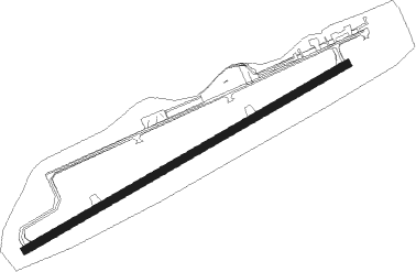
Pullman/moscowid - Pullman Moscow Rgnl
Airport details
| Country | United States of America |
| State | Washington |
| Region | K1 |
| Airspace | Seattle Ctr |
| Municipality | Pullman |
| Elevation | 2556ft (779m) |
| Timezone | GMT -8 |
| Coordinates | 46.74386, -117.10958 |
| Magnetic var | |
| Type | land |
| Available since | X-Plane v10.40 |
| ICAO code | KPUW |
| IATA code | PUW |
| FAA code | PUW |
Communication
| Pullman Moscow Rgnl ASOS | 135.675 |
| Pullman Moscow Rgnl CTAF/UNICOM | 122.800 |
Approach frequencies
| ILS-cat-I | RW05 | 110.35 | 18.00mi |
| 3° GS | RW05 | 110.35 | 18.00mi |
Nearby Points of Interest:
United Presbyterian Church
-Cordova Theatre
-Pullman High School
-Memorial Gymnasium
-Ridenbaugh Hall
-Kappa Sigma Fraternity, Gamma Theta Chapter
-Skattaboe Block
-McConnell–McGuire Building
-Almon Asbury Lieuallen House
-Moscow City Hall
-Moscow Carnegie Library
-Moscow High School
-W. J. McConnell House
-Holy Trinity Episcopal Church
-St. Boniface Church, Convent and Rectory
-Commercial Historic District
-Genesee Exchange Bank
-Ole Bohman House
-American Legion Cabin
-Hotel Rietmann
-Manning-Rye Covered Bridge
-Edward and Ida Soncarty Barn
-Breier Building
-C. C. Van Arsdol House
-Clarkston Public Library
Nearby beacons
| code | identifier | dist | bearing | frequency |
|---|---|---|---|---|
| PUW | PULLMAN (PULLMAN/MOSCOW) VOR/DME | 6.2 | 239° | 109 |
| MQG | NEZ PERCE (LEWISTON) VOR/DME | 23.9 | 146° | 108.20 |
| IDQ | DME | 48.7 | 136° | 115.65 |
| GEG | SPOKANE VORTAC | 53.6 | 328° | 115.50 |
| SKA | FAIRCHILD (SPOKANE) TACAN | 56.7 | 327° | 111.40 |
Instrument approach procedures
| runway | airway (heading) | route (dist, bearing) |
|---|---|---|
| RW05 | PLUUR (94°) | PLUUR WAZOO (9mi, 145°) 5000ft |
| RW05 | UTLEE (44°) | UTLEE WAZOO (9mi, 325°) 5000ft |
| RW05 | WAZOO (72°) | WAZOO 5000ft |
| RNAV | WAZOO 5000ft RYPEN (9mi, 72°) 4300ft ZODID (3mi, 72°) 3420ft KPUW (3mi, 71°) 2617ft (6498mi, 112°) 3460ft PLUUR (6514mi, 292°) 5400ft PLUUR (turn) | |
| RW23-N | JETTS (244°) | JETTS CHEDD (8mi, 194°) 6600ft SPITE (10mi, 244°) 5300ft |
| RW23-N | MQG (326°) | MQG SCWTR (20mi, 17°) 5300ft SPITE (4mi, 286°) 5300ft |
| RW23-N | WAZOO (72°) | WAZOO MATRL (23mi, 89°) 5300ft SPITE (6mi, 15°) 5300ft |
| RNAV | SPITE 5300ft ENGRG (5mi, 286°) 4400ft LABBS (2mi, 269°) 3900ft KPUW (4mi, 253°) 2607ft (6498mi, 112°) 2962ft WAZOO (6513mi, 292°) 5000ft WAZOO (turn) 5000ft | |
| RW23-Y | CEPER (292°) | CEPER CESIN (17mi, 280°) 6000ft WALED (11mi, 20°) 5300ft |
| RW23-Y | JETTS (244°) | JETTS CHEDD (8mi, 194°) 6600ft WALED (8mi, 220°) 5300ft |
| RW23-Y | MQG (326°) | MQG CESIN (10mi, 12°) 6000ft WALED (11mi, 20°) 5300ft |
| RW23-Y | PUW (59°) | PUW WALED (19mi, 85°) 6000ft WALED (turn) 5300ft |
| RNAV | WALED 5300ft TEGRE (7mi, 283°) 4700ft VNDEL (3mi, 279°) 4000ft JORER (2mi, 259°) 3440ft WIMAP (2mi, 259°) 2806ft (6497mi, 112°) 3500ft WAZOO (6513mi, 292°) 5000ft WAZOO (turn) | |
| RW23-Z | JETTS (244°) | JETTS JAKLU (7mi, 195°) 6800ft TONRE (5mi, 248°) 5800ft CAVPA (4mi, 248°) 5800ft ZONOS (3mi, 271°) 4900ft AXION (3mi, 273°) 4100ft |
| RW23-Z | WAXIT (277°) | WAXIT SPITE (4mi, 292°) 6000ft ZONOS (4mi, 294°) 4900ft AXION (3mi, 273°) 4100ft |
| RW23-Z | WAZOO (72°) | WAZOO HUZZA (15mi, 84°) 5000ft CLONK (4mi, 84°) 5000ft ZONOS (6mi, 18°) 4900ft AXION (3mi, 273°) 4100ft |
| RNAV | AXION 4100ft KPUW (5mi, 253°) 2611ft WAZOO (15mi, 252°) 5000ft WAZOO (turn) |
Disclaimer
The information on this website is not for real aviation. Use this data with the X-Plane flight simulator only! Data taken with kind consent from X-Plane 12 source code and data files. Content is subject to change without notice.
