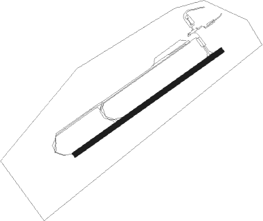
Provincetown - Provincetown Muni
Airport details
| Country | United States of America |
| State | Massachusetts |
| Region | K6 |
| Airspace | Boston Ctr |
| Municipality | Provincetown |
| Elevation | 5ft (2m) |
| Timezone | GMT -5 |
| Coordinates | 42.07228, -70.22073 |
| Magnetic var | |
| Type | land |
| Available since | X-Plane v10.40 |
| ICAO code | KPVC |
| IATA code | PVC |
| FAA code | PVC |
Communication
| Provincetown Muni AWOS 3 | 119.025 |
| Provincetown Muni CTAF/UNICOM | 122.800 |
| Provincetown Muni CAPE Approach/Departure | 118.200 |
Approach frequencies
| ILS-cat-I | RW07 | 111.1 | 18.00mi |
| 3° GS | RW07 | 111.1 | 18.00mi |
Nearby Points of Interest:
Provincetown Public Library
-United States Post Office
-Center Methodist Church
-Provincetown Historic District
-Truro Highlands Historic District
-Jedediah Higgins House
-First Congregational Parish Historic District
-Union Hall
-Cobb Memorial Library
-Thomas Atwood House
-Ahearn House and Summer House
-John Newcomb House
-Rowell House
-Paul and Madeleine Weidlinger House
-Samuel and Minette Kuhn House
-Wellfleet Center Historic District
-Vera and Laszlo Tisza House
-Anthony and Allison Sirna Studio
-Peter Kugel House
-Hinckley's Corner Historic District
-Saunders-Paine House
-Townsend House
-Paine Hollow Road South Historic District
-Marconi Wireless Station Site
-Eastham Center Historic District
Runway info
| Runway 7 / 25 | ||
| length | 1066m (3497ft) | |
| bearing | 66° / 246° | |
| width | 30m (100ft) | |
| surface | asphalt | |
Nearby beacons
| code | identifier | dist | bearing | frequency |
|---|---|---|---|---|
| PVC | PROVINCETOWN NDB | 0.2 | 218° | 389 |
| LFV | MARCONI (NORTH TRURO) VOR/DME | 8.8 | 107° | 114.70 |
| HY | BOGEY (HYANNIS) NDB | 21.4 | 177° | 342 |
| CQX | NAUSET (CHATHAM) NDB | 25.1 | 149° | 279 |
| FMH | OTIS (FALMOUTH) TACAN | 28 | 215° | 115.80 |
| BOS | BOSTON VOR/DME | 38.2 | 290° | 112.70 |
| OW | STOGE (NORWOOD) NDB | 40.5 | 273° | 397 |
| MVY | MARTHA'S VINEYARD VOR/DME | 44.2 | 210° | 114.50 |
| ACK | NANTUCKET VOR/DME | 48.2 | 166° | 116.20 |
| LWM | DME | 55.7 | 307° | 112.50 |
Instrument approach procedures
| runway | airway (heading) | route (dist, bearing) |
|---|---|---|
| RW07 | CRACO (357°) | CRACO PEPDE (23mi, 323°) 3000ft WOMEK (5mi, 321°) 3000ft |
| RW07 | DUNKK (91°) | DUNKK ONRAE (6mi, 135°) 3000ft WOMEK (5mi, 124°) 3000ft |
| RW07 | WOMEK (66°) | WOMEK 3000ft |
| RNAV | WOMEK 3000ft PHONY (8mi, 66°) 2000ft FABIX (4mi, 66°) 740ft KPVC (2mi, 66°) 48ft (4531mi, 121°) 208ft WULGA (4524mi, 301°) 3000ft WULGA (turn) | |
| RW25 | CRACO (357°) | CRACO JUPOT (34mi, 22°) 3000ft WULGA (5mi, 321°) 3000ft |
| RW25 | SCUPP (179°) | SCUPP WASPO (23mi, 158°) 3000ft WULGA (5mi, 142°) 3000ft |
| RW25 | WULGA (246°) | WULGA 3000ft |
| RNAV | WULGA 3000ft JANAG (5mi, 246°) 1600ft KPVC (5mi, 246°) 38ft (4531mi, 121°) 400ft JOBEB (4541mi, 301°) 3000ft JOBEB (turn) |
Disclaimer
The information on this website is not for real aviation. Use this data with the X-Plane flight simulator only! Data taken with kind consent from X-Plane 12 source code and data files. Content is subject to change without notice.
