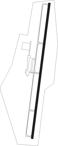
Lexington-parsons - Beech River Regl
Airport details
| Country | United States of America |
| State | Tennessee |
| Region | K7 |
| Airspace | Memphis Ctr |
| Municipality | Henderson County |
| Elevation | 485ft (148m) |
| Timezone | GMT -6 |
| Coordinates | 35.65636, -88.19535 |
| Magnetic var | |
| Type | land |
| Available since | X-Plane v10.40 |
| ICAO code | KPVE |
| IATA code | n/a |
| FAA code | PVE |
Communication
| Beech River Regl AWOS 3 | 118.125 |
| Beech River Regl CTAF | 123.000 |
| Beech River Regl UNICOM | 123.000 |
| Beech River Regl Approach/Departure | 125.850 |
Nearby Points of Interest:
John P. Rains Hotel
-Thompsie Edwards House
-Perry County Courthouse
-Hamlett-Smith House
-Hufstedler Gravehouse
-William Thompson House
-Chester County Courthouse
-Cherry Mansion
-William Kirby Walsh House
-Carnegie Center for Arts and History
-Ross-Sewell House
-Lewis County Courthouse
-Greyhound Half-Way House
Nearby beacons
| code | identifier | dist | bearing | frequency |
|---|---|---|---|---|
| MKL | MC KELLAR (JACKSON) VOR/DME | 35 | 266° | 112 |
| GHM | (CENTERVILLE) DME | 37.7 | 77° | 111.60 |
| MKL | MERSY (JACKSON) NDB | 38.1 | 260° | 394 |
| UU | SEYER (CORINTH) NDB | 43.6 | 213° | 334 |
| UC | OBION (UNION CITY) NDB | 54.7 | 309° | 212 |
| CK | SNUFF(FT CAMPBELL (CLARKSVILLE NDB | 65.3 | 43° | 335 |
| MSL | MUSCLE SHOALS VORTAC | 66.6 | 143° | 116.50 |
| CKV | CLARKSVILLE VOR/DME | 69.3 | 39° | 110.60 |
Instrument approach procedures
| runway | airway (heading) | route (dist, bearing) |
|---|---|---|
| RW01 | COCTA (14°) | COCTA 3000ft |
| RNAV | COCTA 3000ft HIKBO (6mi, 14°) 2200ft XITVE (3mi, 14°) 1280ft KPVE (3mi, 14°) 486ft (5317mi, 112°) 717ft EYODI (5315mi, 292°) 3000ft EYODI (turn) | |
| RW19 | EYODI (194°) | EYODI 3000ft |
| RNAV | EYODI 3000ft DEGYE (6mi, 194°) 2200ft XISGY (3mi, 194°) 1380ft KPVE (3mi, 194°) 528ft (5317mi, 112°) 738ft COCTA (5319mi, 292°) 3000ft COCTA (turn) |
Disclaimer
The information on this website is not for real aviation. Use this data with the X-Plane flight simulator only! Data taken with kind consent from X-Plane 12 source code and data files. Content is subject to change without notice.
