Norfolk - Hampton Roads Executive
Airport details
| Country | United States of America |
| State | Virginia |
| Region | K6 |
| Airspace | Washington Ctr |
| Municipality | Chesapeake |
| Elevation | 26ft (8m) |
| Timezone | GMT -5 |
| Coordinates | 36.78077, -76.45128 |
| Magnetic var | |
| Type | land |
| Available since | X-Plane v10.40 |
| ICAO code | KPVG |
| IATA code | n/a |
| FAA code | PVG |
Communication
| Hampton Roads Executive AWOS-3 | 118.375 |
| Hampton Roads Executive CTAF/UNICOM | 122.725 |
| Hampton Roads Executive NORFOLK Approach | 118.900 |
Approach frequencies
| ILS-cat-I | RW10 | 110.75 | 18.00mi |
| 3° GS | RW10 | 110.75 | 18.00mi |
Nearby Points of Interest:
Driver Historic District
-Bay Point Farm
-Fort Nelson Chapter of the Daughters of the American Revolution Chapter House
-Joel E. Harrell and Son
-The Circle (Portsmouth, Virginia)
-East Suffolk Complex
-Riddick House
-Phoenix Bank of Nansemond
-Building at 216 Bank Street
-Professional Building
-West End Historic District
-East Radford Historic District
-Downtown Portsmouth Historic District
-Godwin-Knight House
-Chuckatuck Historic District
-Pythian Castle
-Quarters A, B, and C, Norfolk Naval Shipyard
-Portsmouth Courthouse
-Confederate Monument
-Drydock Number One, Norfolk Naval Shipyard
-Naval Medical Center Portsmouth
-Old Portlock School No. 5
-Virginia Ice & Freezing Corporation Cold Storage Warehouse
-Fort Norfolk
-Huntington
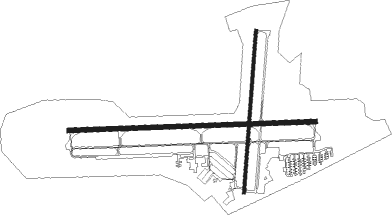
Runway info
Runway 10 / 28  | ||
| length | 1632m (5354ft) | |
| bearing | 92° / 272° | |
| width | 30m (100ft) | |
| surface | asphalt | |
| Runway 2 / 20 | ||
| length | 1076m (3530ft) | |
| bearing | 11° / 191° | |
| width | 21m (70ft) | |
| surface | asphalt | |
| displ threshold | 274m (899ft) / 283m (928ft) | |
Nearby beacons
| code | identifier | dist | bearing | frequency |
|---|---|---|---|---|
| OR | INGLE (NORFOLK) NDB | 10.2 | 73° | 329 |
| NGU | CHAMBERS (NORFOLK) TACAN | 12.7 | 48° | 113.95 |
| ORF | NORFOLK VORTAC | 13.7 | 66° | 116.90 |
| NFE | CHESAPEAKE TACAN | 15.9 | 105° | 108.25 |
| LFI | LANGLEY (HAMPTON) TACAN | 18.8 | 17° | 112.30 |
| NTU | OCEANA TACAN | 20 | 84° | 116.60 |
| FKN | FRANKLIN VORTAC | 27.2 | 263° | 110.60 |
| AKQ | WAKEFIELD NDB | 29 | 290° | 274 |
| CVI | COFIELD VORTAC | 31.7 | 226° | 114.60 |
| LLW | WOODVILLE (ELIZABETH CITY) NDB | 31.9 | 164° | 254 |
| ECG | ELIZABETH CITY VOR/DME | 34.1 | 152° | 112.50 |
| CCV | CAPE CHARLES VORTAC | 40.3 | 39° | 112.20 |
| HCM | HARCUM VORTAC | 42 | 339° | 108.80 |
| HPW | HOPEWELL VORTAC | 45.8 | 310° | 112 |
| RIC | RICHMOND VORTAC | 60 | 310° | 114.10 |
| RBX | WRIGHT BROTHERS (MANTEO) VOR/DME | 63.2 | 139° | 111.60 |
| MQI | MANTEO NDB | 63.5 | 139° | 370 |
Departure and arrival routes
| Transition altitude | 18000ft |
| Transition level | 18000ft |
| STAR starting points | distance | inbound heading | |
|---|---|---|---|
| ALL | |||
| DRONE2 | 18.4 | 41° | |
| TERKS2 | 143.5 | 113° | |
Instrument approach procedures
| runway | airway (heading) | route (dist, bearing) |
|---|---|---|
| RW10 | DRONE (41°) | DRONE RONKE (9mi, 344°) 2100ft SEZJY (7mi, 11°) 2100ft |
| RW10 | SEZJY (92°) | SEZJY 2100ft |
| RNAV | SEZJY 2100ft PEFOC (6mi, 92°) 1600ft HUMIV (3mi, 92°) 540ft KPVG (2mi, 92°) 73ft (4756mi, 116°) 1600ft PSALM (4757mi, 296°) 2500ft PSALM (turn) |
Holding patterns
| STAR name | hold at | type | turn | heading* | altitude | leg | speed limit |
|---|---|---|---|---|---|---|---|
| DRONE2 | DRONE | VHF | right | 233 (53)° | 1.0min timed | ICAO rules | |
| *) magnetic outbound (inbound) holding course | |||||||
Disclaimer
The information on this website is not for real aviation. Use this data with the X-Plane flight simulator only! Data taken with kind consent from X-Plane 12 source code and data files. Content is subject to change without notice.