Waco - Mcgregor Executive
Airport details
| Country | United States of America |
| State | Texas |
| Region | K4 |
| Airspace | Ft Worth Ctr |
| Municipality | McGregor |
| Elevation | 590ft (180m) |
| Timezone | GMT -6 |
| Coordinates | 31.48105, -97.31366 |
| Magnetic var | |
| Type | land |
| Available since | X-Plane v10.40 |
| ICAO code | KPWG |
| IATA code | n/a |
| FAA code | PWG |
Communication
| McGregor Executive AWOS 3 | 135.525 |
| McGregor Executive CTAF/UNICOM | 122.800 |
| McGregor Executive WACO Approach | 135.200 |
| McGregor Executive WACO Departure | 126.125 |
Nearby Points of Interest:
Waco High School
-Praetorian Building
-Westphalia
-Coryell County Courthouse
-The Church of the Visitation
-V. R. Means House
-First Christian Church Parsonage
-Bosque County Courthouse
-Barton House
-George Washington Baines House
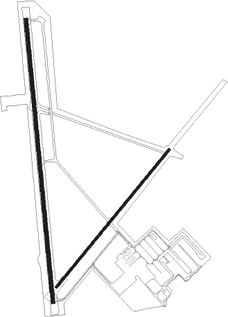
Runway info
Runway 17 / 35  | ||
| length | 1682m (5518ft) | |
| bearing | 179° / 359° | |
| width | 23m (75ft) | |
| surface | asphalt | |
| blast zone | 0m (0ft) / 3m (10ft) | |
| Runway 4 / 22 | ||
| length | 1055m (3461ft) | |
| bearing | 48° / 228° | |
| width | 17m (55ft) | |
| surface | asphalt | |
Nearby beacons
| code | identifier | dist | bearing | frequency |
|---|---|---|---|---|
| ACT | WACO VORTAC | 11.1 | 14° | 115.30 |
| ROB | ROBINSON (WACO) NDB | 12.5 | 85° | 400 |
| TPL | DME | 17.2 | 202° | 110.40 |
| IL | IRESH (KILLEEN) NDB | 34.1 | 221° | 278 |
| GRK | GRAY (FORT HOOD) VOR/DME | 37.1 | 228° | 111.80 |
| GNL | GROESBECK (MEXIA) VOR/DME | 39.6 | 83° | 108.80 |
| LXY | MEXIA NDB | 42.1 | 79° | 329 |
| AGJ | GOOCH SPRINGS VORTAC | 46 | 250° | 112.50 |
| JEN | GLEN ROSE TACAN | 49.8 | 320° | 115 |
| CGQ | POWELL (CORSICANA) NDB | 57.2 | 57° | 344 |
| CRS | CORSICANA NDB | 57.2 | 59° | 396 |
| CLL | COLLEGE STATION VORTAC | 69.8 | 134° | 113.30 |
Instrument approach procedures
| runway | airway (heading) | route (dist, bearing) |
|---|---|---|
| RW17 | IGORR (156°) | IGORR IMJUC (12mi, 138°) 3000ft |
| RW17 | IMIPE (224°) | IMIPE IMJUC (17mi, 248°) 3000ft |
| RW17 | IMJUC (177°) | IMJUC 3000ft |
| RNAV | IMJUC 3000ft BLDEE (6mi, 179°) 2000ft KPWG (5mi, 176°) 628ft (5779mi, 108°) 841ft ZUDIS (5780mi, 288°) SATTY (15mi, 100°) 2500ft SATTY (turn) | |
| RW35 | BARBA (342°) | BARBA ICIDE (10mi, 317°) 3200ft |
| RW35 | ICIDE (360°) | ICIDE 3200ft |
| RNAV | ICIDE 3200ft HISNI (7mi, 359°) 3200ft BRUGO (6mi, 359°) 1300ft KPWG (2mi, 5°) 612ft (5779mi, 108°) 816ft BLDEE (5779mi, 288°) ACT (6mi, 28°) 2500ft ACT (turn) |
Disclaimer
The information on this website is not for real aviation. Use this data with the X-Plane flight simulator only! Data taken with kind consent from X-Plane 12 source code and data files. Content is subject to change without notice.