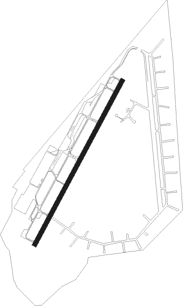
Bremerton - Bremerton National
Airport details
| Country | United States of America |
| State | Washington |
| Region | K1 |
| Airspace | Seattle Ctr |
| Municipality | Bremerton |
| Elevation | 440ft (134m) |
| Timezone | GMT -8 |
| Coordinates | 47.49025, -122.76481 |
| Magnetic var | |
| Type | land |
| Available since | X-Plane v10.40 |
| ICAO code | KPWT |
| IATA code | PWT |
| FAA code | PWT |
Communication
| Bremerton National AWOS 3 | 121.200 |
| Bremerton National CTAF/UNICOM | 123.050 |
| Bremerton National SEATTLE Approach | 127.100 |
| Bremerton National SEATTLE Departure | 127.100 |
Approach frequencies
| ILS-cat-I | RW20 | 111.1 | 18.00mi |
| 3° GS | RW20 | 111.1 | 18.00mi |
Nearby Points of Interest:
United States Post Office-Port Townsend Main
-Puget Sound Naval Shipyard Historic District
-Bremerton Elks Temple Lodge No. 1181 Building
-Fort Ward
-Twanoh State Park
-Colvos Store
-Helmer and Selma Steen House
-Mukai Cold Process Fruit Barrelling Plant
-Camp Yeomalt
-Fox Island School
-Winnifred Street Bridge
-Agate Pass Bridge
-Schmitz Park Bridge
-Tacoma Narrows Bridge
-Old Man House
-Tracy House
-Engine House No. 13
-Fort Lawton
-Ford Motor Company Assembly Plant
-William Ross Rust House
-West Queen Anne School
-Rhodes House
-North Slope
-South Park Bridge
-Hull Building
Nearby beacons
| code | identifier | dist | bearing | frequency |
|---|---|---|---|---|
| SEA | SEATTLE VORTAC | 18.7 | 97° | 116.80 |
| TCM | MC CHORD (TACOMA) TACAN | 23.7 | 140° | 109.60 |
| OLM | OLYMPIA VORTAC | 31.6 | 195° | 113.40 |
| PAE | PAINE (EVERETT) VOR/DME | 32.4 | 49° | 110.60 |
| AW | WATON (ARLINGTON) NDB | 42.9 | 46° | 382 |
| CVV | PENN COVE VOR/DME | 45.3 | 3° | 117.20 |
| NOW | EDIZ HOOK (PORT ANGELES) NDB | 46.7 | 315° | 338 |
| NUW | WHIDBEY ISLAND (OAK HARBO TACAN | 52 | 7° | 113.80 |
| CL | ELWHA (PORT ANGELES) NDB | 53.8 | 306° | 515 |
| BVS | SKAGIT/BAY VIEW (BURLINGTON) NDB | 60.3 | 19° | 240 |
Instrument approach procedures
| runway | airway (heading) | route (dist, bearing) |
|---|---|---|
| RW02 | OLM (15°) | OLM ZOLGI (18mi, 353°) 4000ft |
| RW02 | SANDR (61°) | SANDR ZOLGI (18mi, 75°) 4000ft |
| RW02 | ZOLGI (39°) | ZOLGI 4000ft |
| RNAV | ZOLGI 4000ft CEBOD (9mi, 35°) 2100ft KPWT (6mi, 43°) 500ft (6693mi, 111°) 1200ft ZOLGI (6705mi, 291°) 4000ft ZOLGI (turn) 4000ft | |
| RW20 | LOFAL (193°) | LOFAL GITRE (12mi, 155°) 3400ft |
| RNAV | GITRE 3400ft WUMOX (6mi, 224°) 2500ft KPWT (7mi, 224°) 491ft (6693mi, 111°) 642ft CEBOD (6698mi, 291°) CARRO (7mi, 189°) 4000ft CARRO (turn) 4000ft |
Disclaimer
The information on this website is not for real aviation. Use this data with the X-Plane flight simulator only! Data taken with kind consent from X-Plane 12 source code and data files. Content is subject to change without notice.