Pageland
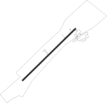
Airport details
| Country | United States of America |
| State | South Carolina |
| Region | K7 |
| Airspace | Jacksonville Ctr |
| Municipality | Chesterfield County |
| Elevation | 575ft (175m) |
| Timezone | GMT -5 |
| Coordinates | 34.74214, -80.34519 |
| Magnetic var | |
| Type | land |
| Available since | X-Plane v10.40 |
| ICAO code | KPYG |
| IATA code | n/a |
| FAA code | PYG |
Communication
| PAGELAND CTAF | 122.900 |
| PAGELAND CHARLOTTE Approach/Departure | 120.050 |
Nearby Points of Interest:
Barrett-Faulkner House
-Dr. Thomas E. Lucas House
-West Main Street Historic District (Chesterfield, South Carolina)
-East Main Street Historic District (Chesterfield, South Carolina)
-Buford's Massacre Site
-William Harrison Sapp House
-Wingate Commercial Historic District
-Malcolm K. Lee House
-Seaboard Air Line Railway Depot in McBee
-Monroe Residential Historic District
-Monroe Downtown Historic District
-Union County Courthouse
-Monroe City Hall
-Piedmont Buggy Factory
-Seaboard Air Line Railway Depot in Patrick
-Waxhaw-Weddington Roads Historic District
-Dr. William Columbus Cauthen House
-Boggan-Hammond House and Alexander Little Wing
-Wadesboro Downtown Historic District
-Thomas Walker Huey House
-United States Post Office
-Naval Health Clinic Charleston
-Leroy Springs House
-Robert Barnwell Allison House
-Craig House
Nearby beacons
| code | identifier | dist | bearing | frequency |
|---|---|---|---|---|
| CTF | CHESTERFIELD VOR/DME | 6.5 | 143° | 108.20 |
| HVS | HARTSVILLE NDB | 23 | 146° | 341 |
| LKR | LANCASTER NDB | 25.3 | 268° | 400 |
| UDG | DARLINGTON NDB | 28.8 | 123° | 245 |
| BES | BENNETTSVILLE NDB | 31 | 101° | 230 |
| UZ | RALLY (ROCK HILL) NDB | 37.3 | 281° | 227 |
| CLT | CHARLOTTE VOR/DME | 40.1 | 306° | 115 |
| FL | ALCOT (FLORENCE) NDB | 41.9 | 139° | 335 |
| DCM | CHESTER NDB | 42.2 | 273° | 220 |
| ME | MAXTN (MAXTON) NDB | 44.4 | 91° | 257 |
| SMS | SUMTER NDB | 45.1 | 181° | 252 |
| FLO | FLORENCE VORTAC | 45.7 | 127° | 115.20 |
| SSC | SHAW (SUMTER) TACAN | 46.2 | 189° | 110.10 |
| VU | ALLER (ALBEMARLE) NDB | 46.6 | 19° | 346 |
| SDZ | SANDHILLS (SOUTHERN PINES VORTAC | 46.8 | 58° | 111.80 |
| GHJ | STONIA (GASTONIA) NDB | 48.2 | 299° | 260 |
| DLC | DILLON NDB | 51.3 | 107° | 274 |
| MMT | MC ENTIRE (COLUMBIA) VORTAC | 54.1 | 209° | 113.20 |
| RU | ROVDY (SALISBURY) NDB | 59.9 | 352° | 275 |
| CFY | EVANS (LAKE CITY) NDB | 60.4 | 147° | 420 |
| CAE | COLUMBIA VORTAC | 63.7 | 219° | 114.70 |
| CA | MURRY (COLUMBIA) NDB | 64.4 | 229° | 362 |
Instrument approach procedures
| runway | airway (heading) | route (dist, bearing) |
|---|---|---|
| RW06 | WITHE (56°) | WITHE 2400ft |
| RNAV | WITHE 2400ft INSIW (5mi, 56°) 2200ft UVEWU (3mi, 56°) 1380ft KPYG (3mi, 56°) 590ft (4929mi, 113°) 889ft WOVEX (4922mi, 293°) 2400ft WOVEX (turn) | |
| RW24 | WOVEX (236°) | WOVEX 2400ft |
| RNAV | WOVEX 2400ft ZIRSI (5mi, 236°) 2200ft KPYG (5mi, 236°) 615ft (4929mi, 113°) 890ft WITHE (4937mi, 293°) 2400ft WITHE (turn) |
Disclaimer
The information on this website is not for real aviation. Use this data with the X-Plane flight simulator only! Data taken with kind consent from X-Plane 12 source code and data files. Content is subject to change without notice.