Rapid City - Rapid City Regl
Airport details
| Country | United States of America |
| State | South Dakota |
| Region | K3 |
| Airspace | Denver Ctr |
| Municipality | Rapid City |
| Elevation | 3204ft (977m) |
| Timezone | GMT -7 |
| Coordinates | 44.04533, -103.05736 |
| Magnetic var | |
| Type | land |
| Available since | X-Plane v10.40 |
| ICAO code | KRAP |
| IATA code | RAP |
| FAA code | RAP |
Communication
| Rapid City Regl ASOS | 118.525 |
| Rapid City Regl CTAF | 125.850 |
| Rapid City Regl UNICOM | 122.950 |
| Rapid City Regl Ground Control | 121.900 |
| Rapid City Regl Tower | 125.850 |
| Rapid City Regl ELLSWORTH Approach | 119.500 |
| Rapid City Regl ELLSWORTH Departure | 119.500 |
Approach frequencies
| ILS-cat-I | RW32 | 109.3 | 18.00mi |
| 3° GS | RW32 | 109.3 | 18.00mi |
Nearby Points of Interest:
Pap Madison Cabin
-Pennington County Courthouse
-Rapid City Masonic Temple
-Milwaukee Road Freight House
-First Congregational Church
-Emmanuel Episcopal Church
-Dinosaur Park
-Hermosa Masonic Lodge
-Keystone School
-Mount Rushmore National Memorial
-Peter Norbeck Summer House
-Black Elk Peak Lookout Tower
-Needles
-Sunday Gulch Trail
-Garlock Building
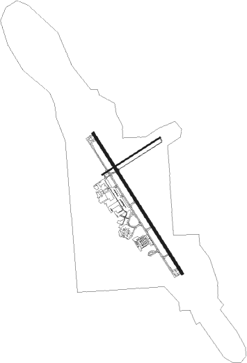
Runway info
Runway 14 / 32  | ||
| length | 2653m (8704ft) | |
| bearing | 143° / 323° | |
| width | 46m (150ft) | |
| surface | concrete | |
| blast zone | 61m (200ft) / 61m (200ft) | |
| Runway 5 / 23 | ||
| length | 1095m (3593ft) | |
| bearing | 69° / 249° | |
| width | 23m (75ft) | |
| surface | asphalt | |
Nearby beacons
| code | identifier | dist | bearing | frequency |
|---|---|---|---|---|
| RAP | RAPID CITY VORTAC | 4.5 | 147° | 112.30 |
| RCA | ELLSWORTH (RAPID CITY) TACAN | 5.9 | 335° | 108.80 |
Instrument approach procedures
| runway | airway (heading) | route (dist, bearing) |
|---|---|---|
| RW05 | RULER (63°) | RULER VEKCU (6mi, 50°) 6600ft |
| RW05 | ZAMBI (74°) | ZAMBI VEKCU (4mi, 82°) 6600ft |
| RNAV | VEKCU 6600ft WODAV (4mi, 69°) 5300ft XEPWY (4mi, 69°) 3920ft KRAP (2mi, 74°) 3207ft (5966mi, 113°) 3423ft EWEBU (5958mi, 293°) 5300ft EWEBU (turn) | |
| RW14 | BFFLO (189°) | BFFLO ASUVE (27mi, 221°) 5500ft |
| RNAV | ASUVE 5500ft ZUDIM (15mi, 143°) 4900ft KRAP (6mi, 143°) 3241ft (5966mi, 113°) 3450ft COTYU (5962mi, 293°) 5500ft COTYU (turn) | |
| RW23 | EWEBU (248°) | EWEBU 4800ft |
| RNAV | EWEBU 4800ft YUKUR (4mi, 249°) 4800ft NULIY (3mi, 249°) 3820ft KRAP (2mi, 243°) 3242ft (5966mi, 113°) 3454ft EWEBU (5958mi, 293°) 5300ft EWEBU (turn) | |
| RW32 | HELTA (324°) | HELTA 5500ft |
| RNAV | HELTA 5500ft YAVUC (6mi, 324°) 5000ft KRAP (6mi, 324°) 3197ft (5966mi, 113°) 3700ft HELTA (5962mi, 293°) 5500ft HELTA (turn) |
Disclaimer
The information on this website is not for real aviation. Use this data with the X-Plane flight simulator only! Data taken with kind consent from X-Plane 12 source code and data files. Content is subject to change without notice.