Warsaw - Warsaw Muni
Airport details
| Country | United States of America |
| State | Missouri |
| Region | K3 |
| Airspace | Kansas City Ctr |
| Municipality | Benton County |
| Elevation | 936ft (285m) |
| Timezone | GMT -6 |
| Coordinates | 38.34785, -93.34539 |
| Magnetic var | |
| Type | land |
| Available since | X-Plane v10.40 |
| ICAO code | KRAW |
| IATA code | n/a |
| FAA code | RAW |
Communication
| WARSAW MUNI AWOS 3 | 118.325 |
| WARSAW MUNI CTAF | 122.900 |
Nearby Points of Interest:
Upper Bridge
-South Main Street Historic District
-Harris House
-Missouri/Sedalia Trust Company
-Sedalia Public Library
-Building at 217 West Main Street
-McVey School
-Missouri, Kansas and Texas Railroad Depot
-Morgan County Courthouse
-William H. Gentry House
-Glasgow Commercial Historic District
-Montserrat Recreational Demonstration Area Rock Bath House
-Montserrat Recreational Demonstration Area Bridge
-Chilhowee Historic District
-Grover Street Victorian Historic District
-Jones Brothers Mule Barn
-Warren Street Methodist Episcopal Church
-Johnson County Courthouse
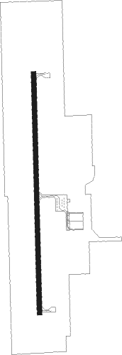
Runway info
| Runway 18 / 36 | ||
| length | 1222m (4009ft) | |
| bearing | 184° / 4° | |
| width | 23m (75ft) | |
| surface | concrete | |
Nearby beacons
| code | identifier | dist | bearing | frequency |
|---|---|---|---|---|
| SZL | WHITEMAN (KNOB NOSTER) TACAN | 25.2 | 332° | 109.80 |
| SHY | SUNSHINE (KAISER) VOR/DME | 39.6 | 112° | 108.40 |
| ANX | NAPOLEON VORTAC | 57.9 | 314° | 114 |
| SGF | SPRINGFIELD VORTAC | 59.5 | 179° | 116.90 |
Instrument approach procedures
| runway | airway (heading) | route (dist, bearing) |
|---|---|---|
| RW18 | WOCAZ (184°) | WOCAZ 2600ft |
| RNAV | WOCAZ 2600ft VUHMY (6mi, 184°) 2600ft UCMOZ (3mi, 184°) 1760ft KRAW (3mi, 184°) 973ft (5563mi, 112°) 1320ft OUTTA (5564mi, 292°) 2600ft OUTTA (turn) | |
| RW36 | OUTTA (4°) | OUTTA 2600ft |
| RNAV | OUTTA 2600ft NUVSE (6mi, 4°) 2600ft LOYEB (3mi, 4°) 1760ft KRAW (3mi, 4°) 969ft (5563mi, 112°) 1129ft WOCAZ (5562mi, 292°) 2600ft WOCAZ (turn) |
Disclaimer
The information on this website is not for real aviation. Use this data with the X-Plane flight simulator only! Data taken with kind consent from X-Plane 12 source code and data files. Content is subject to change without notice.