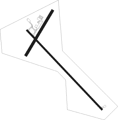
Bassett - Rock County
Airport details
| Country | United States of America |
| State | Nebraska |
| Region | K3 |
| Airspace | Denver Ctr |
| Municipality | Rock County |
| Elevation | 2349ft (716m) |
| Timezone | GMT -6 |
| Coordinates | 42.57113, -99.56952 |
| Magnetic var | |
| Type | land |
| Available since | X-Plane v10.40 |
| ICAO code | KRBE |
| IATA code | n/a |
| FAA code | RBE |
Communication
| Rock County CTAF | 122.900 |
| Rock County DENVER ApproachROACH | 127.950 |
| Rock County DENVER DepartureARTURE | 127.950 |
Nearby Points of Interest:
Bassett Lodge and Range Cafe
-Rock County Courthouse
-Carns State Aid Bridge
-Brantly Sturdevant House
Nearby beacons
| code | identifier | dist | bearing | frequency |
|---|---|---|---|---|
| ANW | AINSWORTH VOR/DME | 18.5 | 270° | 112.70 |
| ONL | O'NEILL VORTAC | 39.5 | 97° | 113.90 |
| VTN | VALENTINE NDB | 46.6 | 287° | 314 |
| ODX | ORD NDB | 63.2 | 147° | 356 |
Instrument approach procedures
| runway | airway (heading) | route (dist, bearing) |
|---|---|---|
| RW13 | ANW (90°) | ANW DEBLE (9mi, 61°) 4600ft CALRO (5mi, 59°) 4600ft |
| RW13 | CALRO (132°) | CALRO 4600ft |
| RW13 | LKOTA (145°) | LKOTA CALRO (35mi, 149°) 4600ft |
| RW13 | ONL (277°) | ONL FARDU (46mi, 287°) 4600ft CALRO (5mi, 239°) 4600ft |
| RNAV | CALRO 4600ft BETME (6mi, 132°) 4000ft HISEK (3mi, 132°) 3020ft KRBE (2mi, 132°) 2384ft (5828mi, 113°) 2723ft BARKE (5821mi, 293°) 5100ft BARKE (turn) | |
| RW31 | ANW (90°) | ANW FABET (26mi, 113°) 5100ft BARKE (5mi, 59°) 5100ft |
| RW31 | BARKE (312°) | BARKE 5100ft |
| RW31 | ONL (277°) | ONL DAKLE (27mi, 269°) 5100ft BARKE (5mi, 239°) 5100ft |
| RNAV | BARKE 5100ft CABAT (7mi, 312°) 4100ft HEKRU (3mi, 312°) 3180ft KRBE (3mi, 313°) 2389ft CALRO (11mi, 312°) 4600ft CALRO (turn) |
Disclaimer
The information on this website is not for real aviation. Use this data with the X-Plane flight simulator only! Data taken with kind consent from X-Plane 12 source code and data files. Content is subject to change without notice.

