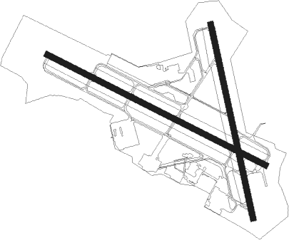
Reading - Reading Regl Carl A Spaatz Fld
Airport details
| Country | United States of America |
| State | Pennsylvania |
| Region | K6 |
| Airspace | New York Ctr |
| Municipality | Bern Township |
| Elevation | 344ft (105m) |
| Timezone | GMT -5 |
| Coordinates | 40.37850, -75.96525 |
| Magnetic var | |
| Type | land |
| Available since | X-Plane v10.40 |
| ICAO code | KRDG |
| IATA code | RDG |
| FAA code | RDG |
Communication
| Reading Regl Carl A Spaatz Fld ATIS | 127.100 |
| Reading Regl Carl A Spaatz Fld UNICOM | 122.950 |
| Reading Regl Carl A Spaatz Fld Ground Control | 121.900 |
| Reading Regl Carl A Spaatz Fld Tower | 119.900 |
| Reading Regl Carl A Spaatz Fld Approach/Departure | 125.150 |
Approach frequencies
| ILS-cat-I | RW36 | 109.5 | 18.00mi |
| ILS-cat-I | RW13 | 110.55 | 18.00mi |
| 3° GS | RW36 | 109.5 | 18.00mi |
| 3° GS | RW13 | 110.55 | 18.00mi |
Nearby Points of Interest:
Stirling
-Queen Anne Historic District
-Meinig Glove Factory-E. Richard Meinig Co.
-Wilhelm Mansion and Carriage House
-Grimshaw Silk Mill
-GoggleWorks
-Reading Knitting Mills
-Livingood House-Stryker Hospital
-Keystone Hook and Ladder Company
-Metropolitan Edison Building
-Hampden Firehouse
-Red Men Hall
-Log House, Hiester House and Market Annex
-City Hall
-Rieser-Shoemaker Farm
-Bethel A.M.E. Church
-Peter Wanner Mansion
-Reading Hardware Company
-Hendel Brothers, Sons and Company Hat Factory
-Reading Hardware Company Butt Works
-Cotton and Maple Streets School
-Leesport Lock House
-Lindbergh Viaduct
-Old Dry Road
-Dauberville Bridge

Nearby beacons
| code | identifier | dist | bearing | frequency |
|---|---|---|---|---|
| ETX | EAST TEXAS VOR/DME | 17.6 | 54° | 110.20 |
| PTW | POTTSTOWN VORTAC | 20.7 | 111° | 116.50 |
| LRP | LANCASTER VOR/DME | 21.5 | 232° | 117.30 |
| BZJ | BELLGROVE (INDIANTOWN GAP) NDB | 27 | 276° | 328 |
| MXE | MODENA VORTAC | 30.7 | 147° | 113.20 |
| RAV | RAVINE VORTAC | 30.8 | 285° | 114.60 |
| FJC | ALLENTOWN VORTAC | 31.3 | 56° | 117.50 |
| ING | AMBLER NDB | 34.6 | 110° | 275 |
| MD | ENOLA (HARRISBURG) NDB | 43.5 | 262° | 204 |
| DQO | DUPONT (WILMINGTON) VORTAC | 45.1 | 153° | 114 |
| SEG | SELINSGROVE VOR/DME | 48.6 | 294° | 110.40 |
| MIP | MILTON VORTAC | 50.1 | 313° | 109.20 |
| IL | HADIN (WILMINGTON) NDB | 50.5 | 156° | 248 |
| OOD | WOODSTOWN VORTAC | 53.9 | 138° | 112.80 |
| LVZ | WILKES-BARRE VORTAC | 55.1 | 17° | 111.60 |
| VCN | CEDAR LAKE (MILLVILLE) VOR/DME | 68.2 | 130° | 115.20 |
| FQM | WILLIAMSPORT VOR/DME | 68.3 | 320° | 114.40 |
| RNB | RAINBOW (MILLVILLE) NDB | 69.2 | 139° | 363 |
Instrument approach procedures
| runway | airway (heading) | route (dist, bearing) |
|---|---|---|
| RW13 | ETX (234°) | ETX GEFWI (21mi, 267°) 4000ft OUTLT (5mi, 218°) 3200ft BRAGG (4mi, 115°) 2900ft |
| RW13 | HWANG (95°) | HWANG OUTLT (8mi, 61°) 3200ft BRAGG (4mi, 115°) 2900ft |
| RW13 | OUTLT (115°) | OUTLT 3200ft BRAGG (4mi, 115°) 2900ft |
| RNAV | BRAGG 2900ft PGODA (3mi, 115°) 2100ft KRDG (6mi, 114°) 388ft UROUT (1mi, 117°) HOUTN (5mi, 104°) 3000ft HOUTN (turn) | |
| RW18 | ETX (234°) | ETX VEWOR (9mi, 274°) 4000ft YOCTA (5mi, 264°) 3200ft ANORY (3mi, 170°) 3000ft |
| RW18 | RAV (105°) | RAV OVOZO (22mi, 88°) 4000ft YOCTA (5mi, 84°) 3200ft ANORY (3mi, 170°) 3000ft |
| RNAV | ANORY 3000ft DEGDY (3mi, 170°) 2300ft KRDG (6mi, 172°) 346ft COTAX (3mi, 166°) BOYER (7mi, 251°) 3000ft BOYER (turn) | |
| RW36 | ETX (234°) | ETX HUMEL (26mi, 212°) 2900ft HUMEL (turn) 2700ft |
| RW36 | LRP (52°) | LRP HUMEL (17mi, 79°) 2700ft |
| RW36 | MXE (327°) | MXE HUMEL (20mi, 317°) 2700ft |
| RW36 | PTW (291°) | PTW HUMEL (17mi, 265°) 2700ft |
| RNAV | HUMEL 2700ft SROKA (6mi, 350°) 1900ft VISBY (3mi, 350°) 1020ft KRDG (2mi, 345°) 382ft (4766mi, 118°) 622ft YEWSU (4767mi, 298°) DUMMR (7mi, 286°) 3000ft DUMMR (turn) |
Disclaimer
The information on this website is not for real aviation. Use this data with the X-Plane flight simulator only! Data taken with kind consent from X-Plane 12 source code and data files. Content is subject to change without notice.