Red Lodge
Airport details
| Country | United States of America |
| State | Montana |
| Region | K1 |
| Airspace | Salt Lake City Ctr |
| Municipality | Carbon County |
| Elevation | 5763ft (1757m) |
| Timezone | GMT -7 |
| Coordinates | 45.18744, -109.26738 |
| Magnetic var | |
| Type | land |
| Available since | X-Plane v10.40 |
| ICAO code | KRED |
| IATA code | n/a |
| FAA code | RED |
Communication
| RED LODGE CTAF | 122.900 |
Nearby Points of Interest:
Smith Mine Historic District
-Beartooth Highway
-Glidden Mercantile
-Fromberg Concrete Arch Bridge
-Oliver H. Hovda House
-Joliet Bridge
-Michael Jacobs House
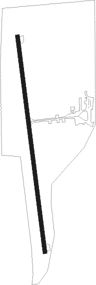
Runway info
| Runway 16 / 34 | ||
| length | 1220m (4003ft) | |
| bearing | 176° / 356° | |
| width | 23m (75ft) | |
| surface | asphalt | |
Nearby beacons
| code | identifier | dist | bearing | frequency |
|---|---|---|---|---|
| POY | POWELL NDB | 28 | 124° | 344 |
| COD | CODY VOR/DME | 36.4 | 152° | 111.80 |
| HCY | COWLEY NDB | 38.6 | 108° | 257 |
| BIL | BILLINGS VORTAC | 46 | 46° | 114.50 |
Disclaimer
The information on this website is not for real aviation. Use this data with the X-Plane flight simulator only! Data taken with kind consent from X-Plane 12 source code and data files. Content is subject to change without notice.