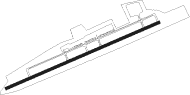
Andrews - Western Carolina Regl
Airport details
| Country | United States of America |
| State | North Carolina |
| Region | K7 |
| Airspace | Atlanta Ctr |
| Municipality | Cherokee County |
| Elevation | 1694ft (516m) |
| Timezone | GMT -5 |
| Coordinates | 35.19523, -83.86304 |
| Magnetic var | |
| Type | land |
| Available since | X-Plane v10.40 |
| ICAO code | KRHP |
| IATA code | n/a |
| FAA code | RHP |
Communication
| Western Carolina Regl AWOS 3 | 119.675 |
| Western Carolina Regl CTAF/UNICOM | 122.800 |
Nearby Points of Interest:
First Baptist Church
-Graham County Courthouse
-Clay County Courthouse
-Spikebuck Town Mound and Village Site
-Charles Noden George House
-Cherokee County Courthouse
-Harshaw Chapel and Cemetery
-John C. Campbell Folk School
-Tapoco Lodge Historic District
-Towns County Jail
-Raburn-Casteel House
-Arkaquah Trail
-Calderwood
-Old Union County Courthouse
-Old Union County Jail
-Jacks Knob Trail
-Franklin Presbyterian Church
-Saint Agnes Episcopal Church
-Pendergrass Building
-Albert Swain Bryson House
-Citico
-Nikwasi
-Swain County Courthouse
-Kituwa
-Look Rock Observation Tower
Nearby beacons
| code | identifier | dist | bearing | frequency |
|---|---|---|---|---|
| HRS | HARRIS VORTAC | 15.3 | 192° | 109.80 |
| ODF | FOOTHILLS (TOCCOA) VOR/DME | 40.9 | 131° | 113.40 |
| VXV | VOLUNTEER (KNOXVILLE) VORTAC | 42.6 | 357° | 116.40 |
| SOT | SNOWBIRD VORTAC | 53.3 | 54° | 108.80 |
| JXT | JEFFERSON (MORRISTOWN) NDB | 58.1 | 23° | 346 |
| FKV | FLOWERY BRANCH (GAINESVILLE) NDB | 59.6 | 182° | 365 |
| DJD | CHERO NDB | 64.4 | 214° | 415 |
Instrument approach procedures
| runway | airway (heading) | route (dist, bearing) |
|---|---|---|
| RW08 | HRS (12°) | HRS HISEN (13mi, 298°) 6200ft HISEN (turn) 6200ft |
| RW08 | MARBL (82°) | MARBL HISEN (6mi, 153°) 6200ft HISEN (turn) 6200ft |
| RW08 | MELLS (58°) | MELLS HISEN (9mi, 49°) 6200ft |
| RNAV | HISEN 6200ft RUGIE (9mi, 62°) 4200ft MIRNE (6mi, 62°) 1913ft (5105mi, 113°) 2099ft HISEN (5117mi, 293°) 6200ft HISEN (turn) |
Disclaimer
The information on this website is not for real aviation. Use this data with the X-Plane flight simulator only! Data taken with kind consent from X-Plane 12 source code and data files. Content is subject to change without notice.
