San Jose - Reid Hillview Santa Clara Co
Airport details
| Country | United States of America |
| State | California |
| Region | K2 |
| Airspace | Oakland Ctr |
| Municipality | San Jose |
| Elevation | 131ft (40m) |
| Timezone | GMT +8 |
| Coordinates | 37.33286, -121.81981 |
| Magnetic var | |
| Type | land |
| Available since | X-Plane v10.40 |
| ICAO code | KRHV |
| IATA code | RHV |
| FAA code | RHV |
Communication
| Reid Hillview Santa Clara Co Reid-Hillview ATIS | 125.200 |
| Reid Hillview Santa Clara Co Reid-Hillview CTAF | 119.800 |
| Reid Hillview Santa Clara Co Reid-Hillview UNICOM | 122.950 |
| Reid Hillview Santa Clara Co Reid-Hillview Ground Control | 121.650 |
| Reid Hillview Santa Clara Co Reid-Hillview Tower 13L/31R | 119.800 |
| Reid Hillview Santa Clara Co Reid-Hillview Tower 13R/31L | 126.100 |
| Reid Hillview Santa Clara Co NORCAL Approach | 120.100 |
| Reid Hillview Santa Clara Co NORCAL Approach | 133.950 |
| Reid Hillview Santa Clara Co NORCAL Approach | 134.500 |
| Reid Hillview Santa Clara Co NORCAL Departure | 121.300 |
Nearby Points of Interest:
Ashworth-Remillard House
-East San Jose Carnegie Library
-Arthur Monroe Free House
-Ross House
-Dohrmann Building
-Twohy Building
-Leib Carriage House
-Hayes Mansion
-Galindo-Leigh House
-Andrew J. Landrum House
-Charles Copeland Morse House
-Capt. James A. Hamilton House
-Grant Ranch County Park
-Campbell Union Grammar School
-Jose Maria Alviso Adobe
-Campbell High School
-James Lick Mansion
-Milpitas Grammar School
-Agnews Developmental Center
-Yung See San Fong House
-New Almaden
-Saratoga
-McCullagh-Jones House
-Le Petit Trianon
-Hangar One
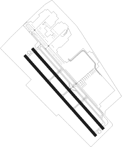
Runway info
Runway 13L / 31R  | ||
| length | 946m (3104ft) | |
| bearing | 137° / 317° | |
| width | 23m (75ft) | |
| surface | asphalt | |
| displ threshold | 152m (499ft) / 125m (410ft) | |
| Runway 13R / 31L | ||
| length | 945m (3100ft) | |
| bearing | 137° / 317° | |
| width | 23m (75ft) | |
| surface | asphalt | |
| displ threshold | 152m (499ft) / 125m (410ft) | |
Nearby beacons
| code | identifier | dist | bearing | frequency |
|---|---|---|---|---|
| SJC | SAN JOSE VOR/DME | 6.4 | 289° | 114.10 |
| NUQ | MOFFETT (MOUNTAIN VIEW) TACAN | 12.8 | 293° | 117.60 |
| OSI | WOODSIDE VOR/DME | 22.3 | 277° | 113.90 |
| LV | REIGA (LIVERMORE) NDB | 22.5 | 21° | 374 |
| OAK | OAKLAND VOR/DME | 30.4 | 314° | 116.80 |
| SFO | SAN FRANCISCO VOR/DME | 31.5 | 297° | 115.80 |
| SNS | SALINAS VORTAC | 41.5 | 162° | 117.30 |
| MR | MUNSO (MONTEREY) NDB | 43.1 | 189° | 385 |
| CCR | CONCORD VOR/DME | 44 | 342° | 117 |
| MOD | MODESTO VOR/DME | 44.7 | 71° | 114.60 |
| SAU | SAUSALITO VOR/DME | 45.8 | 307° | 116.20 |
| UAD | CHUALAR (SALINAS) NDB | 53.2 | 158° | 263 |
| SUU | TRAVIS (FAIRFIELD) TACAN | 55.1 | 352° | 116.60 |
| SGD | SCAGGS ISLAND (NAPA) VORTAC | 57.2 | 327° | 112.10 |
| LIN | LINDEN VOR/DME | 59 | 48° | 114.80 |
Departure and arrival routes
| Transition altitude | 18000ft |
| Transition level | 18000ft |
| SID end points | distance | outbound heading | |
|---|---|---|---|
| RW31L | |||
| DECOT1 | 20mi | 320° | |
| RW31R | |||
| DECOT1 | 20mi | 320° | |
| STAR starting points | distance | inbound heading | |
|---|---|---|---|
| ALL | |||
| PYE3 | 67.0 | 125° | |
Instrument approach procedures
| runway | airway (heading) | route (dist, bearing) |
|---|---|---|
| RW13L | DECOT (140°) | DECOT PIYOG (6mi, 147°) 3800ft |
| RNAV | PIYOG 3800ft HEKUR (7mi, 136°) 2800ft KRHV (6mi, 137°) 169ft (6894mi, 107°) 1900ft GILRO (6888mi, 287°) 5000ft GILRO (turn) | |
| RW31RY | CATHE (295°) | CATHE ZUXOX (9mi, 280°) 5000ft ECYON (8mi, 280°) 4300ft |
| RW31RY | GILRO (319°) | GILRO ECYON (8mi, 323°) 4300ft |
| RNAV | ECYON 4300ft UBIPE (7mi, 312°) 2800ft SIKEW (2mi, 322°) 1760ft KRHV (4mi, 321°) 178ft (6894mi, 107°) 535ft DECOT (6898mi, 287°) 4000ft DECOT (turn) | |
| RW31RZ | CATHE (295°) | CATHE ZUXOX (9mi, 280°) 5000ft ECYON (8mi, 280°) 4300ft |
| RW31RZ | GILRO (319°) | GILRO ECYON (8mi, 323°) 4300ft |
| RNAV | ECYON 4300ft OZNUM (7mi, 317°) 2800ft KRHV (6mi, 316°) 178ft (6894mi, 107°) 533ft CEPEL (6896mi, 287°) DECOT (10mi, 323°) 4000ft DECOT (turn) |
Holding patterns
| STAR name | hold at | type | turn | heading* | altitude | leg | speed limit |
|---|---|---|---|---|---|---|---|
| PYE3 | PYE | NDB | right | 325 (145)° | 1.0min timed | ICAO rules | |
| PYE3 | STINS | VHF | right | 324 (144)° | 1.0min timed | ICAO rules | |
| *) magnetic outbound (inbound) holding course | |||||||
Disclaimer
The information on this website is not for real aviation. Use this data with the X-Plane flight simulator only! Data taken with kind consent from X-Plane 12 source code and data files. Content is subject to change without notice.