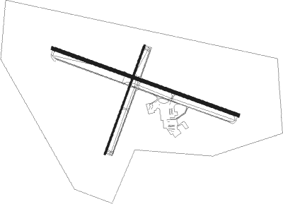
Riverton - Riverton Rgnl
Airport details
| Country | United States of America |
| State | Wyoming |
| Region | K1 |
| Airspace | Salt Lake City Ctr |
| Municipality | Riverton |
| Elevation | 5522ft (1683m) |
| Timezone | GMT -7 |
| Coordinates | 43.06425, -108.45983 |
| Magnetic var | |
| Type | land |
| Available since | X-Plane v10.40 |
| ICAO code | KRIW |
| IATA code | RIW |
| FAA code | RIW |
Communication
| RIVERTON RGNL ASOS | 121.425 |
| RIVERTON RGNL CTAF/UNICOM | 122.800 |
Approach frequencies
| ILS-cat-I | RW28 | 110.5 | 18.00mi |
| 3° GS | RW28 | 110.5 | 18.00mi |
Nearby Points of Interest:
BMU Bridge over Wind River
-United States Post Office and Courthouse
-Lander Downtown Historic District
-Jackson Park Town Site Addition Brick Row
-Fort Washakie
-Shoshone-Episcopal Mission
-Red Canyon
Nearby beacons
| code | identifier | dist | bearing | frequency |
|---|---|---|---|---|
| RIW | RIVERTON VOR/DME | 0.2 | 71° | 114.05 |
| BOY | BOYSEN RESERVOIR VOR/DME | 24.9 | 22° | 117.80 |
| RLY | WORLAND VOR/DME | 58.4 | 29° | 114.80 |
Instrument approach procedures
| runway | airway (heading) | route (dist, bearing) |
|---|---|---|
| RW10 | ARUXY (113°) | ARUXY TIDHU (12mi, 117°) 7900ft |
| RW10 | RIW (251°) | RIW TIDHU (11mi, 288°) 7900ft TIDHU (turn) 7900ft |
| RNAV | TIDHU 7900ft SAHKA (6mi, 108°) 6800ft KRIW (5mi, 109°) 5566ft (6208mi, 112°) 5902ft DONVY (6197mi, 292°) 8600ft DONVY (turn) | |
| RW28 | HUNTZ (295°) | HUNTZ DONVY (7mi, 313°) 8600ft |
| RW28 | RIW (251°) | RIW DONVY (14mi, 109°) 8600ft DONVY (turn) 8600ft |
| RNAV | DONVY 8600ft LIMNY (6mi, 288°) 7700ft KRIW (8mi, 288°) 5493ft (6208mi, 112°) 5659ft TIDHU (6217mi, 292°) 7900ft TIDHU (turn) |
Disclaimer
The information on this website is not for real aviation. Use this data with the X-Plane flight simulator only! Data taken with kind consent from X-Plane 12 source code and data files. Content is subject to change without notice.

