Ridgely - Ridgley Airpark
Airport details
| Country | United States of America |
| State | Maryland |
| Region | K6 |
| Airspace | Washington Ctr |
| Municipality | Ridgely |
| Elevation | 62ft (19m) |
| Timezone | GMT -5 |
| Coordinates | 38.97012, -75.86633 |
| Magnetic var | |
| Type | land |
| Available since | X-Plane v10.40 |
| ICAO code | KRJD |
| IATA code | n/a |
| FAA code | RJD |
Communication
| Ridgley Airpark AWOS 3 | 120.225 |
| Ridgley Airpark CTAF/UNICOM | 122.800 |
| Ridgley Airpark POTOMAC Approach/Departure | 124.550 |
| Ridgley Airpark POTOMAC Approach/Departure | 132.425 |
Nearby Points of Interest:
Leonard House
-Marble Head
-Hawkins Pharsalia
-Stratton
-Thomas House
-West Denton Warehouse-Wharf
-Denton Historic District
-Denton Armory
-Lansdowne
-Content
-Williston Mill Historic District
-Jackson Collins House
-Female Seminary
-Keating House
-Centreville Historic District
-Capt. John H. Ozmon Store
-Vogl House
-Lexon
-Todd's Chapel
-Bishopton
-Kennersley
-Felton Historic District
-St. Paul A.M.E. Church
-St. Stephen's P.E. Church
-Felton Railroad Station
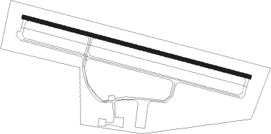
Runway info
| Runway 12 / 30 | ||
| length | 981m (3219ft) | |
| bearing | 105° / 285° | |
| width | 15m (50ft) | |
| surface | asphalt | |
Nearby beacons
| code | identifier | dist | bearing | frequency |
|---|---|---|---|---|
| DOV | DOVER TACAN | 21 | 68° | 110 |
| ENO | SMYRNA (KENTON) VORTAC | 22.6 | 53° | 111.40 |
| ATR | WATERLOO VOR/DME | 32 | 104° | 112.60 |
| MTN | MARTIN (BALTIMORE) TACAN | 33.3 | 304° | 134.10 |
| IL | HADIN (WILMINGTON) NDB | 38.5 | 22° | 248 |
| BAL | BALTIMORE VORTAC | 38.9 | 284° | 115.10 |
| SBY | SALISBURY VORTAC | 41 | 150° | 111.20 |
| BUH | ANNE ARUNDEL (FT MEADE) NDB | 42.2 | 277° | 260 |
| RNB | RAINBOW (MILLVILLE) NDB | 43.3 | 59° | 363 |
| OTT | NOTTINGHAM VORTAC | 44 | 253° | 113.70 |
| DQO | DUPONT (WILMINGTON) VORTAC | 44.1 | 20° | 114 |
| FND | ELLICOTT (BALTIMORE) NDB | 46.5 | 289° | 371 |
| ADW | ANDREWS (CAMP SPRINGS) VORTAC | 47.7 | 261° | 113.10 |
| OOD | WOODSTOWN VORTAC | 47.8 | 40° | 112.80 |
| PXT | PATUXENT (PATUXENT RIVER) VORTAC | 48 | 218° | 117.60 |
| NHK | PATUXENT NDB | 48.1 | 218° | 400 |
| OX | LANDY (OCEAN CITY) NDB | 48.1 | 132° | 407 |
| NHK | NAS PATUXENT RIVER TACAN | 48.6 | 218° | 110.25 |
| VCN | CEDAR LAKE (MILLVILLE) VOR/DME | 53.9 | 58° | 115.20 |
| MXE | MODENA VORTAC | 57.6 | 12° | 113.20 |
| SWL | SNOW HILL VORTAC | 58 | 156° | 112.40 |
Instrument approach procedures
| runway | airway (heading) | route (dist, bearing) |
|---|---|---|
| RW12 | BROSS (176°) | BROSS ANAYA (10mi, 246°) 2000ft DAKEY (5mi, 204°) 2000ft |
| RW12 | CHOPS (24°) | CHOPS GRACO (16mi, 307°) 2000ft DAKEY (7mi, 49°) 2000ft |
| RW12 | PALEO (97°) | PALEO DAKEY (13mi, 89°) 2000ft |
| RNAV | DAKEY 2000ft FIBNA (6mi, 105°) 1700ft KRJD (5mi, 105°) 104ft (4748mi, 117°) 464ft PEKME (4737mi, 297°) 2000ft PEKME (turn) | |
| RW30 | CHOPS (24°) | CHOPS ORLOE (14mi, 76°) 2000ft PEKME (5mi, 24°) 2000ft |
| RW30 | DONIL (259°) | DONIL PEKME (19mi, 243°) 2000ft |
| RW30 | LAFLN (297°) | LAFLN PEKME (9mi, 313°) 2000ft |
| RNAV | PEKME 2000ft TELNE (6mi, 285°) 1700ft KRJD (5mi, 285°) 104ft (4748mi, 117°) 464ft DAKEY (4759mi, 297°) 2000ft DAKEY (turn) |
Disclaimer
The information on this website is not for real aviation. Use this data with the X-Plane flight simulator only! Data taken with kind consent from X-Plane 12 source code and data files. Content is subject to change without notice.