Rockland - Knox County Regional
Airport details
| Country | United States of America |
| State | Maine |
| Region | K6 |
| Airspace | Boston Ctr |
| Municipality | Owls Head |
| Elevation | 56ft (17m) |
| Timezone | GMT -5 |
| Coordinates | 44.06007, -69.09926 |
| Magnetic var | |
| Type | land |
| Available since | X-Plane v10.40 |
| ICAO code | KRKD |
| IATA code | RKD |
| FAA code | RKD |
Communication
| Knox County Regional Knox AWOS 3 | 119.025 |
| Knox County Regional Knox CTAF/UNICOM | 123.050 |
| Knox County Regional Portland Approach | 120.400 |
| Knox County Regional Portland Departure | 120.400 |
Approach frequencies
| ILS-cat-I | RW13 | 111.7 | 18.00mi |
| 3° GS | RW13 | 111.7 | 18.00mi |
Nearby Points of Interest:
George Thorndike House
-Farnsworth Homestead
-Security Trust Building
-Rockland Turntable and Engine House
-Knox County Courthouse
-Rockland Public Library
-Stephen Taber
-Rockland Breakwater
-Finnish Congregational Church and Parsonage
-J. & E. Riggin
-Isaac H. Evans
-Victory Chimes
-American Eagle
-Gen. Davis Tillson House
-Timothy and Jane Williams House
-Thomaston Historic District
-Tillson Farm Barn
-Beech Hill Preserve
-Spite House
-Georges River Canal
-Rockport Historic District
-Rockport Historic Kiln Area
-Olson House
-Chestnut Street Historic District
-Camden Yacht Club
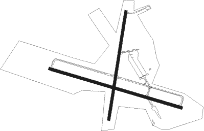
Runway info
Runway 13 / 31  | ||
| length | 1529m (5016ft) | |
| bearing | 105° / 285° | |
| width | 30m (100ft) | |
| surface | asphalt | |
| blast zone | 59m (194ft) / 0m (0ft) | |
| Runway 3 / 21 | ||
| length | 1224m (4016ft) | |
| bearing | 18° / 198° | |
| width | 30m (100ft) | |
| surface | asphalt | |
Nearby beacons
| code | identifier | dist | bearing | frequency |
|---|---|---|---|---|
| SUH | SPRUCEHEAD (OWLS HEAD) NDB | 0.6 | 210° | 356 |
| AUG | AUGUSTA VOR/DME | 33.8 | 290° | 114.95 |
| AU | DUNNS (AUGUSTA) NDB | 38.9 | 295° | 366 |
| BUP | BURNHAM (PITTSFIELD) NDB | 39.8 | 338° | 348 |
| BGR | BANGOR VORTAC | 47.9 | 16° | 114.80 |
Instrument approach procedures
| runway | airway (heading) | route (dist, bearing) |
|---|---|---|
| RW03 | BGR (196°) | BGR PIYOR (61mi, 188°) 2600ft OCAGO (7mi, 280°) 2000ft |
| RW03 | RAZZR (108°) | RAZZR TULUE (23mi, 142°) 2100ft OCAGO (7mi, 100°) 2000ft |
| RNAV | OCAGO 2000ft JESOD (6mi, 18°) 2000ft KRKD (6mi, 18°) 90ft (4513mi, 123°) 374ft HEVUR (4513mi, 303°) RAZZR (23mi, 278°) 3000ft RAZZR (turn) | |
| RW13 | AVMAW (105°) | AVMAW 2400ft |
| RNAV | AVMAW 2400ft NOXKS (12mi, 105°) 1800ft ZIGOS (3mi, 105°) 740ft KRKD (2mi, 104°) 97ft (4513mi, 123°) 800ft AVMAW (4530mi, 302°) 2400ft AVMAW (turn) | |
| RW31 | BGR (196°) | BGR UCFAM (47mi, 175°) 2600ft IQSAL (5mi, 208°) 2000ft |
| RW31 | ENE (67°) | ENE LIGUW (80mi, 74°) 2000ft IQSAL (5mi, 28°) 2000ft |
| RNAV | IQSAL 2000ft STPLS (6mi, 286°) 1700ft KRKD (5mi, 286°) 105ft (4513mi, 123°) 455ft ANCOR (4513mi, 302°) 2000ft ANCOR (turn) 2000ft |
Disclaimer
The information on this website is not for real aviation. Use this data with the X-Plane flight simulator only! Data taken with kind consent from X-Plane 12 source code and data files. Content is subject to change without notice.