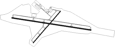
Rock Springs - Southwest Wyoming Rgnl
Airport details
| Country | United States of America |
| State | Wyoming |
| Region | K1 |
| Airspace | Salt Lake City Ctr |
| Municipality | Rock Springs |
| Elevation | 6757ft (2060m) |
| Timezone | GMT -7 |
| Coordinates | 41.59422, -109.06519 |
| Magnetic var | |
| Type | land |
| Available since | X-Plane v10.40 |
| ICAO code | KRKS |
| IATA code | RKS |
| FAA code | RKS |
Communication
| Southwest Wyoming Rgnl ASOS | 118.375 |
| Southwest Wyoming Rgnl CTAF/UNICOM | 122.800 |
Approach frequencies
| ILS-cat-I | RW27 | 109.3 | 18.00mi |
| 3° GS | RW27 | 109.3 | 18.00mi |
Nearby Points of Interest:
Wardell Court Historic Residential District
-Gras House
-Rock Springs Elks' Lodge No. 624
-Downtown Rock Springs Historic District
-City Hall
-Point of Rocks Stage Station State Historic Site
-Green River Downtown Historic District
-Sweetwater Brewery

Nearby beacons
| code | identifier | dist | bearing | frequency |
|---|---|---|---|---|
| OCS | ROCK SPRINGS VOR/DME | 2.2 | 95° | 116 |
Instrument approach procedures
| runway | airway (heading) | route (dist, bearing) |
|---|---|---|
| RW09 | FBR (81°) | FBR REGVE (51mi, 76°) 9800ft |
| RW09 | GRIPS (101°) | GRIPS REGVE (35mi, 101°) 9800ft |
| RW09 | OCS (275°) | OCS REGVE (15mi, 279°) 9800ft REGVE (turn) 9800ft |
| RNAV | REGVE 9800ft ZEREX (6mi, 100°) 8700ft SIRNE (4mi, 100°) 7440ft KRKS (3mi, 100°) 6782ft (6254mi, 111°) 6941ft DIGNE (6243mi, 291°) 9600ft DIGNE (turn) | |
| RW27 | ARUTE (265°) | ARUTE DIGNE (7mi, 231°) 9300ft |
| RW27 | CEBAL (298°) | CEBAL DIGNE (7mi, 343°) 9300ft |
| RW27 | OCS (275°) | OCS DIGNE (10mi, 101°) 10000ft DIGNE (turn) 9300ft |
| RNAV | DIGNE 9300ft EPULE (2mi, 280°) 9300ft HEBUM (4mi, 280°) 8700ft WATUM (3mi, 280°) 7800ft KRKS (4mi, 280°) 6820ft (6254mi, 111°) 6965ft REGVE (6266mi, 291°) 9800ft REGVE (turn) |
Disclaimer
The information on this website is not for real aviation. Use this data with the X-Plane flight simulator only! Data taken with kind consent from X-Plane 12 source code and data files. Content is subject to change without notice.