Rockwood - Rockwood Muni
Airport details
| Country | United States of America |
| State | Tennessee |
| Region | K7 |
| Airspace | Atlanta Ctr |
| Municipality | Cumberland County |
| Elevation | 1664ft (507m) |
| Timezone | GMT -6 |
| Coordinates | 35.92233, -84.68978 |
| Magnetic var | |
| Type | land |
| Available since | X-Plane v10.40 |
| ICAO code | KRKW |
| IATA code | RKW |
| FAA code | RKW |
Communication
| Rockwood Muni AWOS 3 | 118.775 |
| Rockwood Muni UNICOM | 122.800 |
Nearby Points of Interest:
American Temperance University
-Cornstalk Heights
-Col. Gideon Morgan House
-Roane County Courthouse
-Cumberland Homesteads
-Manhattan Project National Historical Park
-Cumberland County Courthouse
-X-10 Graphite Reactor
-Colonial Hall
-Dr. Fred Stone, Sr., Hospital
-New Bethel Baptist Church
-Blair's Ferry Storehouse
-Oak Ridge Historic District
-Luther Brannon House
-Pioneer Hall
-John McCroskey House
-Boyd-Harvey House
-Avery Russell House
-J. B. Jones House
-Bellview School
-Barton Chapel
-William H. Griffitts House
-Black Creek Fire Lookout Tower
-Mialoquo
-Green McAdoo School
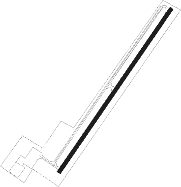
Runway info
| Runway 4 / 22 | ||
| length | 1523m (4997ft) | |
| bearing | 45° / 225° | |
| width | 30m (100ft) | |
| surface | asphalt | |
Nearby beacons
| code | identifier | dist | bearing | frequency |
|---|---|---|---|---|
| HCH | HINCH MTN (CROSSVILLE) VOR/DME | 16.4 | 244° | 117.60 |
| DTE | MARK ANTON (DAYTON) NDB | 28.9 | 209° | 394 |
| SCX | SCOTT (ONEIDA) NDB | 32.4 | 11° | 403 |
| VXV | VOLUNTEER (KNOXVILLE) VORTAC | 38.6 | 91° | 116.40 |
| HEM | HUCHN NDB | 43.7 | 274° | 233 |
| LVT | LIVINGSTON VOR/DME | 45.9 | 324° | 108.40 |
| CQN | DAISY (N.CHATTANOOGA) NDB | 50.8 | 212° | 341 |
| GQO | CHOO CHOO (CHATTANOOGA) VORTAC | 62 | 206° | 115.80 |
| HRS | HARRIS VORTAC | 69.9 | 142° | 109.80 |
Instrument approach procedures
| runway | airway (heading) | route (dist, bearing) |
|---|---|---|
| RW04 | CUTUK (45°) | CUTUK 5300ft |
| RW04 | FOMOS (14°) | FOMOS 5500ft CUTUK (9mi, 324°) 5300ft |
| RW04 | ZOVBA (71°) | ZOVBA 5300ft CUTUK (9mi, 106°) 5300ft |
| RNAV | CUTUK 5300ft WURTI (7mi, 45°) 3500ft KRKW (6mi, 45°) 1710ft (5147mi, 113°) 1909ft LOCIC (5139mi, 293°) 5600ft LOCIC (turn) | |
| RW22 | JOREB (250°) | JOREB 6100ft LOCIC (9mi, 286°) 5600ft |
| RW22 | LOCIC (225°) | LOCIC 5600ft |
| RW22 | YEGNU (196°) | YEGNU 5600ft LOCIC (9mi, 144°) 5600ft |
| RNAV | LOCIC 5600ft USICU (5mi, 225°) 4400ft JUSTU (3mi, 225°) 3500ft FEDOD (4mi, 225°) 2100ft KRKW (2mi, 225°) 1670ft (5147mi, 113°) 1880ft CUTUK (5155mi, 293°) 5300ft CUTUK (turn) |
Disclaimer
The information on this website is not for real aviation. Use this data with the X-Plane flight simulator only! Data taken with kind consent from X-Plane 12 source code and data files. Content is subject to change without notice.