Richland
Airport details
| Country | United States of America |
| State | Washington |
| Region | K1 |
| Airspace | Seattle Ctr |
| Municipality | Richland |
| Elevation | 394ft (120m) |
| Timezone | GMT -8 |
| Coordinates | 46.30564, -119.30419 |
| Magnetic var | |
| Type | land |
| Available since | X-Plane v10.40 |
| ICAO code | KRLD |
| IATA code | n/a |
| FAA code | RLD |
Communication
| Richland AWOS 3 | 132.675 |
| Richland CTAF/UNICOM | 122.700 |
| Richland CHINOOK Approach | 128.750 |
| Richland CHINOOK Departure | 128.750 |
Approach frequencies
| LOC | RW19 | 110.5 | 18.00mi |
Nearby Points of Interest:
Franklin County Courthouse
-Pasco–Kennewick Bridge
-J. W. Carey House
-Wallula Gap
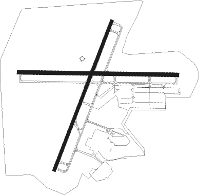
Runway info
Runway 1 / 19  | ||
| length | 1222m (4009ft) | |
| bearing | 35° / 215° | |
| width | 23m (75ft) | |
| surface | asphalt | |
| blast zone | 20m (66ft) / 0m (0ft) | |
| Runway 8 / 26 | ||
| length | 1217m (3993ft) | |
| bearing | 94° / 274° | |
| width | 30m (100ft) | |
| surface | asphalt | |
Nearby beacons
| code | identifier | dist | bearing | frequency |
|---|---|---|---|---|
| PSC | PASCO VOR/DME | 8 | 101° | 109.80 |
| PDT | PENDLETON VORTAC | 39.5 | 149° | 114.70 |
| MW | PELLY (MOSES LAKE) NDB | 48.6 | 2° | 408 |
| MWH | MOSES LAKE VOR/DME | 54.3 | 359° | 115 |
Instrument approach procedures
| runway | airway (heading) | route (dist, bearing) |
|---|---|---|
| RW19-Y | NIALS (146°) | NIALS BAKCA (14mi, 104°) 4000ft BAKCA (turn) 4000ft |
| RW19-Y | SMITT (246°) | SMITT BAKCA (12mi, 272°) 4000ft |
| RNAV | BAKCA 4000ft FIXOV (8mi, 215°) 2100ft KRLD (6mi, 215°) 429ft (6592mi, 111°) 794ft BAKCA (6582mi, 291°) 4000ft BAKCA (turn) | |
| RW19-Z | NIALS (146°) | NIALS BAKCA (14mi, 104°) 4000ft BAKCA (turn) 4000ft |
| RW19-Z | SMITT (246°) | SMITT BAKCA (12mi, 272°) 4000ft |
| RNAV | BAKCA 4000ft FIXOV (8mi, 215°) 2100ft AYABE (3mi, 215°) 1120ft KRLD (2mi, 214°) 429ft (6592mi, 111°) 900ft BAKCA (6582mi, 291°) 4000ft BAKCA (turn) | |
| RW26 | LYLES (282°) | LYLES CUTAS (18mi, 288°) 3000ft |
| RW26 | PSC (281°) | PSC CUTAS (4mi, 81°) 3000ft CUTAS (turn) 3000ft |
| RW26 | SMITT (246°) | SMITT CUTAS (14mi, 212°) 3000ft |
| RNAV | CUTAS 3000ft HOTGA (6mi, 274°) 2200ft JILPU (4mi, 274°) 1020ft KRLD (2mi, 273°) 440ft (6592mi, 111°) 900ft NIALS (6593mi, 291°) 3500ft NIALS (turn) |
Disclaimer
The information on this website is not for real aviation. Use this data with the X-Plane flight simulator only! Data taken with kind consent from X-Plane 12 source code and data files. Content is subject to change without notice.