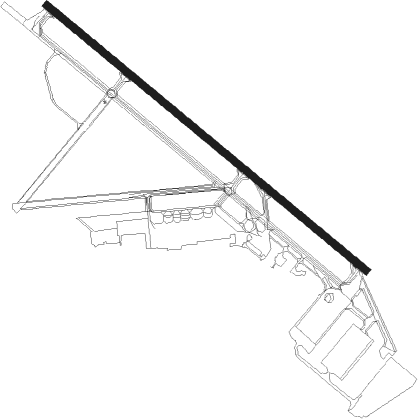
Rome - Griffiss International
Airport details
| Country | United States of America |
| State | New York |
| Region | K6 |
| Airspace | Boston Ctr |
| Municipality | City of Rome |
| Elevation | 502ft (153m) |
| Timezone | GMT -5 |
| Coordinates | 43.23381, -75.40703 |
| Magnetic var | |
| Type | land |
| Available since | X-Plane v10.40 |
| ICAO code | KRME |
| IATA code | RME |
| FAA code | RME |
Communication
| Griffiss International CTAF | 125.600 |
| Griffiss International UNICOM | 122.700 |
| Griffiss International Approach/Departure | 120.925 |
Approach frequencies
| ILS-cat-I | RW33 | 110.1 | 18.00mi |
| 3° GS | RW33 | 110.1 | 18.00mi |
Nearby beacons
| code | identifier | dist | bearing | frequency |
|---|---|---|---|---|
| UCA | UTICA TACAN | 16.3 | 131° | 111.20 |
| GGT | GEORGETOWN TACAN | 32.4 | 223° | 117.80 |
| SYR | SYRACUSE VORTAC | 35.1 | 265° | 117 |
| FZ | FALLN (FULTON) NDB | 39.3 | 273° | 220 |
| RKA | ROCKDALE VOR/DME | 46.6 | 168° | 112.60 |
| ART | WATERTOWN VORTAC | 51.7 | 318° | 109.80 |
| IT | VRNAH (ITHACA) NDB | 64.2 | 230° | 266 |
Instrument approach procedures
| runway | airway (heading) | route (dist, bearing) |
|---|---|---|
| RW15 | SYR (85°) | SYR WEEPY (20mi, 64°) 4000ft TURYN (9mi, 77°) 3500ft |
| RW15 | TURYN (125°) | TURYN 3500ft |
| RNAV | TURYN 3500ft SCOUT (6mi, 125°) 2500ft HOTSU (3mi, 125°) 1500ft KRME (4mi, 125°) 559ft (4770mi, 120°) 704ft BOLTZ (4759mi, 300°) 3500ft BOLTZ (turn) | |
| RW33 | VASTS (41°) | VASTS BOLTZ (16mi, 90°) 3500ft BOLTZ (turn) 3500ft |
| RNAV | BOLTZ 3500ft MARCY (6mi, 305°) 2500ft JERDA (4mi, 305°) 1220ft KRME (3mi, 305°) 554ft (4770mi, 120°) 784ft TURYN (4781mi, 300°) 3500ft TURYN (turn) |
Disclaimer
The information on this website is not for real aviation. Use this data with the X-Plane flight simulator only! Data taken with kind consent from X-Plane 12 source code and data files. Content is subject to change without notice.
