Rome - Rome - Richard B Russel
Airport details
| Country | United States of America |
| State | Georgia |
| Region | K7 |
| Airspace | Atlanta Ctr |
| Municipality | Floyd County |
| Elevation | 644ft (196m) |
| Timezone | GMT -5 |
| Coordinates | 34.35078, -85.15867 |
| Magnetic var | |
| Type | land |
| Available since | X-Plane v10.40 |
| ICAO code | KRMG |
| IATA code | RMG |
| FAA code | RMG |
Communication
| Rome - Richard B Russel ASOS | 119.925 |
| Rome - Richard B Russel CTAF/UNICOM | 123.000 |
Approach frequencies
| ILS-cat-I | RW01 | 111.15 | 18.00mi |
| 3° GS | RW01 | 111.15 | 18.00mi |
Nearby Points of Interest:
United States Post Office and Courthouse
-Between the Rivers Historic District
-Marshall Forest
-Calhoun Depot
-Cassville Post Office
-New Echota
-Corra White Harris House, Study, and Chapel
-Cedartown Waterworks-Woman's Building-Big Spring Park Historic District
-Hawkes Children's Library
-Roselawn Museum
-Bartow County Courthouse
-Old Bartow County Courthouse
-Etowah Indian Mounds
-Walker County Courthouse
-Marsh-Warthen House
-Dr. J.A. Gorman House
-Winston Place
-Masonic Lodge No. 238
-Cherokee Plantation (Alabama)
-Western and Atlantic Depot (Dalton, Georgia)
-Vance C. Larmore House
-Thomas A. Berry House
-W. B. Davis Hosiery Mill
-Chief Vann House Historic Site
-Paulding County Courthouse
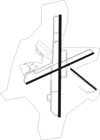
Runway info
Runway 1 / 19  | ||
| length | 1832m (6010ft) | |
| bearing | 6° / 186° | |
| width | 46m (150ft) | |
| surface | asphalt | |
| displ threshold | 0m (0ft) / 35m (115ft) | |
| Runway 7 / 25 | ||
| length | 1333m (4373ft) | |
| bearing | 73° / 253° | |
| width | 30m (100ft) | |
| surface | asphalt | |
| blast zone | 35m (115ft) / 0m (0ft) | |
| Runway 14 / 32 | ||
| length | 590m (1936ft) | |
| bearing | 128° / 308° | |
| width | 23m (75ft) | |
| surface | asphalt | |
| displ threshold | 0m (0ft) / 147m (482ft) | |
Nearby beacons
| code | identifier | dist | bearing | frequency |
|---|---|---|---|---|
| RMG | ROME VORTAC | 11.4 | 168° | 115.40 |
| DJD | CHERO NDB | 33.8 | 98° | 415 |
| GQO | CHOO CHOO (CHATTANOOGA) VORTAC | 36.6 | 0° | 115.80 |
| DOB | DOBBINS (MARIETTA) TACAN | 41.6 | 124° | 113 |
| GPQ | CARROLLTON NDB | 47.1 | 178° | 278 |
| CQN | DAISY (N.CHATTANOOGA) NDB | 48.9 | 0° | 341 |
| GAD | GADSDEN VOR/DME | 51.1 | 248° | 112.30 |
| PDK | PEACHTREE (ATLANTA) VOR/DME | 51.4 | 119° | 116.60 |
| AT | CATTA (ATLANTA) NDB | 52.2 | 139° | 375 |
| ATL | ATLANTA VORTAC | 56.3 | 135° | 116.90 |
| AN | BOGGA (ANNISTON) NDB | 62.3 | 223° | 211 |
| TDG | DME | 64 | 229° | 108.80 |
Instrument approach procedures
| runway | airway (heading) | route (dist, bearing) |
|---|---|---|
| RW01 | WOBIK (6°) | WOBIK 10000ft WOBIK (turn) 3000ft |
| RW01 | YAVUL (39°) | YAVUL WOBIK (7mi, 93°) 3000ft |
| RNAV | WOBIK 3000ft JIDOK (6mi, 6°) 2400ft WEXEX (3mi, 6°) 1340ft KRMG (3mi, 6°) 681ft (5165mi, 112°) 1200ft WOBIK (5166mi, 292°) 3000ft WOBIK (turn) | |
| RW07 | GORGO (34°) | GORGO JIVNA (8mi, 341°) 3000ft |
| RW07 | JIVNA (61°) | JIVNA 10000ft JIVNA (turn) 3000ft |
| RW07 | UZOVO (170°) | UZOVO WEBID (23mi, 214°) 3300ft JIVNA (6mi, 140°) 3000ft |
| RNAV | JIVNA 3000ft HUPOX (6mi, 60°) 2600ft UYIVE (3mi, 60°) 1800ft GOXIW (3mi, 60°) 847ft (5166mi, 112°) 1044ft JIVNA (5175mi, 292°) 3000ft JIVNA (turn) | |
| RW19 | RMG (348°) | RMG JISET (24mi, 358°) 3500ft JISET (turn) 3500ft |
| RW19 | UZOVO (170°) | UZOVO JISET (6mi, 138°) 3500ft |
| RNAV | JISET 3500ft WEMIP (6mi, 186°) 2800ft DEBIY (3mi, 186°) 1840ft KRMG (4mi, 186°) 669ft (5165mi, 112°) 2000ft JISET (5165mi, 292°) 3500ft JISET (turn) | |
| RW25 | UZOVO (170°) | UZOVO TUYUG (14mi, 120°) 3500ft VAYKU (6mi, 156°) 3000ft |
| RW25 | VAYKU (253°) | VAYKU 10000ft VAYKU (turn) 3000ft |
| RW25 | YESVU (274°) | YESVU VAYKU (9mi, 302°) 3000ft |
| RNAV | VAYKU 3000ft UROCI (6mi, 253°) 2400ft VEYUY (3mi, 253°) 1400ft KRMG (3mi, 253°) 671ft (5165mi, 112°) 1100ft VAYKU (5154mi, 292°) 3000ft VAYKU (turn) |
Disclaimer
The information on this website is not for real aviation. Use this data with the X-Plane flight simulator only! Data taken with kind consent from X-Plane 12 source code and data files. Content is subject to change without notice.