Marshall - Brooks Field
Airport details
| Country | United States of America |
| State | Michigan |
| Region | K5 |
| Airspace | Cleveland Ctr |
| Municipality | Marshall |
| Elevation | 939ft (286m) |
| Timezone | GMT -5 |
| Coordinates | 42.25320, -84.96126 |
| Magnetic var | |
| Type | land |
| Available since | X-Plane v10.40 |
| ICAO code | KRMY |
| IATA code | RMY |
| FAA code | RMY |
Communication
| Brooks Field AWOS 3 | 120.025 |
| Brooks Field CTAF/UNICOM | 122.800 |
| Brooks Field KALAMAZOO Approach/Departure | 119.200 |
Nearby Points of Interest:
Governor's Mansion
-Capitol Hill School
-William Prindle Livery Stable
-Masonic Temple Building
-Marshall Historic District
-Stonehall (Marshall, Michigan)
-Harold C. Brooks House
-Isaac Lockwood House
-Superior Street Commercial Historic District
-Homer Village Historic District
-Penniman Castle
-Battle Creek City Hall
-City Hall Historic District
-Merritt Woods Historic District
-Michigan Central Railroad Depot
-Battle Creek Tower
-Record Printing and Box Company Building
-Battle Creek Sanitarium
-Hance House
-Advent Historic District
-Frank and Dorothy Ward House
-Roosevelt American Legion Hospital
-Mann House (Concord, Michigan)
-Concord Village Historic District
-Paddock-Hubbard House
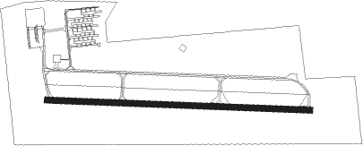
Runway info
| Runway 10 / 28 | ||
| length | 1065m (3494ft) | |
| bearing | 95° / 275° | |
| width | 23m (75ft) | |
| surface | asphalt | |
Nearby beacons
| code | identifier | dist | bearing | frequency |
|---|---|---|---|---|
| BT | BATOL (BATTLE CREEK) NDB | 11.8 | 296° | 272 |
| LFD | LITCHFIELD VOR/DME | 14.4 | 134° | 111.20 |
| JXN | DME | 22.3 | 89° | 115.45 |
| AZ | AUSTN (KALAMAZOO) NDB | 26.3 | 258° | 371 |
| AZO | KALAMAZOO VOR/DME | 26.3 | 268° | 109 |
| IRS | STURGIS NDB | 33.8 | 227° | 382 |
| VIO | VICTORY VOR/DME | 39.8 | 315° | 115.95 |
| GR | KNOBS (GRAND RAPIDS) NDB | 42.7 | 327° | 263 |
| ADG | ADRIAN NDB | 45.6 | 113° | 278 |
| GW | SHENK (AUBURN) NDB | 56.7 | 179° | 227 |
Instrument approach procedures
| runway | airway (heading) | route (dist, bearing) |
|---|---|---|
| RW28 | AWSOF (275°) | AWSOF 3100ft |
| RNAV | AWSOF 3100ft FAPVI (7mi, 275°) 2600ft HIVIR (2mi, 275°) 1900ft KRMY (3mi, 276°) 977ft (5181mi, 116°) 1500ft AWSOF (5169mi, 297°) 3100ft AWSOF (turn) |
Disclaimer
The information on this website is not for real aviation. Use this data with the X-Plane flight simulator only! Data taken with kind consent from X-Plane 12 source code and data files. Content is subject to change without notice.