Roanoke - Roanoke Regl Woodrum Field
Airport details
| Country | United States of America |
| State | Virginia |
| Region | K6 |
| Airspace | Washington Ctr |
| Municipality | Roanoke |
| Elevation | 1171ft (357m) |
| Timezone | GMT -5 |
| Coordinates | 37.32547, -79.97542 |
| Magnetic var | |
| Type | land |
| Available since | X-Plane v10.40 |
| ICAO code | KROA |
| IATA code | ROA |
| FAA code | ROA |
Communication
| Roanoke Regl Woodrum Field ATIS | 132.375 |
| Roanoke Regl Woodrum Field UNICOM | 122.950 |
| Roanoke Regl Woodrum Field Clearance DEL | 119.700 |
| Roanoke Regl Woodrum Field Ground Control | 121.900 |
| Roanoke Regl Woodrum Field Tower | 118.300 |
| Roanoke Regl Woodrum Field Approach/Departure | 126.900 |
| Roanoke Regl Woodrum Field Approach/Departure | 118.150 |
Approach frequencies
| LDA | RW06 | 111.1 | 18.00mi |
| ILS-cat-I | RW34 | 109.7 | 18.00mi |
| 3° GS | RW34 | 109.7 | 18.00mi |
| 3° GS | RW06 | 111.1 | 18.00mi |
Nearby Points of Interest:
Harshbarger House
-Huntingdon (Roanoke, Virginia)
-Burrell Memorial Hospital
-City of Roanoke Fire Station No. 5
-Carlin's Amoco Station
-Monterey (Roanoke, Virginia)
-Colonial National Bank (Roanoke, Virginia)
-Gainsboro Branch of the Roanoke City Public Library
-Gainsboro Historic District
-Henry Street Historic District
-Roanoke City Health Center
-Salem Avenue-Roanoke Automotive Commercial Historic District
-Mountain View (Roanoke, Virginia)
-Norfolk and Western Railway Freight Station
-Norfolk and Western Railway Company Historic District
-Campbell Avenue Complex
-Southwest Historic District (Roanoke, Virginia)
-Grandin Road Commercial Historic District
-Roanoke Downtown Historic District
-Roanoke Apartments
-Roanoke City Market Historic District
-Salem Veterans Affairs Medical Center
-Fire Station No. 1
-Boxley Building
-Apartment Building on Windsor Avenue and Brunswick St.
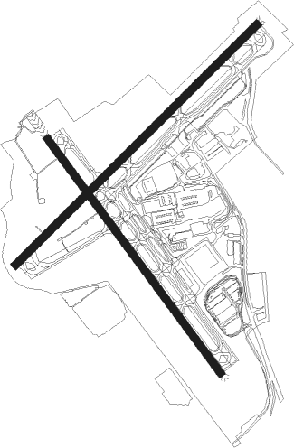
Runway info
Runway 6 / 24  | ||
| length | 2072m (6798ft) | |
| bearing | 56° / 236° | |
| width | 46m (151ft) | |
| surface | asphalt | |
| displ threshold | 0m (0ft) / 241m (791ft) | |
| Runway 16 / 34 | ||
| length | 1772m (5814ft) | |
| bearing | 142° / 322° | |
| width | 46m (151ft) | |
| surface | asphalt | |
Nearby beacons
| code | identifier | dist | bearing | frequency |
|---|---|---|---|---|
| ODR | WOODRUM (ROANOKE) VOR | 0.1 | 250° | 114.90 |
| ROA | ROANOKE VOR/DME | 4.6 | 281° | 109.40 |
| VIT | VINTON (ROANOKE) NDB | 8.5 | 142° | 277 |
| TEC | TECH (BLACKSBURG) NDB | 21.6 | 255° | 368 |
| LY | BOJAR (LYNCHBURG) NDB | 35.1 | 95° | 385 |
| LYH | LYNCHBURG VOR/DME | 35.5 | 95° | 109.20 |
| LW | BUSHI (LEWISBURG) NDB | 36.1 | 313° | 346 |
| LWB | DME | 37.9 | 322° | 116.05 |
| PSK | PULASKI (DUBLIN) VORTAC | 38 | 252° | 116.80 |
| UV | BALES (MARTINSVILLE) NDB | 44.2 | 175° | 396 |
| MOL | MONTEBELLO VOR/DME | 53.8 | 56° | 115.30 |
| DAN | DANVILLE VOR | 54.8 | 140° | 113.10 |
| RNL | RAINELLE VOR | 55.5 | 308° | 116.60 |
| SIF | SLAMMER (REIDSVILLE) NDB | 57.5 | 167° | 423 |
| SBV | SOUTH BOSTON VORTAC | 60.4 | 124° | 110.40 |
Departure and arrival routes
| Transition altitude | 18000ft |
| Transition level | 18000ft |
| SID end points | distance | outbound heading | |
|---|---|---|---|
| RW06 | |||
| SCUTA3 | 79mi | 234° | |
| RW16 | |||
| MONAT3 | 19mi | 116° | |
| HOKEE3 | 21mi | 142° | |
| RW24 | |||
| HOKEE3 | 21mi | 142° | |
| DIXXY8 | 15mi | 248° | |
| BUFIY3 | 23mi | 255° | |
Instrument approach procedures
| runway | airway (heading) | route (dist, bearing) |
|---|---|---|
| RW06-Y | PSK (72°) | PSK RIVRE (18mi, 76°) 6000ft DIXXY (5mi, 69°) 5200ft |
| RW06-Y | ZOOMS (104°) | ZOOMS SUSGE (11mi, 143°) 7000ft WEXOD (6mi, 138°) 6000ft DIXXY (6mi, 102°) 5200ft |
| RNAV | DIXXY 5200ft CLAMM (5mi, 69°) 4300ft HIVLU (5mi, 69°) 2700ft CAKIX (4mi, 69°) 1363ft (4928mi, 115°) 1575ft DEWET (4920mi, 295°) 4000ft DEWET (turn) | |
| RW06-Z | RIVRE (69°) | RIVRE DIXXY (5mi, 69°) 6000ft |
| RW06-Z | WEXOD (78°) | WEXOD DIXXY (6mi, 102°) 6000ft |
| RNAV | DIXXY 6000ft YONTE (8mi, 65°) 3600ft PKMAN (2mi, 65°) 3007ft MJAYY (1mi, 84°) BRADB (turn) 2396ft GARCA (2mi, 80°) KROA (3mi, 58°) 1210ft (4927mi, 115°) 1600ft DEWET (4920mi, 295°) 5000ft DEWET (turn) 5000ft | |
| RW24-Y | HOBOS (211°) | HOBOS GECEP (10mi, 133°) 6400ft CARUS (6mi, 190°) 6400ft PROSE (5mi, 250°) 4700ft |
| RW24-Y | LYH (275°) | LYH CARUS (24mi, 302°) 6400ft PROSE (5mi, 250°) 4700ft |
| RW24-Y | RADIA (246°) | RADIA VULUC (10mi, 251°) 6400ft CARUS (6mi, 250°) 6400ft PROSE (5mi, 250°) 4700ft |
| RNAV | PROSE 4700ft HIBAN (6mi, 247°) 3700ft WUDAG (1mi, 236°) 3220ft KROA (7mi, 235°) 1205ft (4927mi, 115°) 1575ft MONAT (4910mi, 295°) 4000ft MONAT (turn) | |
| RW24-Z | CORTR (267°) | CORTR STEFN (9mi, 287°) 5000ft |
| RW24-Z | JAYYE (226°) | JAYYE STEFN (9mi, 177°) 5000ft |
| RW24-Z | VULUC (245°) | VULUC CARUS (6mi, 250°) 6200ft STEFN (7mi, 225°) 5000ft |
| RNAV | STEFN 5000ft DBERD (5mi, 257°) 3500ft WILHE (5mi, 257°) 2045ft FUDDZ (turn) KROA (2mi, 233°) 1210ft (4927mi, 115°) 1491ft JAYYT (4930mi, 295°) TPUCK (6mi, 134°) MONAT (16mi, 97°) 4000ft MONAT (turn) | |
| RW34-Y | LYH (275°) | LYH MONAT (20mi, 256°) 4000ft ZIPAX (9mi, 256°) 3900ft |
| RW34-Y | PIGGS (326°) | PIGGS ZIPAX (12mi, 331°) 3900ft |
| RW34-Y | TABER (15°) | TABER ZIPAX (12mi, 76°) 4500ft ZIPAX (turn) 3900ft |
| RNAV | ZIPAX 3900ft NAVBE (6mi, 322°) 3800ft KROA (9mi, 323°) 1199ft (4927mi, 115°) 2800ft PROSE (4916mi, 295°) 6000ft PROSE (turn) 6000ft | |
| RW34-Z | DANCO (72°) | DANCO AYEAY (23mi, 87°) 5600ft SAMBE (10mi, 87°) 5200ft KAGEE (5mi, 87°) 4500ft NAVBE (5mi, 33°) 3800ft |
| RW34-Z | MCHEL (282°) | MCHEL HARDN (9mi, 263°) 4000ft SCHER (7mi, 263°) 4000ft NAVBE (3mi, 290°) 3800ft |
| RW34-Z | PIGGS (326°) | PIGGS ZIPAX (12mi, 331°) 3900ft NAVBE (6mi, 322°) 3800ft |
| RNAV | NAVBE 3800ft KROA (9mi, 323°) 1199ft DMOSS (turn) SETHB (6mi, 8°) JEEVY (3mi, 69°) PROSE (8mi, 86°) 6000ft PROSE (turn) |
Disclaimer
The information on this website is not for real aviation. Use this data with the X-Plane flight simulator only! Data taken with kind consent from X-Plane 12 source code and data files. Content is subject to change without notice.