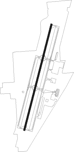
Rogers - Rogers Muni Carter Fld
Airport details
| Country | United States of America |
| State | Arkansas |
| Region | K4 |
| Airspace | Memphis Ctr |
| Municipality | Rogers |
| Elevation | 1355ft (413m) |
| Timezone | GMT -6 |
| Coordinates | 36.37242, -94.10697 |
| Magnetic var | |
| Type | land |
| Available since | X-Plane v10.40 |
| ICAO code | KROG |
| IATA code | ROG |
| FAA code | ROG |
Communication
| Rogers Muni Carter Fld AWOS 3 | 134.375 |
| Rogers Muni Carter Fld CTAF/UNICOM | 119.375 |
| Rogers Muni Carter Fld Clearance DEL | 121.750 |
| Rogers Muni Carter Fld Ground | 118.000 |
| Rogers Muni Carter Fld RAZORBACK Tower | 119.375 |
| Rogers Muni Carter Fld RAZORBACK Approach/Departure | 126.600 |
| Rogers Muni Carter Fld RAZORBACK Approach/Departure | 128.150 |
Approach frequencies
| ILS-cat-I | RW20 | 111.5 | 18.00mi |
| 3° GS | RW20 | 111.5 | 18.00mi |
Nearby beacons
| code | identifier | dist | bearing | frequency |
|---|---|---|---|---|
| RZC | RAZORBACK (FAYETTEVILLE) VORTAC | 7.5 | 187° | 116.40 |
| SLG | SILOAM SPRINGS NDB | 21.5 | 244° | 284 |
| EOS | NEOSHO VOR/DME | 32.3 | 325° | 117.30 |
| HRO | HARRISON VOR/DME | 43.3 | 93° | 112.50 |
| JL | LUNNS (JOPLIN) NDB | 54.4 | 331° | 344 |
| FSM | FORT SMITH VORTAC | 59.6 | 189° | 110.40 |
| SGF | SPRINGFIELD VORTAC | 69.7 | 38° | 116.90 |
Departure and arrival routes
| Transition altitude | 18000ft |
| Transition level | 18000ft |
| SID end points | distance | outbound heading | |
|---|---|---|---|
| RW02 | |||
| ROG3 | 24mi | 130° | |
| RW20 | |||
| ROG3 | 24mi | 130° | |
Instrument approach procedures
| runway | airway (heading) | route (dist, bearing) |
|---|---|---|
| RW02 | HONON (23°) | HONON 3100ft |
| RNAV | HONON 3100ft WETCO (6mi, 23°) 3000ft ROLCO (3mi, 23°) 2020ft KROG (2mi, 23°) 1417ft (5604mi, 111°) 1620ft NASIC (5599mi, 291°) 3200ft NASIC (turn) | |
| RW20 | CITGA (229°) | CITGA NASIC (5mi, 286°) 3200ft |
| RW20 | NASIC (203°) | NASIC 3200ft |
| RW20 | PINNE (133°) | PINNE FISUP (8mi, 61°) 3200ft NASIC (5mi, 106°) 3200ft |
| RW20 | WALTN (203°) | WALTN NASIC (5mi, 203°) 3200ft |
| RNAV | NASIC 3200ft JAPKO (7mi, 203°) 3100ft KROG (6mi, 203°) 1398ft HONON (11mi, 203°) 3100ft HONON (turn) |
Disclaimer
The information on this website is not for real aviation. Use this data with the X-Plane flight simulator only! Data taken with kind consent from X-Plane 12 source code and data files. Content is subject to change without notice.
