Roswell - Roswell Intl Air Center
Airport details
| Country | United States of America |
| State | New Mexico |
| Region | K2 |
| Airspace | Albuquerque Ctr |
| Municipality | Roswell |
| Elevation | 3669ft (1118m) |
| Timezone | GMT -7 |
| Coordinates | 33.30524, -104.52160 |
| Magnetic var | |
| Type | land |
| Available since | X-Plane v10.40 |
| ICAO code | KROW |
| IATA code | ROW |
| FAA code | ROW |
Communication
| Roswell Intl Air Center ATIS | 128.450 |
| Roswell Intl Air Center CTAF | 118.500 |
| Roswell Intl Air Center UNICOM | 122.950 |
| Roswell Intl Air Center Clearance DEL | 132.875 |
| Roswell Intl Air Center Ground Control | 121.900 |
| Roswell Intl Air Center Tower | 118.500 |
| Roswell Intl Air Center Approach/Departure | 119.600 |
| Roswell Intl Air Center Approach/Departure | 120.350 |
Approach frequencies
| ILS-cat-I | RW21 | 109.9 | 18.00mi |
| 2.7° GS | RW21 | 109.9 | 18.00mi |
Nearby Points of Interest:
Saunders-Crosby House
-Louise Massey House
-James Phelps White House
-Chaves County Courthouse
-Bitter Lake National Wildlife Refuge
-Rio Felix Bridge at Hagerman
-William Baskin House
-Willie D. Atkeson House
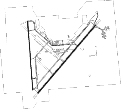
Runway info
Runway 3 / 21  | ||
| length | 3963m (13002ft) | |
| bearing | 50° / 230° | |
| width | 46m (150ft) | |
| surface | concrete | |
| blast zone | 255m (837ft) / 255m (837ft) | |
| Runway 17 / 35 | ||
| length | 3058m (10033ft) | |
| bearing | 180° / 0° | |
| width | 30m (100ft) | |
| surface | asphalt | |
| blast zone | 0m (0ft) / 45m (148ft) | |
Nearby beacons
| code | identifier | dist | bearing | frequency |
|---|---|---|---|---|
| CME | CHISUM (ROSWELL) VORTAC | 5.3 | 288° | 116.10 |
| RO | TOPAN (ROSWELL) NDB | 5.3 | 53° | 305 |
| ATS | ARTESIA NDB | 27.3 | 172° | 414 |
| CEP | CAPITAN (RUIDOSO) NDB | 45.6 | 282° | 278 |
| PIO | PINON VOR/DME | 61 | 225° | 110.40 |
Instrument approach procedures
| runway | airway (heading) | route (dist, bearing) |
|---|---|---|
| RW03 | CME (108°) | CME GICEC (12mi, 202°) 6500ft GICEC (turn) 6300ft LIKIC (4mi, 50°) 5700ft |
| RW03 | HOPET (56°) | HOPET GICEC (8mi, 66°) 6300ft LIKIC (4mi, 50°) 5700ft |
| RW03 | NELON (359°) | NELON HUGEX (6mi, 293°) 6300ft GICEC (5mi, 310°) 6300ft LIKIC (4mi, 50°) 5700ft |
| RNAV | LIKIC 5700ft CUSIL (3mi, 50°) 5300ft KROW (6mi, 48°) 3717ft (6132mi, 108°) 3917ft AQZED (6122mi, 288°) 6000ft AQZED (turn) | |
| RW17 | CME (108°) | CME HOGIG (11mi, 27°) 6400ft HOGIG (turn) 6000ft |
| RW17 | FRAIZ (231°) | FRAIZ FOVUB (6mi, 286°) 6100ft HOGIG (5mi, 270°) 6000ft |
| RW17 | HONDS (128°) | HONDS HOGIG (16mi, 102°) 6000ft |
| RNAV | HOGIG 6000ft RARKE (6mi, 180°) 5300ft KROW (6mi, 169°) 3713ft (6132mi, 108°) 3916ft KIGDE (6134mi, 288°) 6000ft KIGDE (turn) | |
| RW21 | CME (108°) | CME AQZED (15mi, 69°) 6400ft AQZED (turn) 6000ft |
| RW21 | ONSOM (255°) | ONSOM AQZED (11mi, 279°) 6000ft |
| RNAV | AQZED 6000ft JEKTO (6mi, 230°) 5400ft KROW (6mi, 233°) 3674ft (6132mi, 108°) 3899ft GICEC (6141mi, 288°) 6300ft GICEC (turn) | |
| RW35 | CME (108°) | CME KIGDE (15mi, 161°) 6400ft KIGDE (turn) 6000ft |
| RW35 | HAGER (301°) | HAGER LELIY (8mi, 242°) 6000ft KIGDE (5mi, 270°) 6000ft |
| RW35 | HOPET (56°) | HOPET KIGDE (14mi, 89°) 6000ft |
| RW35 | NELON (359°) | NELON KIGDE (3mi, 334°) 6000ft |
| RNAV | KIGDE 6000ft SIBPO (6mi, 0°) 5400ft KROW (6mi, 10°) 3721ft (6132mi, 108°) 3921ft HOGIG (6131mi, 288°) 6000ft HOGIG (turn) |
Disclaimer
The information on this website is not for real aviation. Use this data with the X-Plane flight simulator only! Data taken with kind consent from X-Plane 12 source code and data files. Content is subject to change without notice.