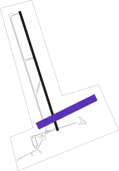
Roseau - Roseau Muni Rudy Billberg Fld
Airport details
| Country | United States of America |
| State | Minnesota |
| Region | K3 |
| Airspace | Minneapolis Ctr |
| Municipality | Roseau County |
| Elevation | 1059ft (323m) |
| Timezone | GMT -6 |
| Coordinates | 48.85600, -95.69708 |
| Magnetic var | |
| Type | land |
| Available since | X-Plane v10.40 |
| ICAO code | KROX |
| IATA code | ROX |
| FAA code | ROX |
Communication
| Roseau Muni Rudy Billberg Fld CTAF/UNICOM | 122.800 |
Nearby Points of Interest:
Roseau County Courthouse
-Canadian National Depot
Nearby beacons
| code | identifier | dist | bearing | frequency |
|---|---|---|---|---|
| ROX | ROSEAU VOR/DME | 0.1 | 120° | 108.80 |
| SW | ROADD (WARROAD) NDB | 17.9 | 89° | 360 |
| TVF | THIEF RIVER FALLS VOR/DME | 51.1 | 212° | 114.45 |
Instrument approach procedures
| runway | airway (heading) | route (dist, bearing) |
|---|---|---|
| RW16 | BADYA (160°) | BADYA 2800ft |
| RW16 | EBAGE (195°) | EBAGE BADYA (5mi, 261°) 2800ft |
| RW16 | FALPA (59°) | FALPA ANEYU (23mi, 22°) 2800ft BADYA (5mi, 81°) 2800ft |
| RNAV | BADYA 2800ft CATPI (6mi, 160°) 2700ft KROX (5mi, 160°) 1086ft (5630mi, 117°) 1305ft ACEBO (5628mi, 297°) 2800ft ACEBO (turn) | |
| RW34 | ACEBO (340°) | ACEBO 2800ft |
| RW34 | FALPA (59°) | FALPA CAMOD (11mi, 90°) 2800ft ACEBO (5mi, 81°) 2800ft |
| RW34 | FATIK (294°) | FATIK BIRNE (36mi, 289°) 2800ft ACEBO (5mi, 261°) 2800ft |
| RNAV | ACEBO 2800ft DAYAL (6mi, 340°) 2700ft KROX (5mi, 341°) 1100ft ALICI (4mi, 340°) BIPAC (8mi, 264°) FALPA (15mi, 205°) 2900ft FALPA (turn) |
Disclaimer
The information on this website is not for real aviation. Use this data with the X-Plane flight simulator only! Data taken with kind consent from X-Plane 12 source code and data files. Content is subject to change without notice.

