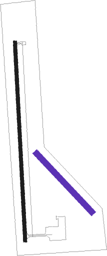
Belleville - Belleville Muni
Airport details
| Country | United States of America |
| State | Kansas |
| Region | K3 |
| Airspace | Minneapolis Ctr |
| Municipality | Belleville |
| Elevation | 1537ft (468m) |
| Timezone | GMT -6 |
| Coordinates | 39.81776, -97.65958 |
| Magnetic var | |
| Type | land |
| Available since | X-Plane v10.40 |
| ICAO code | KRPB |
| IATA code | n/a |
| FAA code | RPB |
Communication
| Belleville Muni CTAF/UNICOM | 122.800 |
Nearby Points of Interest:
County Line Bowstring
-Pawnee Indian Museum State Historic Site
-Bankers Loan and Trust Company Building
-Hebron United States Post Office
-Wallace Warren and Lillian Genevieve Bradshaw Kendall House
-Jewell County Courthouse
-Washington County Courthouse
-Richard E. Dill House
-Jefferson County Courthouse
-IOOF Temple Building
-Fairbury Public Library
-Pott's Ford Bridge
-St. John the Baptist Catholic Church
-Nuckolls County Courthouse
-Burr Oak United Methodist Church
-Mitchell County Courthouse
-Nelson Cemetery Walk
Nearby beacons
| code | identifier | dist | bearing | frequency |
|---|---|---|---|---|
| TKO | MANKATO VORTAC | 27.7 | 269° | 109.80 |
| FBY | FAIRBURY NDB | 31.3 | 54° | 293 |
| FMZ | BEKLOF (FAIRMONT) NDB | 46.5 | 7° | 392 |
| BIE | BEATRICE VOR | 50.7 | 62° | 110.60 |
| SLN | SALINA VORTAC | 53.6 | 178° | 117.10 |
| HSI | HASTINGS VOR/DME | 58.9 | 316° | 108.80 |
| MHK | MANHATTAN VOR/DME | 61.1 | 124° | 110.20 |
| FRI | FORT RILEY (JUNCTION CITY VOR | 62.9 | 137° | 109.40 |
| LN | POTTS (LINCOLN) NDB | 69.3 | 44° | 385 |
Instrument approach procedures
| runway | airway (heading) | route (dist, bearing) |
|---|---|---|
| RW18 | FEBNO (182°) | FEBNO 3400ft |
| RW18 | GADWY (221°) | GADWY FEBNO (31mi, 233°) 3400ft |
| RNAV | FEBNO 3400ft WUPIK (6mi, 182°) 3200ft ATIJA (2mi, 182°) 2440ft KRPB (3mi, 181°) 1565ft (5758mi, 112°) 2300ft FEBNO (5757mi, 292°) 3400ft FEBNO (turn) | |
| RW36 | SLN (358°) | SLN ZANPU (42mi, 356°) 3400ft |
| RNAV | ZANPU 3400ft YISYU (6mi, 2°) 3200ft UMHOY (3mi, 2°) 2180ft KRPB (2mi, 3°) 1579ft (5758mi, 112°) 1920ft FEBNO (5757mi, 292°) 3400ft FEBNO (turn) |
Disclaimer
The information on this website is not for real aviation. Use this data with the X-Plane flight simulator only! Data taken with kind consent from X-Plane 12 source code and data files. Content is subject to change without notice.

