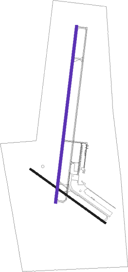
Rice Lake - Rice Lake Regl
Airport details
| Country | United States of America |
| State | Wisconsin |
| Region | K5 |
| Airspace | Minneapolis Ctr |
| Municipality | Rice Lake |
| Elevation | 1105ft (337m) |
| Timezone | GMT -6 |
| Coordinates | 45.42011, -91.77333 |
| Magnetic var | |
| Type | land |
| Available since | X-Plane v10.40 |
| ICAO code | KRPD |
| IATA code | RIE |
| FAA code | RPD |
Communication
| Rice Lake Regl AWOS 3 | 120.525 |
| Rice Lake Regl CTAF/UNICOM | 122.700 |
Approach frequencies
| ILS-cat-I | RW01 | 108.3 | 18.00mi |
| 3° GS | RW01 | 108.3 | 18.00mi |
Nearby Points of Interest:
Edward N. and Mary T. Stebbins House
-Rice Lake station
-ZCBJ Hall
-Cumberland Public Library
-George V. Siegner House
-Colfax Municipal Building
-Flambeau Mission Church
-Mrs. Richard Polson House
Nearby beacons
| code | identifier | dist | bearing | frequency |
|---|---|---|---|---|
| RP | WICKR (RICE LAKE) NDB | 6.2 | 196° | 221 |
| RCX | RUSK COUNTY (LADYSMITH) NDB | 32.8 | 84° | 356 |
| EAU | EAU CLAIRE VORTAC | 33.7 | 151° | 113.65 |
| BXR | BIG DOCTOR (SIREN) NDB | 34.6 | 304° | 203 |
| RZN | DME | 34.8 | 304° | 109.40 |
| HYR | DME | 38.4 | 29° | 113.40 |
| RG | REGUE (RED WING) NDB | 61.7 | 227° | 274 |
Instrument approach procedures
| runway | airway (heading) | route (dist, bearing) |
|---|---|---|
| RW01 | ALEEN (119°) | ALEEN CENOS (29mi, 147°) 3200ft HERRB (5mi, 98°) 3200ft |
| RW01 | EAU (331°) | EAU HERRB (24mi, 312°) 3200ft |
| RW01 | HERRB (16°) | HERRB 3200ft |
| RW01 | STILS (72°) | STILS CENOS (30mi, 82°) 3200ft HERRB (5mi, 98°) 3200ft |
| RNAV | HERRB 3200ft KOHHL (6mi, 16°) 3100ft JADIX (4mi, 16°) 1760ft KRPD (2mi, 17°) 1141ft (5480mi, 116°) 1390ft ORBEW (5477mi, 296°) 3200ft ORBEW (turn) | |
| RW19 | ALEEN (119°) | ALEEN FEMER (18mi, 90°) 3200ft ORBEW (5mi, 118°) 3200ft |
| RW19 | LAYVU (259°) | LAYVU HOKSI (28mi, 276°) 3300ft ORBEW (6mi, 256°) 3200ft |
| RW19 | ORBEW (196°) | ORBEW 6000ft ORBEW (turn) 3200ft |
| RNAV | ORBEW 3200ft TISME (6mi, 196°) 2900ft WANSO (3mi, 196°) 1900ft KRPD (3mi, 195°) 1147ft (5480mi, 116°) 1309ft HERRB (5483mi, 296°) 3200ft HERRB (turn) |
Disclaimer
The information on this website is not for real aviation. Use this data with the X-Plane flight simulator only! Data taken with kind consent from X-Plane 12 source code and data files. Content is subject to change without notice.

