Big Rapids - Roben Hood
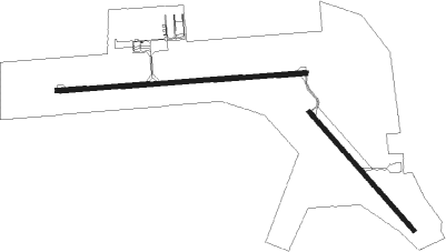
Airport details
| Country | United States of America |
| State | Michigan |
| Region | K5 |
| Airspace | Minneapolis Ctr |
| Municipality | Big Rapids Township |
| Elevation | 990ft (302m) |
| Timezone | GMT -5 |
| Coordinates | 43.72264, -85.50406 |
| Magnetic var | |
| Type | land |
| Available since | X-Plane v10.40 |
| ICAO code | KRQB |
| IATA code | WBR |
| FAA code | RQB |
Communication
| ROBEN HOOD AWOS 3P | 125.875 |
| ROBEN HOOD CTAF/UNICOM | 122.800 |
Nearby Points of Interest:
Fairman Building
-Nisbett Building
-Idlewild
-Marlborough Historic District
-Sherman City Union Church
-Fremont High School
-Elk Rapids Township Hall
-George and Martha Hitchcock House

Nearby beacons
| code | identifier | dist | bearing | frequency |
|---|---|---|---|---|
| HIC | WHITE CLOUD VOR/DME | 12.7 | 235° | 117.60 |
| MA | WEXOR (CADILLAC) NDB | 30.9 | 355° | 336 |
| MOP | MOUNT PLEASANT VOR/DME | 33.8 | 97° | 110.60 |
| MKG | MUSKEGON TACAN | 40.6 | 224° | 115.20 |
| MB | JEPOT (MANISTEE) NDB | 42.9 | 311° | 254 |
| MBL | DME | 46.1 | 306° | 111.40 |
| GR | KNOBS (GRAND RAPIDS) NDB | 49.9 | 171° | 263 |
| VIO | VICTORY VOR/DME | 56.2 | 180° | 115.95 |
| TVC | TRAVERSE CITY VOR/DME | 56.8 | 357° | 114.60 |
| CGG | GRAYLING VOR | 66.5 | 39° | 109.80 |
Instrument approach procedures
| runway | airway (heading) | route (dist, bearing) |
|---|---|---|
| RW27 | HIC (55°) | HIC IDANY (23mi, 73°) 3100ft IDANY (turn) 3100ft |
| RW27 | MOP (277°) | MOP IDANY (22mi, 282°) 3100ft |
| RNAV | IDANY 3100ft MEKDY (7mi, 270°) 2600ft VIVUY (3mi, 270°) 1780ft KRQB (3mi, 268°) 985ft (5210mi, 117°) 1176ft HUSHU (5216mi, 297°) 2900ft HUSHU (turn) |
Disclaimer
The information on this website is not for real aviation. Use this data with the X-Plane flight simulator only! Data taken with kind consent from X-Plane 12 source code and data files. Content is subject to change without notice.