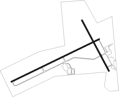
Merrill - Merrill Muni
Airport details
| Country | United States of America |
| State | Wisconsin |
| Region | K5 |
| Airspace | Minneapolis Ctr |
| Municipality | Merrill |
| Elevation | 1315ft (401m) |
| Timezone | GMT -6 |
| Coordinates | 45.19892, -89.71286 |
| Magnetic var | |
| Type | land |
| Available since | X-Plane v10.40 |
| ICAO code | KRRL |
| IATA code | RRL |
| FAA code | RRL |
Communication
| Merrill Muni AWOS 3 | 119.925 |
| Merrill Muni CTAF/UNICOM | 122.800 |
Nearby Points of Interest:
T.B. Scott Free Library
-First Street Bridge (Merrill, Wisconsin)
-Merrill City Hall
-Fromm Brothers Fur and Ginseng Farm
-C. B. Bird House
-Ely Wright House
-D. C. Everest House
-C. F. Dunbar House
-E.K. Schuetz House
-Hiram C. Stewart House
-C. H. Wegner House
-Marathon County Fairgrounds
-Granville D. Jones House
-Duey and Julia Wright House
-Louis Marchetti House
-Antigo Opera House
-Antigo Depot
-Langlade County Courthouse
-Antigo Post Office
-Antigo Public Library and Deleglise Cabin
-Karl Mathie House
-Joseph Dessert Library
-Taylor County Courthouse
-Medford Free Public Library
-Medford Post Office

Nearby beacons
| code | identifier | dist | bearing | frequency |
|---|---|---|---|---|
| AUW | WAUSAU VOR/DME | 21.8 | 160° | 111.60 |
| RH | ARSHA (RHINELANDER) NDB | 26 | 12° | 272 |
| RHI | RHINELANDER VOR/DME | 28.2 | 30° | 109.20 |
| DO | DOUGY (MINOCQUA WOODRUFF) NDB | 38.1 | 358° | 236 |
Instrument approach procedures
| runway | airway (heading) | route (dist, bearing) |
|---|---|---|
| RW07 | AUW (340°) | AUW KEYBE (19mi, 301°) 3600ft JELUR (5mi, 331°) 3500ft |
| RW07 | JELUR (74°) | JELUR 3500ft |
| RW07 | LACIY (84°) | LACIY JELUR (5mi, 109°) 3500ft |
| RNAV | JELUR 3500ft GEKPE (6mi, 74°) 3000ft ZUMBO (3mi, 74°) 2020ft KRRL (3mi, 75°) 1358ft (5393mi, 117°) 1635ft FOROG (5382mi, 297°) 3500ft FOROG (turn) | |
| RW25 | AUW (340°) | AUW SIPKE (22mi, 27°) 3500ft FOROG (5mi, 331°) 3500ft |
| RW25 | FOROG (255°) | FOROG 3500ft |
| RW25 | YANUT (235°) | YANUT FOROG (5mi, 146°) 3500ft |
| RNAV | FOROG 3500ft SUTOY (3mi, 255°) 3500ft CEYDA (3mi, 255°) 3000ft PERIC (3mi, 255°) 2060ft KRRL (3mi, 254°) 1346ft (5393mi, 117°) 1640ft JELUR (5404mi, 297°) 3500ft JELUR (turn) |
Disclaimer
The information on this website is not for real aviation. Use this data with the X-Plane flight simulator only! Data taken with kind consent from X-Plane 12 source code and data files. Content is subject to change without notice.