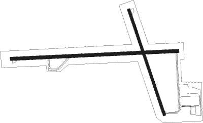
Robinson - Crawford County
Airport details
| Country | United States of America |
| State | Illinois |
| Region | K5 |
| Airspace | Indianapolis Ctr |
| Municipality | Crawford County |
| Elevation | 460ft (140m) |
| Timezone | GMT -6 |
| Coordinates | 39.01603, -87.64978 |
| Magnetic var | |
| Type | land |
| Available since | X-Plane v10.35 |
| ICAO code | KRSV |
| IATA code | n/a |
| FAA code | RSV |
Communication
| Crawford County AWOS | 120.500 |
| Crawford County CTAF | 123.000 |
| Crawford County Hulman Approach | 119.250 |
| Crawford County Hulman Departure | 119.250 |
Nearby Points of Interest:
Stoner Site
-Fife Opera House
-Palestine Commercial Historic District
-John B. Harper House
-Riverton Site
-Union Christian College, Merom
-American Trust and Savings Bank
-Swan Island Site
-Sherman Building
-Sullivan County Courthouse
-Sullivan County Poor Home
-Shelburn Interurban Depot-THI&E Interurban Depot
-Lawrence County Courthouse
-Kixmiller's Store
-Kimmell Park
-Enoco Coal Mine
-Grouseland
-Hack and Simon Office Building
-Old State Bank
-Forts of Vincennes, Indiana
-St. Francis Xavier Cathedral and Library
-Vincennes Fortnightly Club
-Linton Township High School and Community Building
-Pyramid Mound
-Shadowwood

Nearby beacons
| code | identifier | dist | bearing | frequency |
|---|---|---|---|---|
| PLX | PALESTINE (ROBINSON) NDB | 0.3 | 103° | 391 |
| LWV | DME | 14.9 | 169° | 108.80 |
| HU | YINNO (TERRE HAUTE) NDB | 25.2 | 34° | 245 |
| OLY | OLNEY NDB | 30.2 | 240° | 272 |
| TTH | TERRE HAUTE VORTAC | 33.9 | 40° | 115.30 |
| SAM | SAMSVILLE VOR/DME | 37.8 | 219° | 116.60 |
| BIB | BIBLE GROVE VORTAC | 39.2 | 263° | 109 |
| MTO | DME | 40.5 | 306° | 109.40 |
| FWC | WAYNE CO (FAIRFIELD) NDB | 52.2 | 230° | 257 |
| EVV | VICCI (EVANSVILLE) NDB | 54.3 | 167° | 219 |
| CM | VEALS (CHAMPAIGN/URBANA) NDB | 62.1 | 331° | 407 |
| CFJ | CRAWFORDSVILLE NDB | 67.1 | 37° | 388 |
Instrument approach procedures
| runway | airway (heading) | route (dist, bearing) |
|---|---|---|
| RW09 | BIB (83°) | BIB PULOY (28mi, 80°) 2200ft |
| RW09 | LUPCE (236°) | LUPCE OZIRO (28mi, 263°) 2600ft PULOY (9mi, 182°) 2200ft |
| RW09 | PULOY (91°) | PULOY 2200ft |
| RW09 | SAM (39°) | SAM PULOY (33mi, 19°) 2200ft |
| RNAV | PULOY 2200ft FEGEG (6mi, 91°) 2200ft NACIT (3mi, 91°) 1380ft KRSV (3mi, 92°) 501ft (5296mi, 114°) 805ft JIXUT (5284mi, 294°) 2200ft JIXUT (turn) | |
| RW17 | DELCO (142°) | DELCO MJUDD (14mi, 129°) 3300ft |
| RW17 | IFIGO (184°) | IFIGO MJUDD (14mi, 199°) 3300ft |
| RW17 | SAM (39°) | SAM MJUDD (46mi, 29°) 3300ft MJUDD (turn) 3300ft |
| RNAV | MJUDD 3300ft ZILEB (5mi, 162°) 2200ft IRIRY (3mi, 162°) 1320ft KRSV (3mi, 166°) 506ft (5296mi, 114°) 1300ft MJUDD (5298mi, 294°) 3300ft MJUDD (turn) | |
| RW27 | BUNKA (262°) | BUNKA JIXUT (12mi, 254°) 3000ft |
| RW27 | CLOWN (327°) | CLOWN WUMOB (22mi, 348°) 3000ft JIXUT (8mi, 3°) 3000ft |
| RW27 | JIXUT (271°) | JIXUT 3000ft |
| RW27 | SAM (39°) | SAM WUMOB (40mi, 60°) 3000ft JIXUT (8mi, 3°) 3000ft |
| RNAV | JIXUT 3000ft COTUG (6mi, 272°) 2200ft ZEGEN (3mi, 271°) 1320ft KRSV (3mi, 271°) 500ft (5296mi, 114°) 705ft PULOY (5307mi, 294°) 3000ft PULOY (turn) |
Disclaimer
The information on this website is not for real aviation. Use this data with the X-Plane flight simulator only! Data taken with kind consent from X-Plane 12 source code and data files. Content is subject to change without notice.