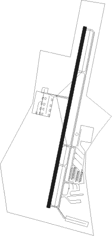
Salisbury - Mid-carolina Regl
Airport details
| Country | United States of America |
| State | North Carolina |
| Region | K7 |
| Airspace | Atlanta Ctr |
| Municipality | Rowan County |
| Elevation | 771ft (235m) |
| Timezone | GMT -5 |
| Coordinates | 35.64589, -80.52028 |
| Magnetic var | |
| Type | land |
| Available since | X-Plane v10.40 |
| ICAO code | KRUQ |
| IATA code | SRW |
| FAA code | RUQ |
Communication
| Mid-Carolina Regl AWOS 3 | 118.175 |
| Mid-Carolina Regl CTAF/UNICOM | 122.800 |
| Mid-Carolina Regl CHARLOTTE Approach/Departure | 128.325 |
Approach frequencies
| ILS-cat-I | RW20 | 109.95 | 18.00mi |
| 3° GS | RW20 | 109.95 | 18.00mi |
Nearby Points of Interest:
Calvin H. Wiley School
-J. C. Price High School
-Monroe Street School
-Hambley-Wallace House
-McNeely-Strachan House
-Grubb-Sigmon-Weisiger House
-Archibald Henderson Law Office
-Maxwell Chambers House
-Shaver Rental Houses District
-Bernhardt House
-Salisbury Historic District
-Community Building
-Ellis Street Graded School Historic District
-Grimes Mill
-North Long Street-Park Avenue Historic District
-Walter McCanless House
-Kesler Manufacturing Co.-Cannon Mills Co. Plant No. 7 Historic District
-Michael Braun House
-Southern Railway's Spencer Shops
-China Grove Roller Mill
-Hall Family House
-Christ Episcopal Church
-Kerr Mill
-Philip Sowers House
-Rankin-Sherrill House
Nearby beacons
| code | identifier | dist | bearing | frequency |
|---|---|---|---|---|
| RU | ROVDY (SALISBURY) NDB | 5.4 | 19° | 275 |
| VU | ALLER (ALBEMARLE) NDB | 23.3 | 110° | 346 |
| IN | REENO (WINSTON SALEM) NDB | 30.7 | 40° | 317 |
| CLT | CHARLOTTE VOR/DME | 34.5 | 223° | 115 |
| GSO | GREENSBORO VORTAC | 35.7 | 54° | 116.20 |
| BZM | BARRETTS MOUNTAIN (HICKOR VOR/DME | 37.5 | 287° | 113.75 |
| HK | TAWBA (HICKORY) NDB | 39.1 | 280° | 332 |
| GHJ | STONIA (GASTONIA) NDB | 41.4 | 235° | 260 |
| LIB | LIBERTY VORTAC | 45.3 | 80° | 113 |
| HB | ALAMM NDB | 49.7 | 70° | 361 |
| SDZ | SANDHILLS (SOUTHERN PINES VORTAC | 52.4 | 115° | 111.80 |
| UZ | RALLY (ROCK HILL) NDB | 53 | 217° | 227 |
| SIF | SLAMMER (REIDSVILLE) NDB | 57.5 | 46° | 423 |
| LKR | LANCASTER NDB | 57.8 | 200° | 400 |
| CTF | CHESTERFIELD VOR/DME | 60.9 | 166° | 108.20 |
| JUH | ASHEE (JEFFERSON) NDB | 61.2 | 315° | 410 |
| DCM | CHESTER NDB | 61.5 | 218° | 220 |
| UV | BALES (MARTINSVILLE) NDB | 63.8 | 33° | 396 |
Departure and arrival routes
| Transition altitude | 18000ft |
| Transition level | 18000ft |
| SID end points | distance | outbound heading | |
|---|---|---|---|
| ALL | |||
| KILNS4 | 90mi | 72° | |
| BARMY4 | 139mi | 83° | |
| KNI2 | 41mi | 124° | |
| LILLS2 | 52mi | 140° | |
| KWEEN4 | 87mi | 191° | |
| ICONS4 | 103mi | 197° | |
| BEAVY5 | 115mi | 203° | |
| ESTRR4 | 138mi | 241° | |
| BOBZY4 | 80mi | 250° | |
| JOJJO4 | 224mi | 275° | |
| KRITR5 | 23mi | 312° | |
| WEAZL4 | 56mi | 321° | |
| RW02 | |||
| KER3 | 161mi | 200° | |
| RW20 | |||
| KER3 | 161mi | 200° | |
| STAR starting points | distance | inbound heading | |
|---|---|---|---|
| ALL | |||
| NASCR4 | 11.4 | 6° | |
| CHPTR3 | 83.1 | 41° | |
| UNARM6 | 81.1 | 49° | |
| KABEE3 | 61.6 | 340° | |
Instrument approach procedures
| runway | airway (heading) | route (dist, bearing) |
|---|---|---|
| RW02 | LOCAS (350°) | LOCAS COLID (17mi, 331°) 3100ft |
| RW02 | OWALT (106°) | OWALT COLID (23mi, 135°) 3100ft COLID (turn) 3100ft |
| RNAV | COLID 3100ft KOTNE (6mi, 19°) 2500ft JARPO (3mi, 19°) 1460ft KRUQ (2mi, 19°) 826ft (4943mi, 114°) 1500ft COLID (4945mi, 294°) 3100ft COLID (turn) | |
| RW20 | AZELL (233°) | AZELL ZUGMY (10mi, 268°) 2500ft |
| RW20 | JOTTA (138°) | JOTTA YIDPO (12mi, 119°) 3000ft ZUGMY (10mi, 104°) 2500ft |
| RNAV | ZUGMY 2500ft IKPEZ (7mi, 199°) 2500ft KRUQ (6mi, 199°) 812ft (4943mi, 114°) 2100ft YIDPO (4951mi, 294°) 3400ft YIDPO (turn) |
Holding patterns
| STAR name | hold at | type | turn | heading* | altitude | leg | speed limit |
|---|---|---|---|---|---|---|---|
| CHPTR3 | EYPAD | VHF | right | 218 (38)° | DME 10.0mi | ICAO rules | |
| CHPTR3 | GRD | NDB | right | 227 (47)° | < 17999ft | 1.0min timed | ICAO rules |
| KABEE3 | FLO | NDB | left | 140 (320)° | 1.0min timed | ICAO rules | |
| KABEE3 | KABEE | VHF | left | 145 (325)° | DME 10.0mi | ICAO rules | |
| UNARM6 | GRD | NDB | right | 227 (47)° | < 17999ft | 1.0min timed | ICAO rules |
| UNARM6 | LOCKS | VHF | right | 232 (52)° | < 17999ft | 1.0min timed | ICAO rules |
| UNARM6 | UNARM | VHF | right | 233 (53)° | DME 4.0mi | ICAO rules | |
| *) magnetic outbound (inbound) holding course | |||||||
Disclaimer
The information on this website is not for real aviation. Use this data with the X-Plane flight simulator only! Data taken with kind consent from X-Plane 12 source code and data files. Content is subject to change without notice.