Siren - Burnett Co
Airport details
| Country | United States of America |
| State | Wisconsin |
| Region | K5 |
| Airspace | Minneapolis Ctr |
| Municipality | Town of Meenon |
| Elevation | 985ft (300m) |
| Timezone | GMT -6 |
| Coordinates | 45.82346, -92.37370 |
| Magnetic var | |
| Type | land |
| Available since | X-Plane v10.40 |
| ICAO code | KRZN |
| IATA code | n/a |
| FAA code | RZN |
Communication
| BURNETT CO AWOS-3 | 118.325 |
| BURNETT CO CTAF/UNICOM | 122.800 |
Nearby Points of Interest:
Daniels Town Hall
-St. Croix Recreational Demonstration Area
-Burnett County Abstract Company
-St. Croix State Park Fire Tower
-George V. Siegner House
-Mrs. Richard Polson House
-Polk County Courthouse
-Cumberland Public Library
-Wild River State Park
-Lamar Community Center
-Northern Pacific Depot
-Cushing Land Agency Building
-Thomas Henry Thompson House
-Taylors Falls Public Library
-Snake River Fur Post
-Interstate State Park WPA/Rustic Style Historic Resources
-ZCBJ Hall
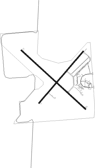
Runway info
Runway 14 / 32  | ||
| length | 1523m (4997ft) | |
| bearing | 126° / 306° | |
| width | 23m (75ft) | |
| surface | asphalt | |
| displ threshold | 0m (0ft) / 104m (341ft) | |
| Runway 5 / 23 | ||
| length | 1188m (3898ft) | |
| bearing | 55° / 235° | |
| width | 23m (75ft) | |
| surface | asphalt | |
| blast zone | 0m (0ft) / 72m (236ft) | |
Nearby beacons
| code | identifier | dist | bearing | frequency |
|---|---|---|---|---|
| RZN | DME | 0.1 | 195° | 109.40 |
| BXR | BIG DOCTOR (SIREN) NDB | 0.3 | 107° | 203 |
| ROS | RUSH CITY NDB | 25.5 | 258° | 282 |
| RP | WICKR (RICE LAKE) NDB | 38.7 | 132° | 221 |
| HYR | DME | 40.4 | 78° | 113.40 |
| GEP | GOPHER (MINNEAPOLIS) VORTAC | 58.5 | 236° | 117.30 |
| DLH | DULUTH VORTAC | 59.2 | 10° | 112.60 |
| MSP | MINNEAPOLIS VOR/DME | 66.5 | 223° | 115.30 |
| EAU | EAU CLAIRE VORTAC | 67.2 | 136° | 113.65 |
Instrument approach procedures
| runway | airway (heading) | route (dist, bearing) |
|---|---|---|
| RW05 | HIREL (55°) | HIREL 3400ft |
| RNAV | HIREL 3400ft JOVIK (6mi, 55°) 2500ft YESUL (3mi, 55°) 1680ft KRZN (2mi, 55°) 1029ft (5504mi, 116°) 1360ft OPGIH (5496mi, 296°) 3400ft OPGIH (turn) | |
| RW14 | LILTS (126°) | LILTS 3400ft |
| RNAV | LILTS 3400ft ECUCE (6mi, 126°) 2500ft OYXUP (3mi, 126°) 1520ft KRZN (2mi, 126°) 1027ft (5504mi, 116°) 1340ft OYORO (5497mi, 296°) 3400ft OYORO (turn) | |
| RW23 | OPGIH (236°) | OPGIH 3400ft |
| RNAV | OPGIH 3400ft OVIME (6mi, 236°) 2500ft KRZN (5mi, 236°) 1024ft (5504mi, 116°) 1389ft HIREL (5512mi, 296°) 3400ft HIREL (turn) | |
| RW32 | OYORO (307°) | OYORO 3400ft |
| RNAV | OYORO 3400ft HOTIB (6mi, 307°) 2500ft KRZN (5mi, 307°) 1028ft (5504mi, 116°) 1389ft LILTS (5512mi, 296°) 3400ft LILTS (turn) |
Disclaimer
The information on this website is not for real aviation. Use this data with the X-Plane flight simulator only! Data taken with kind consent from X-Plane 12 source code and data files. Content is subject to change without notice.