Sacramento - Sacramento Executive
Airport details
| Country | United States of America |
| State | California |
| Region | K2 |
| Airspace | Oakland Ctr |
| Municipality | Sacramento |
| Elevation | 22ft (7m) |
| Timezone | GMT -8 |
| Coordinates | 38.51028, -121.49905 |
| Magnetic var | |
| Type | land |
| Available since | X-Plane v10.40 |
| ICAO code | KSAC |
| IATA code | SAC |
| FAA code | SAC |
Communication
| Sacramento Executive ATIS | 125.500 |
| Sacramento Executive CTAF | 119.500 |
| Sacramento Executive UNICOM | 122.950 |
| Sacramento Executive Ground Control | 125.000 |
| Sacramento Executive Tower | 119.500 |
| Sacramento Executive NORCAL Approach (N-E) | 127.400 |
| Sacramento Executive NORCAL Approach (SE-NW) | 125.250 |
Approach frequencies
| ILS-cat-I | RW02 | 110.3 | 18.00mi |
| 3° GS | RW02 | 110.3 | 18.00mi |
Nearby Points of Interest:
J. C. Carly House
-Fire Station No. 6
-Dunlap's Dining Room
-Sacramento Historic City Cemetery
-Julia Morgan House
-Libby, McNeil and Libby Cannery
-Old Tavern (Sacramento, California)
-Eastern Star Hall
-Blue Anchor Building
-Firehouse No. 3
-Heilbron House
-California State Capitol
-SMUD Headquarters Building
-Winters House
-Coolot Company Building
-Sacramento City Library
-Cranston-Geary House
-Sacramento Masonic Temple
-Federal Building
-Big Four House
-Pony Express Terminal
-J. Neely Johnson House
-Calpak Plant No. 11
-Mesick House
-I Street Bridge
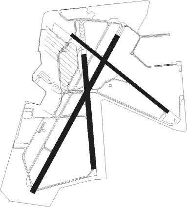
Runway info
Runway 2 / 20  | ||
| length | 1679m (5509ft) | |
| bearing | 40° / 220° | |
| width | 46m (151ft) | |
| surface | asphalt | |
| Runway 12 / 30 | ||
| length | 1169m (3835ft) | |
| bearing | 126° / 306° | |
| width | 30m (98ft) | |
| surface | asphalt | |
| blast zone | 213m (699ft) / 155m (509ft) | |
| Runway 16 / 34 | ||
| length | 1065m (3494ft) | |
| bearing | 179° / 359° | |
| width | 46m (151ft) | |
| surface | asphalt | |
Nearby beacons
| code | identifier | dist | bearing | frequency |
|---|---|---|---|---|
| SAC | SACRAMENTO VORTAC | 4.6 | 218° | 115.20 |
| MCC | MC CLELLAN (SACRAMENTO) VOR/DME | 10.4 | 31° | 109.20 |
| SUU | TRAVIS (FAIRFIELD) TACAN | 26.3 | 239° | 116.60 |
| LIN | LINDEN VOR/DME | 35 | 131° | 114.80 |
| MYV | MARYSVILLE VOR/DME | 35.5 | 353° | 110.80 |
| HNW | HANGTOWN (PLACERVILLE) VOR/DME | 37.4 | 74° | 115.50 |
| BAB | BEALE (MARYSVILLE) TACAN | 37.6 | 5° | 108.60 |
| CCR | CONCORD VOR/DME | 38 | 230° | 117 |
| ILA | WILLIAMS VORTAC | 41.7 | 317° | 114.40 |
| SGD | SCAGGS ISLAND (NAPA) VORTAC | 45.7 | 249° | 112.10 |
| LV | REIGA (LIVERMORE) NDB | 49.9 | 193° | 374 |
| OAK | OAKLAND VOR/DME | 58.2 | 223° | 116.80 |
| MOD | MODESTO VOR/DME | 58.8 | 148° | 114.60 |
| SFO | SAN FRANCISCO VOR/DME | 67.6 | 224° | 115.80 |
Instrument approach procedures
| runway | airway (heading) | route (dist, bearing) |
|---|---|---|
| RW02 | COUPS (38°) | COUPS JIRAG (3mi, 36°) 2000ft |
| RW02 | EMBER (55°) | EMBER JIRAG (11mi, 69°) 2000ft |
| RW02 | VISTO (22°) | VISTO JIRAG (10mi, 3°) 2000ft |
| RNAV | JIRAG 2000ft SEBAE (6mi, 40°) 1500ft WUDRO (3mi, 40°) 700ft KSAC (2mi, 37°) 74ft (6854mi, 108°) 440ft JIRAG (6863mi, 288°) 2000ft JIRAG (turn) |
Disclaimer
The information on this website is not for real aviation. Use this data with the X-Plane flight simulator only! Data taken with kind consent from X-Plane 12 source code and data files. Content is subject to change without notice.