San Diego - San Diego Intl
Airport details
| Country | United States of America |
| State | California |
| Region | K2 |
| Airspace | Los Angeles Ctr |
| Municipality | San Diego |
| Elevation | 17ft (5m) |
| Timezone | GMT -8 |
| Coordinates | 32.73355, -117.18967 |
| Magnetic var | |
| Type | land |
| Available since | X-Plane v10.40 |
| ICAO code | KSAN |
| IATA code | SAN |
| FAA code | SAN |
Communication
| San Diego Intl ATIS | 134.800 |
| San Diego Intl UNICOM | 122.950 |
| San Diego Intl Clearance DEL | 125.900 |
| San Diego Intl Ground Control | 123.900 |
| San Diego Intl LINDBERGH Tower | 118.300 |
| San Diego Intl SOCAL Approach/Departure | 119.600 |
| San Diego Intl SOCAL Approach/Departure | 124.350 |
Approach frequencies
| LOC | RW27 | 110.9 | 18.00mi |
| ILS-cat-I | RW09 | 111.55 | 18.00mi |
| 3.1° GS | RW09 | 111.55 | 18.00mi |
Nearby Points of Interest:
Mission Brewery
-Marine Corps Recruit Depot San Diego
-Pilot
-Naval Training Center San Diego
-Spruce Street Suspension Bridge
-Casa de Estudillo
-Presidio of San Diego
-Cosmopolitan Hotel and Restaurant
-Park Place Methodist Episcopal Church South
-Old Police Headquarters
-Jacob Weinberger United States Courthouse
-San Diego Athletic Club
-San Diego Trust and Savings Bank Building
-Ford Building
-California Quadrangle
-El Prado Complex
-Independent Order of Odd Fellows Building
-Eagles Hall
-Rockwell Field
-Naval Air Station North Island
-Heilman Villas
-Rosecroft
-Granger Hall
-Aztec Bowl
-Hepner Hall
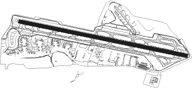
Runway info
| Runway 9 / 27 | ||
| length | 2865m (9400ft) | |
| bearing | 104° / 284° | |
| width | 61m (200ft) | |
| surface | asphalt | |
| displ threshold | 305m (1001ft) / 551m (1808ft) | |
| blast zone | 21m (69ft) / 0m (0ft) | |
Nearby beacons
| code | identifier | dist | bearing | frequency |
|---|---|---|---|---|
| NZY | NORTH ISLAND (SAN DIEGO) TACAN | 2.2 | 221° | 117 |
| MZB | MISSION BAY (SAN DIEGO) VORTAC | 3.4 | 324° | 117.80 |
| NKX | MIRAMAR (SAN DIEGO) TACAN | 8.3 | 14° | 109.60 |
| NRS | IMPERIAL BEACH TACAN | 10.9 | 155° | 109.20 |
| PGY | POGGI (SAN DIEGO) VORTAC | 12.9 | 120° | 116.45 |
| TIJ | TIJUANA VOR/DME | 16.6 | 129° | 116.50 |
| OCN | OCEANSIDE VORTAC | 32.5 | 336° | 115.30 |
| NFG | CAMP PENDLETON (OCEANSIDE TACAN | 33.9 | 340° | 111.80 |
| JLI | JULIAN VORTAC | 39 | 56° | 114 |
| ELB | EL TORO (SANTA ANA) VOR/DME | 62.8 | 330° | 117.20 |
| ENS | ENSENADA NDB | 63.6 | 148° | 400 |
Departure and arrival routes
| Transition altitude | 18000ft |
| Transition level | 18000ft |
| SID end points | distance | outbound heading | |
|---|---|---|---|
| RW09 | |||
| SAYOW2 | 78mi | 53° | |
| BRDR7 | 39mi | 56° | |
| MMOTO2 | 122mi | 264° | |
| FALCC1 | 73mi | 298° | |
| ECHHO2 | 77mi | 321° | |
| RW27 | |||
| ZZOOO2 | 78mi | 53° | |
| BRDR7 | 39mi | 56° | |
| MMOTO2 | 122mi | 264° | |
| PEBLE6, FALCC1 | 73mi | 298° | |
| PADRZ2 | 126mi | 319° | |
| CWARD2, ECHHO2 | 77mi | 321° | |
| STAR starting points | distance | inbound heading | |
|---|---|---|---|
| ALL | |||
| SHAMU1 | 38.2 | 126° | |
| COMIX2 | 28.4 | 144° | |
| HUBRD1 | 37.1 | 144° | |
| LUCKI1 | 18.8 | 274° | |
| TOPGN2 | 31.4 | 278° | |
| RW09 | |||
| PLYYA1 | 39.2 | 123° | |
| BARET5 | 25.9 | 265° | |
| RW27 | |||
| BARET5 | 25.9 | 265° | |
Instrument approach procedures
| runway | airway (heading) | route (dist, bearing) |
|---|---|---|
| RW27-Y | LYNDI (278°) | LYNDI 5000ft VYDDA (3mi, 254°) 4000ft |
| RNAV | VYDDA 4000ft OKAIN (2mi, 284°) 3600ft CIJHI (3mi, 284°) 2700ft REEBO (2mi, 284°) 2000ft KSAN (6mi, 284°) 80ft (6763mi, 106°) 417ft SARGS (6772mi, 286°) 2500ft SARGS (turn) | |
| RW27-Z | KLOMN (250°) | KLOMN 6000ft AJADE (4mi, 104°) 5200ft CATDG (1mi, 121°) 4800ft CRSNR (3mi, 197°) 3700ft SAYAE (2mi, 266°) 3200ft CIJHI (2mi, 284°) 2700ft |
| RW27-Z | LYNDI (278°) | LYNDI 5000ft VYDDA (3mi, 254°) 4000ft OKAIN (2mi, 284°) 3600ft SAYAE (2mi, 284°) 3200ft CIJHI (2mi, 284°) 2700ft |
| RNAV | CIJHI 2700ft REEBO (2mi, 284°) 2000ft KSAN (6mi, 284°) 80ft SARGS (11mi, 284°) 2500ft SARGS (turn) |
Holding patterns
| STAR name | hold at | type | turn | heading* | altitude | leg | speed limit |
|---|---|---|---|---|---|---|---|
| BARET5 | SALTN | VHF | right | 40 (220)° | DME 10.0mi | 210 | |
| COMIX2 | MRVEL | VHF | left | 302 (122)° | DME 10.0mi | ICAO rules | |
| COMIX2 | SLAER | VHF | left | 268 (88)° | DME 10.0mi | ICAO rules | |
| HUBRD1 | OTISS | VHF | right | 298 (118)° | < 17999ft | 1.0min timed | ICAO rules |
| LUCKI1 | DSURT | VHF | left | 44 (224)° | DME 10.0mi | ICAO rules | |
| LUCKI1 | IPL | NDB | right | 74 (254)° | 1.5min timed | ICAO rules | |
| PLYYA1 | MNLYT | VHF | right | 318 (138)° | DME 10.0mi | ICAO rules | |
| PLYYA1 | PLYYA | VHF | left | 303 (123)° | DME 10.0mi | ICAO rules | |
| SHAMU1 | SARGS | VHF | right | 255 (75)° | 1.0min timed | ICAO rules | |
| TOPGN2 | DSURT | VHF | left | 44 (224)° | DME 10.0mi | ICAO rules | |
| TOPGN2 | IPL | NDB | right | 74 (254)° | 1.5min timed | ICAO rules | |
| TOPGN2 | ISEMN | VHF | right | 70 (250)° | DME 10.0mi | ICAO rules | |
| *) magnetic outbound (inbound) holding course | |||||||
Disclaimer
The information on this website is not for real aviation. Use this data with the X-Plane flight simulator only! Data taken with kind consent from X-Plane 12 source code and data files. Content is subject to change without notice.