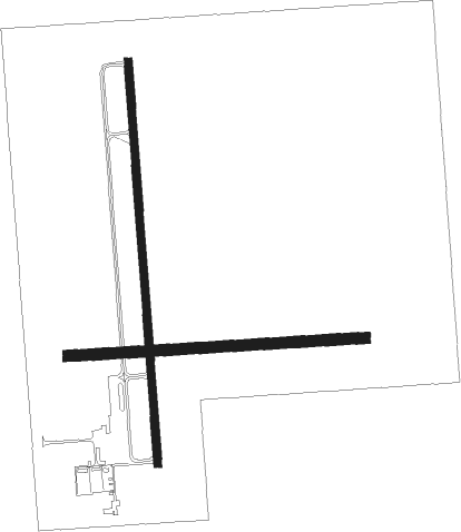
Sparta - Sparta Com Hunter Fld
Airport details
| Country | United States of America |
| State | Illinois |
| Region | K5 |
| Airspace | Kansas City Ctr |
| Municipality | Sparta |
| Elevation | 538ft (164m) |
| Timezone | GMT -6 |
| Coordinates | 38.14886, -89.69850 |
| Magnetic var | |
| Type | land |
| Available since | X-Plane v10.40 |
| ICAO code | KSAR |
| IATA code | SAR |
| FAA code | SAR |
Communication
| Sparta Com Hunter Fld AWOS 3 | 118.375 |
| Sparta Com Hunter Fld CTAF/UNICOM | 122.800 |
| Sparta Com Hunter Fld ST LOUIS Approach/Departure | 125.200 |
Nearby Points of Interest:
Charter Oak Schoolhouse
-Marissa Academy
-Rutter Store
-Shiloh College
-Red Bud Historic District
-Pierre Menard House
-Tegtmeyer Site
-Piney Creek West Site
-Piney Creek Site
-Christian F. Weinrich House
-Piney Creek South Site
-Old Fire Station
-Perry County Jail
-Frederick Weistar House
-Madison County Sheriff's House and Jail
-Heritage House Museum
-Louisville and Nashville Depot (Nashville, Illinois)
-Creole House
-Amoureux House
-Jacques Guibourd Historic House
-French Colonial Historic District
-George Draser, Jr., Houses
-Berger-Kiel House
-Fort de Chartres
-Cleiman Mound and Village Site

Nearby beacons
| code | identifier | dist | bearing | frequency |
|---|---|---|---|---|
| JD | GOOEY (BELLEVILLE) NDB | 19.8 | 353° | 385 |
| SKE | SCOTT (BELLEVILLE) TACAN | 24.8 | 339° | 112.20 |
| MD | CABBI (CARBONDALE-MURPHYSBORO) NDB | 27.1 | 122° | 388 |
| CP | ACORE (CAHOKIA/ST LOUIS) NDB | 28 | 316° | 350 |
| ENL | CENTRALIA VORTAC | 30.1 | 63° | 115 |
| TOY | TROY VORTAC | 36.9 | 340° | 116 |
| FAM | FARMINGTON VORTAC | 38.1 | 228° | 115.70 |
| MW | JONNY (MARION) NDB | 39.1 | 113° | 382 |
| MWA | DME | 40.2 | 120° | 110.40 |
| GRE | GREENVILLE NDB | 43.9 | 25° | 233 |
| VNN | VERNON DME | 43.9 | 77° | 113.80 |
| CVM | CIVIC MEMORIAL (ALTON) NDB | 47.7 | 334° | 263 |
| CSX | DME | 47.8 | 312° | 116.45 |
| FZ | EAVES (ST LOUIS) NDB | 51 | 302° | 227 |
| CG | DUTCH (CAPE GIRARDEAU) NDB | 53.7 | 180° | 248 |
| CGI | GIRARDEAU DME | 55.6 | 172° | 112.90 |
| STL | SAINT LOUIS VORTAC | 56.4 | 312° | 117.40 |
| VLA | VANDALIA VOR/DME | 62 | 30° | 114.30 |
Instrument approach procedures
| runway | airway (heading) | route (dist, bearing) |
|---|---|---|
| RW18 | BURCK (113°) | BURCK TOSSO (16mi, 83°) 2200ft TOSSO (turn) 2200ft |
| RW18 | SUMAN (259°) | SUMAN TOSSO (13mi, 305°) 2200ft TOSSO (turn) 2200ft |
| RNAV | TOSSO 2200ft ACIGO (6mi, 180°) 2200ft WEMLO (4mi, 180°) 1060ft KSAR (2mi, 179°) 593ft (5391mi, 113°) 1200ft TOSSO (5391mi, 293°) 2200ft TOSSO (turn) | |
| RW36 | BURCK (113°) | BURCK CIVVA (23mi, 145°) 2200ft HOKDO (5mi, 90°) 2200ft |
| RW36 | HOKDO (1°) | HOKDO 2200ft |
| RW36 | SUMAN (259°) | SUMAN TUDME (14mi, 204°) 2200ft HOKDO (5mi, 270°) 2200ft |
| RNAV | HOKDO 2200ft KIDYE (6mi, 0°) 2100ft PILKE (3mi, 0°) 1260ft KSAR (2mi, 2°) 563ft (5391mi, 113°) 938ft HOKDO (5391mi, 293°) 2200ft HOKDO (turn) |
Disclaimer
The information on this website is not for real aviation. Use this data with the X-Plane flight simulator only! Data taken with kind consent from X-Plane 12 source code and data files. Content is subject to change without notice.