Salton City - Salton Sea
Airport details
| Country | United States of America |
| State | California |
| Region | K2 |
| Airspace | Los Angeles Ctr |
| Municipality | CAL Fire San Diego Unit |
| Elevation | -83ft (-25m) |
| Timezone | GMT -8 |
| Coordinates | 33.24120, -115.95258 |
| Magnetic var | |
| Type | land |
| Available since | X-Plane v10.40 |
| ICAO code | KSAS |
| IATA code | n/a |
| FAA code | n/a |
Communication
Nearby Points of Interest:
North Shore Beach and Yacht Club
-El Centro Main Post Office
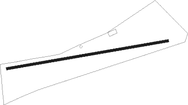
Runway info
| Runway 07 / 25 | ||
| length | 1525m (5003ft) | |
| bearing | 86° / 266° | |
| width | 23m (75ft) | |
| surface | gravel | |
Nearby beacons
| code | identifier | dist | bearing | frequency |
|---|---|---|---|---|
| TRM | THERMAL VORTAC | 25.4 | 332° | 116.20 |
| NJK | EL CENTRO TACAN | 28.1 | 146° | 111 |
| JLI | JULIAN VORTAC | 32.4 | 261° | 114 |
| IPL | IMPERIAL VORTAC | 37 | 138° | 115.90 |
| PSP | PALM SPRINGS VORTAC | 44.6 | 323° | 115.50 |
| MXL | MEXICALI VOR/DME | 51.3 | 130° | 115 |
| TNP | TWENTYNINE PALMS VORTAC | 53.1 | 12° | 114.20 |
Disclaimer
The information on this website is not for real aviation. Use this data with the X-Plane flight simulator only! Data taken with kind consent from X-Plane 12 source code and data files. Content is subject to change without notice.