Savannah - Savannah Hilton Head Intl
Airport details
| Country | United States of America |
| State | Georgia |
| Region | K7 |
| Airspace | Jacksonville Ctr |
| Municipality | Savannah |
| Elevation | 49ft (15m) |
| Timezone | GMT -5 |
| Coordinates | 32.12758, -81.20214 |
| Magnetic var | |
| Type | land |
| Available since | X-Plane v10.40 |
| ICAO code | KSAV |
| IATA code | SAV |
| FAA code | SAV |
Communication
| Savannah Hilton Head Intl UNICOM | 122.950 |
| Savannah Hilton Head Intl Clearance DEL | 119.550 |
| Savannah Hilton Head Intl Ground Control | 121.900 |
| Savannah Hilton Head Intl Tower | 119.100 |
| Savannah Hilton Head Intl Approach | 118.400 |
| Savannah Hilton Head Intl Departure | 125.300 |
| Savannah Hilton Head Intl Departure | 118.400 |
Approach frequencies
| ILS-cat-I | RW10 | 111.35 | 18.00mi |
| ILS-cat-I | RW01 | 111.9 | 18.00mi |
| 3° GS | RW10 | 111.35 | 18.00mi |
| 3° GS | RW01 | 111.9 | 18.00mi |
Nearby Points of Interest:
Savannah–Ogeechee Canal
-Carver Village Historic District
-William Scarbrough House
-Atlantic Greyhound Bus Terminal
-Central of Georgia Railroad: Savannah Shops and Terminal Facilities
-Tomochichi Federal Building and United States Courthouse
-United States Customhouse
-124 East Bay Street
-Oliver Sturges House
-17 Hundred 90 Inn
-Old Harbor Light
-Lebanon Plantation
-Wild Heron
-Hill Hall at Savannah State College
-Wormsloe Historic Site
-Bethesda Academy
-Glen Echo
-Strathy Hall
-Eureka Club-Farr's Point
-Fort McAllister Historic Park
-Old Effingham County Courthouse
-Wassaw Island
-Bluffton Historic District
-Dutton-Waller Raised Tybee Cottage
-Rose Hill Plantation House
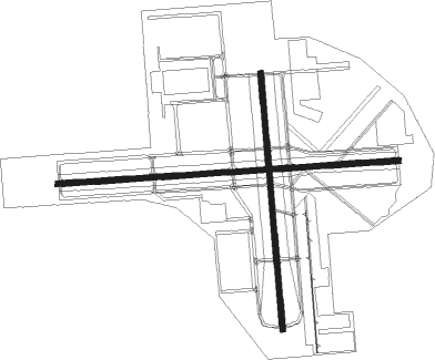
Runway info
Runway 10 / 28  | ||
| length | 2845m (9334ft) | |
| bearing | 91° / 271° | |
| width | 46m (150ft) | |
| surface | asphalt | |
| blast zone | 255m (837ft) / 46m (151ft) | |
| Runway 1 / 19 | ||
| length | 2141m (7024ft) | |
| bearing | 360° / 180° | |
| width | 46m (150ft) | |
| surface | asphalt | |
| blast zone | 0m (0ft) / 61m (200ft) | |
Nearby beacons
| code | identifier | dist | bearing | frequency |
|---|---|---|---|---|
| SAV | SAVANNAH VORTAC | 1.1 | 9° | 115.95 |
| SVN | HUNTER (SAVANNAH) VOR/DME | 7.6 | 152° | 111.60 |
| SV | WASSA (SAVANNAH) NDB | 13.2 | 120° | 335 |
| MOQ | MC INTOSH (HINESVILLE) NDB | 23.7 | 226° | 263 |
| BZ | BULLO (STATESBORO) NDB | 29.1 | 302° | 407 |
| NBC | BEAUFORT TACAN | 32.4 | 54° | 110.50 |
| JYL | SYLVANIA NDB | 37.1 | 323° | 245 |
| ALD | ALLENDALE VOR | 53.3 | 354° | 116.70 |
| DYB | DORCHESTER COUNTY(SUMMERVILLE) NDB | 73 | 45° | 365 |
Instrument approach procedures
| runway | airway (heading) | route (dist, bearing) |
|---|---|---|
| RW01 | TERBE (359°) | TERBE 2500ft |
| RW01 | WOSUG (24°) | WOSUG 2600ft TERBE (5mi, 90°) 2500ft |
| RW01 | ZUTAN (335°) | ZUTAN 2500ft TERBE (5mi, 270°) 2500ft |
| RNAV | TERBE 2500ft MIZLU (6mi, 360°) 2000ft KSAV (7mi, 358°) 86ft SUTME (12mi, 0°) 2500ft SUTME (turn) | |
| RW10 | TILEE (91°) | TILEE 2600ft |
| RW10 | WOXIT (109°) | WOXIT 2600ft TILEE (5mi, 181°) 2600ft |
| RW10 | ZUTOX (72°) | ZUTOX 2600ft TILEE (5mi, 1°) 2600ft |
| RNAV | TILEE 2600ft SOVIE (6mi, 90°) 2000ft KSAV (7mi, 91°) 67ft TELOE (12mi, 90°) 2500ft TELOE (turn) | |
| RW19 | SUTME (180°) | SUTME 2500ft |
| RW19 | WUTNA (205°) | WUTNA 2500ft SUTME (5mi, 270°) 2500ft |
| RW19 | ZUTVO (155°) | ZUTVO 2600ft SUTME (5mi, 90°) 2500ft |
| RNAV | SUTME 2500ft TOSEA (6mi, 180°) 2000ft KSAV (6mi, 181°) 94ft TERBE (13mi, 179°) 2500ft TERBE (turn) | |
| RW28-Y | FEXEM (270°) | FEXEM 2500ft DUCAN (4mi, 271°) 2000ft |
| RW28-Y | KELER (356°) | KELER 6000ft RLENE (6mi, 62°) 5000ft HOTAN (4mi, 62°) 4000ft GRILO (4mi, 29°) 3000ft DUCAN (5mi, 307°) 2000ft |
| RW28-Y | MAYAR (109°) | MAYAR 10000ft ZELGI (18mi, 89°) 6000ft MODAE (6mi, 89°) 4500ft CARIK (6mi, 135°) 3000ft DUCAN (5mi, 235°) 2000ft |
| RNAV | DUCAN 2000ft OSANE (2mi, 271°) 1800ft KSAV (6mi, 270°) 98ft HANGI (13mi, 271°) 2500ft HANGI (turn) | |
| RW28-Z | KUCES (251°) | KUCES 2500ft TELOE (5mi, 181°) 2500ft |
| RW28-Z | TELOE (270°) | TELOE 2500ft |
| RW28-Z | WORIB (290°) | WORIB 2600ft TELOE (5mi, 1°) 2500ft |
| RNAV | TELOE 2500ft SINBY (6mi, 271°) 1800ft KSAV (6mi, 270°) 98ft TILEE (13mi, 271°) 2600ft TILEE (turn) |
Disclaimer
The information on this website is not for real aviation. Use this data with the X-Plane flight simulator only! Data taken with kind consent from X-Plane 12 source code and data files. Content is subject to change without notice.