Santa Barbara - Santa Barbara Mun
Airport details
| Country | United States of America |
| State | California |
| Region | K2 |
| Airspace | Los Angeles Ctr |
| Municipality | Santa Barbara |
| Elevation | 13ft (4m) |
| Timezone | GMT -8 |
| Coordinates | 34.43162, -119.83485 |
| Magnetic var | |
| Type | land |
| Available since | X-Plane v10.40 |
| ICAO code | KSBA |
| IATA code | SBA |
| FAA code | SBA |
Communication
| Santa Barbara Mun KSBA ATIS | 132.650 |
| Santa Barbara Mun SANTA BARBARA CTAF | 119.700 |
| Santa Barbara Mun SANTA BARBARA CLD | 132.900 |
| Santa Barbara Mun SANTA BARBARA Ground Control | 121.700 |
| Santa Barbara Mun SANTA BARBARA Tower | 119.700 |
| Santa Barbara Mun SANTA BARBARA DepartureARTURE E | 124.150 |
| Santa Barbara Mun SANTA BARBARA DepartureARTURE W | 120.550 |
Approach frequencies
| ILS-cat-I | RW07 | 110.3 | 18.00mi |
| 3° GS | RW07 | 110.3 | 18.00mi |
Nearby Points of Interest:
Joseph and Lucy Foster Sexton House
-Goleta Depot
-Janssens-Orella-Birk Building
-Santa Barbara County Courthouse
-Hill-Carrillo Adobe
-United States Post Office
-Rafael Gonzalez House
-Andalucia Building
-Carpinteria
-Gaviota Pass
-San Buenaventura Mission Aqueduct
-Feraud General Merchandise Store
-Emmanuel Franz House
-Elizabeth Bard Memorial Hospital
-First Baptist Church of Ventura
-Charles M. Pratt House
-Los Alamos Ranch House
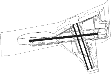
Runway info
Runway 7 / 25  | ||
| length | 1843m (6047ft) | |
| bearing | 89° / 269° | |
| width | 46m (151ft) | |
| surface | asphalt | |
| blast zone | 50m (164ft) / 255m (837ft) | |
| Runway 15R / 33L | ||
| length | 1276m (4186ft) | |
| bearing | 163° / 343° | |
| width | 30m (98ft) | |
| surface | asphalt | |
| Runway 15L / 33R | ||
| length | 1277m (4190ft) | |
| bearing | 163° / 343° | |
| width | 23m (75ft) | |
| surface | asphalt | |
Nearby beacons
| code | identifier | dist | bearing | frequency |
|---|---|---|---|---|
| RZS | SAN MARCUS (SANTA BARBARA VORTAC | 5.6 | 39° | 114.90 |
| GVO | GAVIOTA VORTAC | 14 | 291° | 113.80 |
| CMA | CAMARILLO VOR/DME | 39 | 106° | 115.80 |
| FLW | FELLOWS VOR/DME | 39.7 | 357° | 117.50 |
| NTD | POINT MUGU (OXNARD) TACAN | 39.9 | 113° | 110.60 |
| VBG | VANDENBERG (LOMPOC) TACAN | 41.1 | 292° | 112.25 |
| VTU | VENTURA (OXNARD) VOR/DME | 43.3 | 112° | 108.20 |
| GLJ | GUADALUPE (SANTA MARIA) VOR | 46.1 | 307° | 111 |
| FIM | FILLMORE VORTAC | 47.4 | 94° | 112.50 |
| GMN | GORMAN VORTAC | 53 | 69° | 116.10 |
| MQO | MORRO BAY (SAN LUIS OBISP VORTAC | 67.1 | 312° | 112.40 |
Departure and arrival routes
| Transition altitude | 18000ft |
| Transition level | 18000ft |
| SID end points | distance | outbound heading | |
|---|---|---|---|
| RW07 | |||
| MISHN3 | 156mi | 81° | |
| FLOUT5 | 43mi | 112° | |
| HABUT4 | 14mi | 291° | |
| GAUCH2 | 67mi | 312° | |
| RW15 (ALL) | |||
| MISHN3 | 156mi | 81° | |
| FLOUT5 | 43mi | 112° | |
| HABUT4 | 14mi | 291° | |
| GAUCH2 | 67mi | 312° | |
| RW25 | |||
| MISHN3 | 156mi | 81° | |
| FLOUT5 | 43mi | 112° | |
| HABUT4 | 14mi | 291° | |
| GAUCH2 | 67mi | 312° | |
| STAR starting points | distance | inbound heading | |
|---|---|---|---|
| RW07 | |||
| PITBL1 | 37.8 | 274° | |
| RW25 | |||
| PITBL1 | 37.8 | 274° | |
Instrument approach procedures
| runway | airway (heading) | route (dist, bearing) |
|---|---|---|
| RW07 | AFOXY (118°) | AFOXY RIMVE (8mi, 159°) 4400ft ECEVA (4mi, 159°) 2800ft |
| RW07 | GOLET (11°) | GOLET LOBER (11mi, 265°) 4000ft ECEVA (10mi, 359°) 2800ft |
| RNAV | ECEVA 2800ft NAPPS (6mi, 89°) 1800ft KSBA (6mi, 87°) 59ft CESRA (4mi, 92°) IYOBE (8mi, 178°) GOLET (5mi, 265°) 4000ft GOLET (turn) |
Disclaimer
The information on this website is not for real aviation. Use this data with the X-Plane flight simulator only! Data taken with kind consent from X-Plane 12 source code and data files. Content is subject to change without notice.