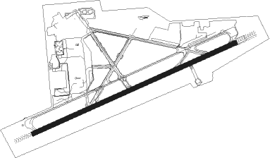
San Bernardino - San Bernardino Intl
Airport details
| Country | United States of America |
| State | California |
| Region | K2 |
| Airspace | Los Angeles Ctr |
| Municipality | San Bernardino |
| Elevation | 1157ft (353m) |
| Timezone | GMT -8 |
| Coordinates | 34.10481, -117.24146 |
| Magnetic var | |
| Type | land |
| Available since | X-Plane v10.40 |
| ICAO code | KSBD |
| IATA code | SBD |
| FAA code | SBD |
Communication
| San Bernardino Intl ATIS | 124.175 |
| San Bernardino Intl Ground Control | 121.800 |
| San Bernardino Intl Tower | 119.450 |
| San Bernardino Intl SOCAL Approach/Departure | 135.400 |
| San Bernardino Intl SOCAL Approach/Departure | 125.500 |
| San Bernardino Intl SOCAL Approach/Departure | 127.250 |
| San Bernardino Intl SOCAL Approach/Departure | 134.000 |
Approach frequencies
| ILS-cat-I | RW06 | 109.3 | 18.00mi |
| 3° GS | RW06 | 109.3 | 18.00mi |
Nearby Points of Interest:
Highland Historic District
-San Bernardino County Court House
-San Bernardino Downtown Station
-Barton Villa
-Redlands Santa Fe Depot District
-U.S. Post Office
-A. K. Smiley Public Library
-Smiley Park Historic District
-Redlands Central Railway Company Car Barn
-Beverly Ranch
-Mill Creek Zanja
-Auerbacher Home
-Harada House
-Riverside Municipal Auditorium
-Bono's Restaurant and Deli
-Victoria Avenue
-Arlington Branch Library and Fire Hall
-Hofer Ranch
-Cucamonga Service Station
-Sam and Alfreda Maloof Compound
-Gilman Ranch
-Perris Depot
-Carnegie Library (Upland, California)
-Frankish Building
-Ontario State Bank Block
Nearby beacons
| code | identifier | dist | bearing | frequency |
|---|---|---|---|---|
| SB | PETIS (SAN BERNARDINO) NDB | 6.8 | 249° | 397 |
| RIV | MARCH (RIVERSIDE) TACAN | 12 | 190° | 113 |
| RAL | RIVERSIDE VOR | 13.7 | 234° | 112.40 |
| PDZ | PARADISE (ONTARIO) VORTAC | 18.2 | 237° | 112.20 |
| HDF | HOMELAND (RIVERSIDE) VOR | 19.9 | 170° | 113.40 |
| POM | POMONA VORTAC | 27.1 | 267° | 110.40 |
| VCV | VICTORVILLE VOR/DME | 30.2 | 343° | 109.05 |
| ELB | EL TORO (SANTA ANA) VOR/DME | 35.4 | 229° | 117.20 |
| PSP | PALM SPRINGS VORTAC | 42.8 | 106° | 115.50 |
| SLI | SEAL BEACH (LOS ALAMITOS) VORTAC | 44.8 | 248° | 115.70 |
| NFG | CAMP PENDLETON (OCEANSIDE TACAN | 50.3 | 190° | 111.80 |
| PMD | PALMDALE VORTAC | 51.5 | 303° | 114.50 |
| OCN | OCEANSIDE VORTAC | 52.6 | 192° | 115.30 |
| HEC | HECTOR VORTAC | 56.6 | 48° | 112.70 |
| EDW | EDWARDS VORTAC | 58 | 331° | 116.40 |
| DAG | DAGGETT VORTAC | 61 | 38° | 113.20 |
| JLI | JULIAN VORTAC | 66.5 | 146° | 114 |
Departure and arrival routes
| Transition altitude | 18000ft |
| Transition level | 18000ft |
| STAR starting points | distance | inbound heading | |
|---|---|---|---|
| ALL | |||
| SETER5 | 13.9 | 327° | |
Instrument approach procedures
| runway | airway (heading) | route (dist, bearing) |
|---|---|---|
| RW06-Y | PDZ (57°) | PDZ UCUDO (6mi, 21°) 4000ft |
| RNAV | UCUDO 4000ft WIDAD (6mi, 73°) 3300ft KSBD (8mi, 69°) 1135ft (6743mi, 106°) 2800ft PDZ (6760mi, 286°) 6000ft PDZ (turn) 6000ft | |
| RW06-Z | PDZ (57°) | PDZ UCUDO (6mi, 21°) 4000ft |
| RNAV | UCUDO 4000ft WIDAD (6mi, 73°) 3300ft KSBD (8mi, 69°) 1135ft (6743mi, 106°) 2000ft PDZ (6760mi, 286°) 6000ft PDZ (turn) 6000ft |
Holding patterns
| STAR name | hold at | type | turn | heading* | altitude | leg | speed limit |
|---|---|---|---|---|---|---|---|
| SETER5 | JLI | NDB | left | 108 (288)° | 1.5min timed | ICAO rules | |
| ZIGGY7 | PETIS | VHF | right | 76 (256)° | 1.0min timed | ICAO rules | |
| *) magnetic outbound (inbound) holding course | |||||||
Disclaimer
The information on this website is not for real aviation. Use this data with the X-Plane flight simulator only! Data taken with kind consent from X-Plane 12 source code and data files. Content is subject to change without notice.